| [3] |
Name on the Register[4] |
Image |
Date listed[5] |
Location |
City or town |
Description |
|---|
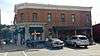
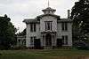
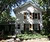
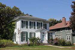
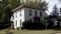
| 1 |
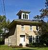
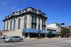
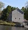
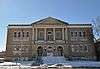
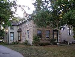
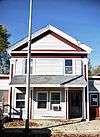
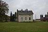
John Alexander Wheat Warehouse |
|
September 13, 1978
(#78003383) |
304 S. Janesville St.
42°46′29″N 88°56′11″W / 42.774722°N 88.936389°W / 42.774722; -88.936389 (John Alexander Wheat Warehouse) |
Milton |
Italianate-styled warehouse with poured grout walls a foot thick, built about 1850 when wheat was king. Later a blacksmith shop, a filling station, and an apple warehouse.[6][7] |
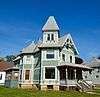
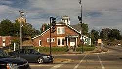
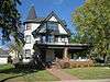
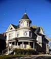
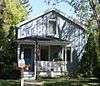
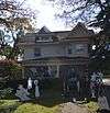
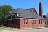
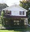
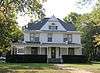
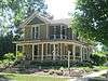
| 2 |
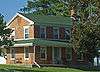
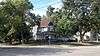
Abram Allen House |
|
September 13, 1978
(#78003386) |
205 E. Madison Ave.
42°46′45″N 88°56′54″W / 42.779167°N 88.948333°W / 42.779167; -88.948333 (Abram Allen House) |
Milton |
|
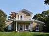
| 3 |
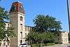
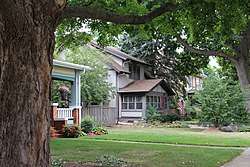
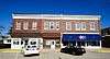
The Armory |
|
November 21, 1978
(#78000130) |
10 S. High St.
42°40′49″N 89°01′40″W / 42.680278°N 89.027778°W / 42.680278; -89.027778 (The Armory) |
Janesville |
1930 armory designed by Lt. Colonel Henry C. Hengles in Spanish Revival style, with walls of colored brick and tile roof. Originally housed the 32nd Tank Company of the Wisconsin National Guard, which helped defend Bataan in 1941-42 and endured the Bataan Death March. Nearly two thirds did not return.[8][9] |
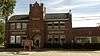
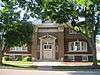
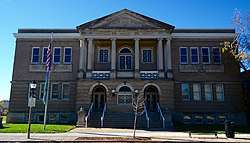
| 4 |
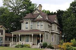
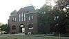
Bartlett Memorial Historical Museum |
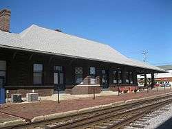
|
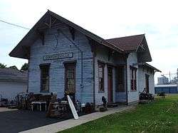
April 11, 1977
(#77000048) |
2149 St. Lawrence Ave.
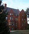
42°30′15″N 89°04′10″W / 42.504167°N 89.069444°W / 42.504167; -89.069444 (Bartlett Memorial Historical Museum) |
Beloit |
|
| 5 |
Beloit Power Plant |
|
July 31, 2017
(#100001404) |
850 Pleasant St.
42°30′23″N 89°01′56″W / 42.506470°N 89.032300°W / 42.506470; -89.032300 (Beloit Power Plant) |
Beloit |
|
| 6 |
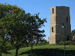
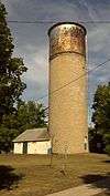
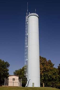
Beloit Water Tower |
|
January 7, 1983
(#83003410) |
1005 Pleasant St.
42°30′33″N 89°01′49″W / 42.509167°N 89.030278°W / 42.509167; -89.030278 (Beloit Water Tower) |
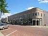
Beloit |
|
| 7 |
Benton Avenue Historic District |
|
March 7, 1996
(#96000251) |
Roughly bounded by Benton Ave., Milton Ave., Sherman Ave., Richardson St., Blaine Ave. and Prairie Ave.
42°41′48″N 89°00′48″W / 42.696667°N 89.013333°W / 42.696667; -89.013333 (Benton Avenue Historic District) |
Janesville |
|
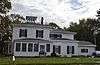
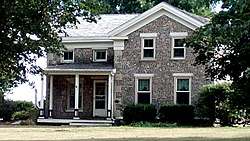
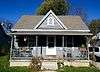
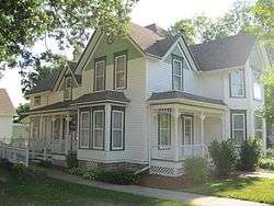
| 8 |
Selvy Blodgett House |
|
May 23, 1980
(#80000183) |
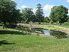
417 Bluff St.
42°29′59″N 89°02′29″W / 42.499722°N 89.041389°W / 42.499722; -89.041389 (Selvy Blodgett House) |
Beloit |
|
| 9 |
Bluff Street Historic District |
|
January 7, 1983
(#83003411) |
Roughly both sides of Bluff St. from Shirland Ave. to Merrill St.
42°30′04″N 89°02′30″W / 42.501111°N 89.041667°W / 42.501111; -89.041667 (Bluff Street Historic District) |
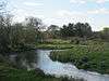
Beloit |
|
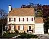
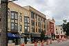
| 10 |
Bostwick Avenue Historic District |
|
April 24, 2006
(#06000321) |
404-436 Bostwick Ave. and 1118 and 1128 Grace St.
42°40′56″N 89°00′37″W / 42.682222°N 89.010278°W / 42.682222; -89.010278 (Bostwick Avenue Historic District) |
Janesville |
|
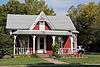
| 11 |
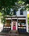
Brasstown Cottage |
|
March 4, 1983
(#83003412) |
1701 Colley Rd.
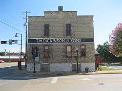
42°30′26″N 89°00′53″W / 42.507222°N 89.014722°W / 42.507222; -89.014722 (Brasstown Cottage) |
Beloit |
|
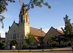
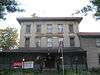
| 12 |
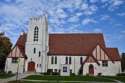
Church of St. Thomas the Apostle |
|
January 7, 1983
(#83003413) |
822 E. Grand Ave.
42°29′58″N 89°01′41″W / 42.499444°N 89.028056°W / 42.499444; -89.028056 (Church of St. Thomas the Apostle) |
Beloit |
1885 brick church with Gothic-style details and Stick style porches. Home of Beloit's oldest Catholic parish, with roots back to 1846. |
| 13 |
Citizens Bank |
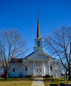
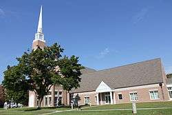
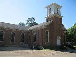
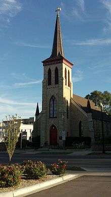
|
August 1, 1985
(#85001661) |
Front & Allen Sts.
42°33′12″N 88°51′46″W / 42.553333°N 88.862778°W / 42.553333; -88.862778 (Citizens Bank) |
Clinton |
|
| 14 |
City of Beloit Waterworks and Pump Station |
|
September 13, 1990
(#90001460) |
1005 Pleasant St.
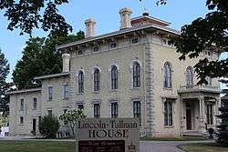
42°30′32″N 89°01′51″W / 42.508889°N 89.030833°W / 42.508889; -89.030833 (City of Beloit Waterworks and Pump Station) |
Beloit |
|
| 15 |
Clark-Brown House |
|
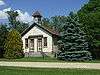
September 13, 1985
(#85002126) |
3457 Riverside Dr.
42°33′45″N 89°02′06″W / 42.5625°N 89.035°W / 42.5625; -89.035 (Clark-Brown House) |
Beloit |
|
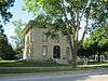
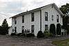
| 16 |
Clinton Village Hall |
|
August 1, 1985
(#85001660) |
301 Cross St.
42°33′18″N 88°51′42″W / 42.555°N 88.861667°W / 42.555; -88.861667 (Clinton Village Hall) |
Clinton |
|
| 17 |
Clinton Water Tower |
|
March 7, 1985
(#85000493) |
High St.
42°33′39″N 88°51′48″W / 42.560833°N 88.863333°W / 42.560833; -88.863333 (Clinton Water Tower) |
Clinton |
|
| 18 |
Columbus Circle Historic District |
|
May 19, 2005
(#05000453) |
Columbus Circle generally bounded by N. Adams and E. Milwaukee Sts. and N. Garfield Ave.
42°41′24″N 89°00′38″W / 42.69°N 89.010556°W / 42.69; -89.010556 (Columbus Circle Historic District) |
Janesville |
|
| 19 |
Conrad Cottages Historic District |
|
March 11, 1993
(#93000157) |
235-330 Milton Ave.
42°41′12″N 89°01′03″W / 42.686667°N 89.0175°W / 42.686667; -89.0175 (Conrad Cottages Historic District) |
Janesville |
|
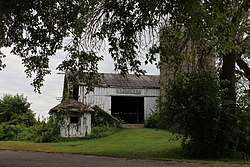
| 20 |
Cooksville Cheese Factory |
|
September 17, 1980
(#80000395) |
SR 1
42°50′06″N 89°14′36″W / 42.835°N 89.243333°W / 42.835; -89.243333 (Cooksville Cheese Factory) |
Evansville |
|
| 21 |
Cooksville Historic District |
|
October 25, 1973
(#73000254) |
Both sides of streets bordering the Public Sq. and Rock St.
42°50′08″N 89°14′19″W / 42.835556°N 89.238611°W / 42.835556; -89.238611 (Cooksville Historic District) |
Cooksville |
Boundary increase (listed September 17, 1980): Roughly Tolles Rd., Church St., Rock St., Dane St., and Main St. |
| 22 |
Cooksville Mill and Mill Pond Site |
|
September 17, 1980
(#80000394) |
SR 1
42°50′19″N 89°14′32″W / 42.838611°N 89.242222°W / 42.838611; -89.242222 (Cooksville Mill and Mill Pond Site) |
Evansville |
|
| 23 |
Cooper-Gillies House |
|
September 17, 1980
(#80000397) |
SR 1
42°50′03″N 89°15′17″W / 42.834167°N 89.254722°W / 42.834167; -89.254722 (Cooper-Gillies House) |
Evansville |
|
| 24 |
Courier Building |
|
August 24, 2015
(#15000552) |
513 Vernal Ave.
42°46′50″N 88°57′47″W / 42.780609°N 88.963117°W / 42.780609; -88.963117 (Courier Building) |
Milton |
|
| 25 |
Court Street Methodist Church |
|
November 17, 1977
(#77000045) |
36 S. Main St.
42°40′55″N 89°01′17″W / 42.681944°N 89.021389°W / 42.681944; -89.021389 (Court Street Methodist Church) |
Janesville |
|
| 26 |
Courthouse Hill Historic District |
|
January 17, 1986
(#86000205) |
Roughly bounded by E. Milwaukee St., Garfield and Oakland Aves., S. Main St., and E. Court St. and Milton Ave.
42°41′00″N 89°00′58″W / 42.683333°N 89.016111°W / 42.683333; -89.016111 (Courthouse Hill Historic District) |
Janesville |
|
| 27 |
J. W. Crist House |
|
January 7, 1983
(#83003414) |
2601 Afton Rd.
42°32′26″N 89°03′04″W / 42.540556°N 89.051111°W / 42.540556; -89.051111 (J. W. Crist House) |
Beloit |
|
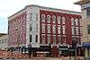
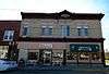
| 28 |
Crosby Block |
|
August 1, 1985
(#85001658) |
102 Allen St.
42°33′12″N 88°51′46″W / 42.553333°N 88.862778°W / 42.553333; -88.862778 (Crosby Block) |
Clinton |
|
| 29 |
James B. Crosby House |
|
December 14, 1995
(#95001454) |
1005 Sutherland Ave.
42°41′41″N 89°01′27″W / 42.694722°N 89.024167°W / 42.694722; -89.024167 (James B. Crosby House) |
Janesville |
|
| 30 |
Charles L. Culton House |
|
August 22, 1977
(#77000046) |
708 Washington St.
42°50′19″N 89°04′34″W / 42.838611°N 89.076111°W / 42.838611; -89.076111 (Charles L. Culton House) |
Edgerton |
|
| 31 |
De Jean House |
|
September 13, 1978
(#78003388) |
27 Third St.
42°46′54″N 88°57′33″W / 42.781667°N 88.959167°W / 42.781667; -88.959167 (De Jean House) |
Milton |
|
| 32 |
Erastus Dean Farmstead |
|
December 4, 1978
(#78000131) |
E of Janesville on U.S. 14
42°39′20″N 88°52′50″W / 42.655556°N 88.880556°W / 42.655556; -88.880556 (Erastus Dean Farmstead) |
Janesville |
|
| 33 |
Homer B. DeLong House |
|
August 1, 1985
(#85001659) |
500 Milwaukee Rd.
42°33′29″N 88°51′51″W / 42.558056°N 88.864167°W / 42.558056; -88.864167 (Homer B. DeLong House) |
Clinton |
|
| 34 |
John T. Dow House |
|
September 17, 1980
(#80000396) |
SR 1
42°50′05″N 89°14′49″W / 42.834722°N 89.246944°W / 42.834722; -89.246944 (John T. Dow House) |
Evansville |
|
| 35 |
Eager Free Public Library |
|
August 16, 1977
(#77000047) |
39 W. Main St.
42°46′48″N 89°18′03″W / 42.780037°N 89.300950°W / 42.780037; -89.300950 (Eager Free Public Library) |
Evansville |
|
| 36 |
Almeron Eager Funerary Monument and Plot |
|
July 20, 2011
(#11000477) |
8012 N. Cemetery Rd.
42°46′59″N 89°17′21″W / 42.783056°N 89.289167°W / 42.783056; -89.289167 (Almeron Eager Funerary Monument and Plot) |
Evansville |
|
| 37 |
East Milwaukee Street Historic District |
|
February 8, 1980
(#80000184) |
N. Parker Dr. and E. Milwaukee St.
42°41′01″N 89°01′18″W / 42.683611°N 89.021667°W / 42.683611; -89.021667 (East Milwaukee Street Historic District) |
Janesville |
|
| 38 |
Edgerton Depot |
|
April 13, 1998
(#98000283) |
20 S. Main St.
42°50′00″N 89°04′13″W / 42.833333°N 89.070278°W / 42.833333; -89.070278 (Edgerton Depot) |
Edgerton |
|
| 39 |
Edgerton Post Office |
|
October 24, 2000
(#00001239) |
104 N. Swift St.
42°50′08″N 89°04′16″W / 42.835556°N 89.071111°W / 42.835556; -89.071111 (Edgerton Post Office) |
Edgerton |
|
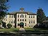
| 40 |
Edgerton Public Grade Schools |
|
January 14, 1987
(#86003568) |
116 N. Swift St.
42°50′09″N 89°04′11″W / 42.835833°N 89.069722°W / 42.835833; -89.069722 (Edgerton Public Grade Schools) |
Edgerton |
|
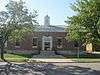
| 41 |
Emerson Hall |
|
September 20, 1979
(#79000109) |
Beloit College campus
42°30′26″N 89°01′43″W / 42.507222°N 89.028611°W / 42.507222; -89.028611 (Emerson Hall) |
Beloit |
|
| 42 |
Evansville Historic District |
|
November 16, 1978
(#78000132) |
roughly bounded by Allens Creek, Liberty, 4th and Garfield Sts.
42°46′46″N 89°18′10″W / 42.779444°N 89.302778°W / 42.779444; -89.302778 (Evansville Historic District) |
Evansville |
|
| 43 |
Evansville Standpipe |
|
February 27, 2008
(#08000120) |
288 N. 4th St.
42°47′05″N 89°18′47″W / 42.784722°N 89.313056°W / 42.784722; -89.313056 (Evansville Standpipe) |
Evansville |
|
| 44 |
Fairbanks Flats |
|
January 7, 1983
(#83003416) |
205, 215 Birch Ave. and 206, 216 Carpenter Ave.
42°31′19″N 89°02′24″W / 42.521944°N 89.04°W / 42.521944; -89.04 (Fairbanks Flats) |
Beloit |
|
| 45 |
First Congregational Church |
|
January 23, 1975
(#75000078) |
801 Bushnell St.
42°30′06″N 89°01′40″W / 42.501667°N 89.027778°W / 42.501667; -89.027778 (First Congregational Church) |
Beloit |
|
| 46 |
Footville Condensery |
|
May 7, 1982
(#82000704) |
Beloit St.
42°40′00″N 89°12′27″W / 42.666667°N 89.2075°W / 42.666667; -89.2075 (Footville Condensery) |
Footville |
|
| 47 |
Footville State Bank |
|
May 7, 1982
(#82000705) |
158 Depot St.
42°40′11″N 89°12′40″W / 42.669722°N 89.211111°W / 42.669722; -89.211111 (Footville State Bank) |
Footville |
|
| 48 |
Fredendall Block |
|
March 25, 1982
(#82000706) |
33-39 S. Main St.
42°40′56″N 89°01′17″W / 42.682222°N 89.021389°W / 42.682222; -89.021389 (Fredendall Block) |
Janesville |
|
| 49 |
Fulton Congregational Church |
|
June 7, 1976
(#76000077) |
Fulton St.
42°48′21″N 89°07′44″W / 42.805833°N 89.128889°W / 42.805833; -89.128889 (Fulton Congregational Church) |
Fulton |
|
| 50 |
Fulton Street Historic District |
|
July 1, 1999
(#99000788) |
Along Fulton St., roughly bounded by Main and Albion Sts.; 11-21 Swift St.
42°50′03″N 89°04′13″W / 42.834167°N 89.070278°W / 42.834167; -89.070278 (Fulton Street Historic District) |
Edgerton |
|
| 51 |
Gempeler Round Barn |
|
June 4, 1979
(#79000110) |
SW of Orfordville
42°39′50″N 89°19′50″W / 42.663889°N 89.330556°W / 42.663889; -89.330556 (Gempeler Round Barn) |
Orfordville |
|
| 52 |
Gifford House |
|
September 13, 1978
(#78003387) |
308 Vernal
42°46′51″N 88°57′36″W / 42.780833°N 88.96°W / 42.780833; -88.96 (Gifford House) |
Milton |
|
| 53 |
Gilley-Tofsland Octagonal Barn |
|
June 4, 1979
(#79000111) |
NW of Edgerton
42°50′40″N 89°10′30″W / 42.844444°N 89.175°W / 42.844444; -89.175 (Gilley-Tofsland Octagonal Barn) |
Edgerton |
|
| 54 |
Goodrich Blacksmith Shop |
|
September 13, 1978
(#78003382) |
28 S. Janesville St.
42°46′34″N 88°56′10″W / 42.776111°N 88.936111°W / 42.776111; -88.936111 (Goodrich Blacksmith Shop) |
Milton |
|
| 55 |
Goodrich-Buten House |
|
September 13, 1978
(#78003385) |
528 E. Madison St.
42°46′38″N 88°56′22″W / 42.777222°N 88.939444°W / 42.777222; -88.939444 (Goodrich-Buten House) |
Milton |
|
| 56 |
Ezra and Elizabeth Goodrich House |
|
July 14, 2015
(#15000425) |
742 E. Madison Ave.
42°46′38″N 88°56′17″W / 42.777177°N 88.938046°W / 42.777177; -88.938046 (Ezra and Elizabeth Goodrich House) |
Milton |
|
| 57 |
William H. and Edith Gray Farmstead |
|
June 30, 2015
(#15000377) |
313 E. High St.
42°46′23″N 88°56′46″W / 42.7730°N 88.9460°W / 42.7730; -88.9460 (William H. and Edith Gray Farmstead) |
Milton |
|
| 58 |
Reynolds and Lois Greenman House |
|
August 23, 2016
(#16000567) |
12 Merchant Row
42°46′59″N 88°57′44″W / 42.782945°N 88.962345°W / 42.782945; -88.962345 (Reynolds and Lois Greenman House) |
Milton |
|
| 59 |
Grove Street Historic District |
|
August 10, 2011
(#11000531) |
103, 111, 112, 116, 119, 125, 126, 133 & 134 Grove St.
42°47′00″N 89°18′08″W / 42.783464°N 89.302222°W / 42.783464; -89.302222 (Grove Street Historic District) |
Evansville |
|
| 60 |
Hanchett Block |
|
March 20, 1980
(#80000185) |
307 State St.
42°29′56″N 89°02′08″W / 42.498889°N 89.035556°W / 42.498889; -89.035556 (Hanchett Block) |
Beloit |
|
| 61 |
Haven-Crandall House |
|
August 29, 2016
(#16000575) |
220 S. Janesville St.
42°46′29″N 88°56′12″W / 42.774837°N 88.936743°W / 42.774837; -88.936743 (Haven-Crandall House) |
Milton |
|
| 62 |
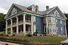
Hilton House Hotel |
|
November 7, 2003
(#03001128) |
434 E. Grand Ave.
42°29′58″N 89°02′02″W / 42.499444°N 89.033889°W / 42.499444; -89.033889 (Hilton House Hotel) |
Beloit |
No longer standing |
| 63 |
How-Beckman Mill |
|
September 7, 1977
(#77000049) |
11600 County Highway H
42°30′38″N 89°10′12″W / 42.510434°N 89.170053°W / 42.510434; -89.170053 (How-Beckman Mill) |
Beloit |
|
| 64 |
John and Martha Hugunin House |
|
June 1, 2005
(#05000534) |
2739 Beloit Ave.
42°38′23″N 89°00′40″W / 42.639692°N 89.011222°W / 42.639692; -89.011222 (John and Martha Hugunin House) |
Janesville |
|
| 65 |
Janesville Cotton Mill |
|
July 16, 1980
(#80000186) |
220 N. Franklin St.
42°41′02″N 89°01′39″W / 42.683889°N 89.0275°W / 42.683889; -89.0275 (Janesville Cotton Mill) |
Janesville |
|
| 66 |
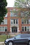
Janesville High School |
|
June 25, 1999
(#99000760) |
408 S. Main St.
42°40′40″N 89°01′02″W / 42.677778°N 89.017222°W / 42.677778; -89.017222 (Janesville High School) |
Janesville |
Also known as Marshall Junior High School |
| 67 |
Janesville Public Library |
|
July 1, 1981
(#81000057) |
64 S. Main St.
42°40′53″N 89°01′15″W / 42.681389°N 89.020833°W / 42.681389; -89.020833 (Janesville Public Library) |
Janesville |
|
| 68 |
Janesville Pumping Station |
|
March 7, 1985
(#85000494) |
500 Blk. River St.
42°40′48″N 89°01′22″W / 42.68°N 89.022778°W / 42.68; -89.022778 (Janesville Pumping Station) |
Janesville |
|
| 69 |
Jefferson Avenue Historic District |
|
April 19, 2006
(#06000300) |
Bounded by Oakland, Garfield and Ruger Aves. and Forest Park Blvd.
42°41′10″N 89°00′40″W / 42.686111°N 89.011111°W / 42.686111; -89.011111 (Jefferson Avenue Historic District) |
Janesville |
|
| 70 |
John H. Jones House |
|
March 14, 2008
(#08000186) |
538 S. Main St.
42°40′36″N 89°00′56″W / 42.676667°N 89.015556°W / 42.676667; -89.015556 (John H. Jones House) |
Janesville |
|
| 71 |
Samuel S. Jones Cobblestone House |
|
February 23, 1978
(#78000133) |
E of Clinton on Milwaukee Rd.
42°33′57″N 88°49′02″W / 42.565833°N 88.817222°W / 42.565833; -88.817222 (Samuel S. Jones Cobblestone House) |
Clinton |
|
| 72 |
Kinney Farmstead-Tay-e-he-Dah Site |
|
February 17, 1978
(#78000134) |
1612 E. Hotel Dr.
42°50′32″N 89°00′17″W / 42.842264°N 89.004621°W / 42.842264; -89.004621 (Kinney Farmstead-Tay-e-he-Dah Site) |
Edgerton |
|
| 73 |
Lappin-Hayes Block |
|
November 7, 1976
(#76000224) |
20 E. Milwaukee St.
42°40′58″N 89°01′21″W / 42.682778°N 89.0225°W / 42.682778; -89.0225 (Lappin-Hayes Block) |
Janesville |
|
| 74 |
LaPrairie Grange Hall No. 79 |
|
April 11, 1977
(#77000050) |
SE of Janesville on Town Hall Rd.
42°37′37″N 88°57′12″W / 42.626944°N 88.953333°W / 42.626944; -88.953333 (LaPrairie Grange Hall No. 79) |
Janesville |
|
| 75 |
Lathrop-Munn Cobblestone House |
|
August 22, 1977
(#77000051) |
524 Bluff St.
42°30′03″N 89°02′31″W / 42.500833°N 89.041944°W / 42.500833; -89.041944 (Lathrop-Munn Cobblestone House) |
Beloit |
|
| 76 |
Leonard—Leota Park |
|
September 4, 2012
(#12000610) |
20, 30, 40, 50, ca 60, 120, 121 Antes Dr., 321, 340, 359, 360, 363, 365, 395 Burr W. Jones Cir., Leonard Park Dr.
42°47′07″N 89°18′06″W / 42.785362°N 89.30164°W / 42.785362; -89.30164 (Leonard—Leota Park) |
Evansville |
|
| 77 |
Look West Historic District |
|
March 26, 1987
(#87000506) |
Roughly bounded by Mineral Point Ave., N. Franklin and Race Sts., Laurel Ave., and N. Chatham St.
42°41′03″N 89°02′00″W / 42.684167°N 89.033333°W / 42.684167; -89.033333 (Look West Historic District) |
Janesville |
Boundary increase (listed December 10, 1993): Roughly bounded by Laurel Ave. and N. Madison, W. Court and N. Palm Sts. |
| 78 |
Lovejoy and Merrill-Nowlan Houses |
|
January 21, 1980
(#80000187) |
220 and 202 St. Lawrence Ave.
42°40′55″N 89°01′07″W / 42.681944°N 89.018611°W / 42.681944; -89.018611 (Lovejoy and Merrill-Nowlan Houses) |
Janesville |
|
| 79 |
Masonic Temple |
|
July 21, 2015
(#15000458) |
508 Vernal Ave.
42°46′51″N 88°57′47″W / 42.780920°N 88.963056°W / 42.780920; -88.963056 (Masonic Temple) |
Milton |
|
| 80 |
Peter McEwan Warehouse |
|
September 13, 1978
(#78003384) |
711 E. High St.
42°46′22″N 88°56′19″W / 42.772778°N 88.938611°W / 42.772778; -88.938611 (Peter McEwan Warehouse) |
Milton |
|
| 81 |
Merchant Row Historic District |
|
August 3, 2015
(#15000504) |
212, 216, 218-220, 228-230 Merchant Row & 553, 537, 541 Vernal Ave.
42°46′54″N 88°57′48″W / 42.781606°N 88.963216°W / 42.781606; -88.963216 (Merchant Row Historic District) |
Milton |
|
| 82 |
Merrill Avenue Historic District |
|
February 19, 1993
(#93000028) |
103, 107, 111, 115 Merrill Ave.
42°30′34″N 89°02′13″W / 42.509444°N 89.036944°W / 42.509444; -89.036944 (Merrill Avenue Historic District) |
Beloit |
|
| 83 |
Miller House |
|
September 17, 1980
(#80000399) |
SR 1
42°49′40″N 89°14′25″W / 42.827778°N 89.240278°W / 42.827778; -89.240278 (Miller House) |
Evansville |
|
| 84 |
Milton College Historic District |
|
May 27, 1980
(#80000188) |
College St.
42°46′27″N 88°56′32″W / 42.774167°N 88.942222°W / 42.774167; -88.942222 (Milton College Historic District) |
Milton |
|
| 85 |
Milton House |
|
February 1, 1972
(#72000065) |
18 S. Janesville St.
42°46′37″N 88°56′11″W / 42.776944°N 88.936389°W / 42.776944; -88.936389 (Milton House) |
Milton |
|
| 86 |
Moran's Saloon |
|
January 7, 1983
(#83003417) |
312 State St.
42°29′57″N 89°02′09″W / 42.499167°N 89.035833°W / 42.499167; -89.035833 (Moran's Saloon) |
Beloit |
|
| 87 |
Mouth of the Yahara Archeological District |
|
April 28, 1975
(#75000079) |
Address Restricted
|
Fulton |
|
| 88 |
Murray-George House |
|
September 13, 1985
(#85002125) |
SR P
42°30′33″N 88°56′18″W / 42.509167°N 88.938333°W / 42.509167; -88.938333 (Murray-George House) |
Beloit |
|
| 89 |
Peter Myers Pork Packing Plant and Willard Coleman Building |
|
July 7, 1983
(#83003418) |
117-123 N. Main St.
42°41′03″N 89°01′26″W / 42.684167°N 89.023889°W / 42.684167; -89.023889 (Peter Myers Pork Packing Plant and Willard Coleman Building) |
Janesville |
|
| 90 |
Myers-Newhoff House |
|
May 18, 1979
(#79000277) |
121 N. Parker Dr.
42°41′05″N 89°01′22″W / 42.684722°N 89.022778°W / 42.684722; -89.022778 (Myers-Newhoff House) |
Janesville |
|
| 91 |
Near East Side Historic District |
|
January 7, 1983
(#83003419) |
Roughly bounded by Pleasant, Clary Sts., Wisconsin and E. Grand Aves.
42°30′10″N 89°01′40″W / 42.502778°N 89.027778°W / 42.502778; -89.027778 (Near East Side Historic District) |
Beloit |
|
| 92 |
Elbert Neese House |
|
January 7, 1983
(#83003420) |
1302 Bushnell St
42°30′04″N 89°01′15″W / 42.501111°N 89.020833°W / 42.501111; -89.020833 (Elbert Neese House) |
Beloit |
|
| 93 |
North Main Street Historic District |
|
February 8, 1980
(#80000189) |
N. Main St. and N. Parker Dr.
42°41′02″N 89°01′23″W / 42.683889°N 89.023056°W / 42.683889; -89.023056 (North Main Street Historic District) |
Janesville |
|
| 94 |
Sterling North House |
|
January 9, 1997
(#96001579) |
409 W. Rollin St.
42°50′14″N 89°04′04″W / 42.837222°N 89.067778°W / 42.837222; -89.067778 (Sterling North House) |
Edgerton |
|
| 95 |
Clark Nye House |
|
January 7, 1983
(#83003422) |
2501 Spring Creek Rd.
42°31′34″N 89°04′45″W / 42.526111°N 89.079167°W / 42.526111; -89.079167 (Clark Nye House) |
Beloit |
|
| 96 |
Old Fourth Ward Historic District |
|
May 30, 1990
(#90000789) |
Roughly bounded by Washington St., Center Ave., Court St., Franklin St., and Monterey Park
42°40′24″N 89°01′45″W / 42.673333°N 89.029167°W / 42.673333; -89.029167 (Old Fourth Ward Historic District) |
Janesville |
|
| 97 |
Orfordville Depot |
|
October 13, 1988
(#88002004) |
Beloit St.
42°37′41″N 89°15′22″W / 42.628056°N 89.256111°W / 42.628056; -89.256111 (Orfordville Depot) |
Orfordville |
|
| 98 |
John and Margaret Owen House |
|
August 23, 2016
(#16000568) |
33 2nd St.
42°46′54″N 88°57′38″W / 42.781647°N 88.960547°W / 42.781647; -88.960547 (John and Margaret Owen House) |
Milton |
|
| 99 |
William J. Owen Store |
|
May 7, 1982
(#82000707) |
220 Depot St.
42°40′11″N 89°12′40″W / 42.669722°N 89.211111°W / 42.669722; -89.211111 (William J. Owen Store) |
Footville |
|
| 100 |
J. L. Pangborn House |
|
August 1, 1985
(#85001664) |
300 Allen St.
42°33′20″N 88°51′47″W / 42.555556°N 88.863056°W / 42.555556; -88.863056 (J. L. Pangborn House) |
Clinton |
|
| 101 |
Parkview Historic District |
|
August 3, 2015
(#15000505) |
644-655 College St. & 247-319 Parkview Dr.
42°46′27″N 88°56′22″W / 42.774176°N 88.939473°W / 42.774176; -88.939473 (Parkview Historic District) |
Milton |
|
| 102 |
Payne-Craig House |
|
July 2, 1987
(#87000990) |
2200 W. Memorial Dr.
42°41′44″N 89°02′52″W / 42.695556°N 89.047778°W / 42.695556; -89.047778 (Payne-Craig House) |
Janesville |
|
| 103 |
Pearsons Hall of Science |
|
June 30, 1980
(#80000190) |
Beloit College campus
42°30′13″N 89°01′53″W / 42.503611°N 89.031389°W / 42.503611; -89.031389 (Pearsons Hall of Science) |
Beloit |
|
| 104 |
Pomeroy and Pelton Tobacco Warehouse |
|
July 9, 1998
(#98000848) |
1 W. Fulton St.
42°50′00″N 89°04′10″W / 42.833333°N 89.069444°W / 42.833333; -89.069444 (Pomeroy and Pelton Tobacco Warehouse) |
Edgerton |
Also known as Dickinson Tobacco Warehouse |
| 105 |
J. K. Porter Farmstead |
|
September 17, 1980
(#80000400) |
SR 1
42°50′09″N 89°13′35″W / 42.835833°N 89.226389°W / 42.835833; -89.226389 (J. K. Porter Farmstead) |
Evansville |
|
| 106 |
Prospect Hill Historic District |
|
November 5, 1992
(#92001558) |
Roughly bounded by Eisenhower, Prospect and Atwood Aves., Milwaukee St., Parker Dr. and Centerway
42°41′10″N 89°01′16″W / 42.686111°N 89.021111°W / 42.686111; -89.021111 (Prospect Hill Historic District) |
Janesville |
|
| 107 |
Brewster Randall House |
|
March 1, 1984
(#84003782) |
1412 Ruger Ave.
42°41′10″N 89°00′19″W / 42.686111°N 89.005278°W / 42.686111; -89.005278 (Brewster Randall House) |
Janesville |
|
| 108 |
Rasey House |
|
December 27, 1974
(#74000123) |
517 Prospect St.
42°30′05″N 89°01′50″W / 42.501389°N 89.030556°W / 42.501389; -89.030556 (Rasey House) |
Beloit |
|
| 109 |
Charles Rau House |
|
January 7, 1983
(#83003423) |
757 Euclid Ave.
42°30′01″N 89°02′56″W / 42.500278°N 89.048889°W / 42.500278; -89.048889 (Charles Rau House) |
Beloit |
|
| 110 |
Richardson Grout House |
|
September 17, 1980
(#80000402) |
SR 1
42°49′06″N 89°12′41″W / 42.818333°N 89.211389°W / 42.818333; -89.211389 (Richardson Grout House) |
Evansville |
|
| 111 |
Hamilton Richardson House |
|
July 17, 1978
(#78000135) |
429 Prospect Ave.
42°41′14″N 89°01′13″W / 42.687222°N 89.020278°W / 42.687222; -89.020278 (Hamilton Richardson House) |
Janesville |
|
| 112 |
Richardson-Brinkman Cobblestone House |
|
July 28, 1977
(#77000052) |
607 W. Milwaukee Rd.
42°33′27″N 88°51′58″W / 42.5575°N 88.866111°W / 42.5575; -88.866111 (Richardson-Brinkman Cobblestone House) |
Clinton |
|
| 113 |
Rindfleisch Building |
|
January 7, 1983
(#83003424) |
512 E. Grand Ave.
42°29′58″N 89°02′00″W / 42.499444°N 89.033333°W / 42.499444; -89.033333 (Rindfleisch Building) |
Beloit |
|
| 114 |
Risum Round Barn |
|
June 4, 1979
(#79000112) |
Southwest of Orfordville
42°35′55″N 89°17′35″W / 42.598611°N 89.293056°W / 42.598611; -89.293056 (Risum Round Barn) |
Orfordville |
|
| 115 |
John C. and Mary Robinson Farmstead |
|
January 7, 2010
(#09001221) |
18002 W. County Trunk Highway C
42°47′14″N 89°21′26″W / 42.787339°N 89.357269°W / 42.787339; -89.357269 (John C. and Mary Robinson Farmstead) |
Union |
|
| 116 |
St. John's Lutheran Church |
|
August 14, 2012
(#12000521) |
312 S. 3rd St.
42°46′34″N 89°18′21″W / 42.775992°N 89.305706°W / 42.775992; -89.305706 (St. John's Lutheran Church) |
Evansville |
|
| 117 |
Seventh Day Baptist Church |
|
August 22, 2016
(#16000569) |
720 E. Madison Ave.
42°46′37″N 88°56′15″W / 42.777015°N 88.937606°W / 42.777015; -88.937606 (Seventh Day Baptist Church) |
Milton |
|
| 118 |
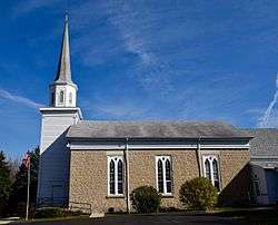
Shopiere Congregational Church |
|
August 13, 1976
(#76000078) |
Buss Rd., near Shopiere Rd.
42°34′14″N 88°56′17″W / 42.570556°N 88.938056°W / 42.570556; -88.938056 (Shopiere Congregational Church) |
Shopiere |
Congregational church built starting in 1850, with its limestone main block in Greek Revival style and the New England-styled tower and steeple added later. |
| 119 |
Stephen Slaymaker House |
|
January 7, 1983
(#83003425) |
348 Euclid Ave.
42°29′59″N 89°02′32″W / 42.499722°N 89.042222°W / 42.499722; -89.042222 (Stephen Slaymaker House) |
Beloit |
|
| 120 |
Samuel Smiley House |
|
October 21, 1982
(#82001849) |
SE of Orfordville on WI 213
42°35′59″N 89°12′25″W / 42.599722°N 89.206944°W / 42.599722; -89.206944 (Samuel Smiley House) |
Orfordville |
|
| 121 |
John Smith House |
|
August 1, 1985
(#85001663) |
312 Pleasant St.
42°33′24″N 88°52′04″W / 42.556667°N 88.867778°W / 42.556667; -88.867778 (John Smith House) |
Clinton |
|
| 122 |
South First Street Residential Historic District |
|
August 10, 2011
(#11000532) |
341, 348, 349, 402, 408, 409, 412, 419, 433, 439 & 443, S. 1st St.
42°46′29″N 89°18′03″W / 42.774722°N 89.300833°W / 42.774722; -89.300833 (South First Street Residential Historic District) |
Evansville |
NRHP # 11000532 |
| 123 |
South Main Street Historic District |
|
June 1, 1990
(#90000820) |
Roughly S. Main St. from Milwaukee St. to Rock Co. Courthouse grounds and E. Court St. from Parker Dr. to Rock R.
42°40′55″N 89°01′17″W / 42.681944°N 89.021389°W / 42.681944; -89.021389 (South Main Street Historic District) |
Janesville |
|
| 124 |
St. Paul's Episcopal Church |
|
April 4, 1978
(#78000136) |
212 W. Grand Ave.
42°30′05″N 89°02′22″W / 42.501389°N 89.039444°W / 42.501389; -89.039444 (St. Paul's Episcopal Church) |
Beloit |
|
| 125 |
Stark-Clint House |
|
September 13, 1985
(#85002124) |
Creek Rd.
42°35′04″N 88°55′32″W / 42.584444°N 88.925556°W / 42.584444; -88.925556 (Stark-Clint House) |
Tiffany |
|
| 126 |
Harrison Stebbins House |
|
September 17, 1980
(#80000401) |
SR 1
42°49′36″N 89°12′55″W / 42.826667°N 89.215278°W / 42.826667; -89.215278 (Harrison Stebbins House) |
Evansville |
Demolished in 2013[10] |
| 127 |
Soloman J. Strang House |
|
May 7, 1982
(#82000708) |
231 North Gilbert
42°40′25″N 89°12′32″W / 42.673611°N 89.208889°W / 42.673611; -89.208889 (Soloman J. Strang House) |
Footville |
|
| 128 |
Strong Building |
|
January 7, 1983
(#83003426) |
400-408 E. Grand Ave.
42°29′58″N 89°02′07″W / 42.499444°N 89.035278°W / 42.499444; -89.035278 (Strong Building) |
Beloit |
|
| 129 |
Strong Partridge Mound Group |
|
March 1, 1994
(#94000057) |
1750 Arrowhead Dr.
42°31′09″N 89°00′37″W / 42.519167°N 89.010278°W / 42.519167; -89.010278 (Strong Partridge Mound Group) |
Beloit |
|
| 130 |
John and Eleanor Strunk House |
|
March 11, 2008
(#08000184) |
2306 N. Parker Dr.
42°42′38″N 89°01′59″W / 42.710556°N 89.033056°W / 42.710556; -89.033056 (John and Eleanor Strunk House) |
Janesville |
|
| 131 |
Tallman House |
|
October 15, 1970
(#70000085) |
440 N. Jackson St.
42°41′10″N 89°01′53″W / 42.686111°N 89.031389°W / 42.686111; -89.031389 (Tallman House) |
Janesville |
|
| 132 |
A. E. Taylor House |
|
August 1, 1985
(#85001662) |
318 Durand St.
42°33′25″N 88°51′51″W / 42.556944°N 88.864167°W / 42.556944; -88.864167 (A. E. Taylor House) |
Clinton |
|
| 133 |
Turtleville Iron Bridge |
|
September 15, 1977
(#77000053) |
N of Beloit on Lathers Rd.
42°33′56″N 88°57′52″W / 42.565556°N 88.964444°W / 42.565556; -88.964444 (Turtleville Iron Bridge) |
Beloit |
|
| 134 |
West Luther Valley Lutheran Church |
|
May 27, 1980
(#80000191) |
SW of Orfordville on W. Church Rd.
42°36′26″N 89°19′35″W / 42.607222°N 89.326389°W / 42.607222; -89.326389 (West Luther Valley Lutheran Church) |
Orfordville |
|
| 135 |
West Milwaukee Street Historic District |
|
May 17, 1990
(#90000790) |
Roughly bounded by Wall, River, Court, and Academy Sts.
42°40′52″N 89°01′33″W / 42.681111°N 89.025833°W / 42.681111; -89.025833 (West Milwaukee Street Historic District) |
Janesville |
|
| 136 |
Whiton-Parker House |
|
February 8, 2016
(#15001056) |
1000 E. Milwaukee St.
42°41′17″N 89°00′45″W / 42.687966°N 89.012434°W / 42.687966; -89.012434 (Whiton-Parker House) |
Janesville |
|
| 137 |
Frances Willard Schoolhouse |
|
October 5, 1977
(#77000054) |
Craig Ave.
42°41′29″N 89°00′19″W / 42.691389°N 89.005278°W / 42.691389; -89.005278 (Frances Willard Schoolhouse) |
Janesville |
|
| 138 |
Wyman-Rye Farmstead |
|
November 7, 1977
(#77000055) |
N of Clinton on Wyman-Rye Dr.
42°35′28″N 88°52′18″W / 42.591111°N 88.871667°W / 42.591111; -88.871667 (Wyman-Rye Farmstead) |
Clinton |
|
| 139 |
Florence Yates House |
|
January 7, 1983
(#83003427) |
1614 Emerson St.
42°30′16″N 89°00′59″W / 42.504444°N 89.016389°W / 42.504444; -89.016389 (Florence Yates House) |
Beloit |
|


.jpg)