| [3] |
Name on the Register |
Image |
Date listed[4] |
Location |
City or town |
Description |
|---|
| 1 |
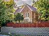
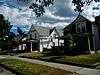
B Street District |
|
September 5, 1979
(#79001408) |
307-317 B St.
45°39′35″N 110°33′18″W / 45.659722°N 110.555°W / 45.659722; -110.555 (B Street District) |
Livingston |
Four small one-story houses |
| 2 |
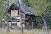
Oliver and Lucy Bonnell Gothic Arch Roofed Barn |
|
September 15, 2004
(#04000978) |
247 Shields River Road, E.
45°47′31″N 110°29′55″W / 45.791944°N 110.498611°W / 45.791944; -110.498611 (Oliver and Lucy Bonnell Gothic Arch Roofed Barn) |
Clyde Park |
|
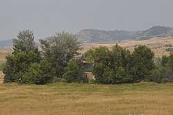
| 3 |
Carbella Bridge |
|
January 4, 2010
(#09001184) |
Milepost 0 on Tom Miner Rd., near its junction with U.S. Route 89
45°12′16″N 110°54′06″W / 45.204514°N 110.901558°W / 45.204514; -110.901558 (Carbella Bridge) |
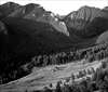
Gardiner |
|
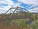
| 4 |
Carter Bridge |
|
April 28, 2011
(#11000226) |
Milepost 31.6 on MT 540
45°35′49″N 110°34′02″W / 45.596944°N 110.567222°W / 45.596944; -110.567222 (Carter Bridge) |
Livingston vicinity |
Reinforced Concrete Bridges in Montana, 1900-1958 MPS |
| 5 |
Chicken Creek Farmstead Historic District |
|
December 12, 2008
(#08001194) |
790 Rock Creek Rd., N.
45°53′23″N 110°25′32″W / 45.889772°N 110.425686°W / 45.889772; -110.425686 (Chicken Creek Farmstead Historic District) |
Clyde Park |
|
| 6 |
Chico Hot Springs |
|
August 21, 1998
(#98001085) |
2 miles northeast of Chico, 3.5 miles southeast of Emigrant
45°20′10″N 110°41′35″W / 45.336111°N 110.693056°W / 45.336111; -110.693056 (Chico Hot Springs) |
Pray |
|
| 7 |
Commercial District |
|
September 5, 1979
(#79001409) |
Roughly bounded by Park, C, Clark, 3rd, and Callendar Sts.
45°39′34″N 110°33′48″W / 45.659444°N 110.563333°W / 45.659444; -110.563333 (Commercial District) |
Livingston |
|
| 8 |
Convict Grade Historic District |
|
August 3, 2015
(#15000485) |
1 mi. E. of jct. with US 89
45°43′46″N 110°26′15″W / 45.729428°N 110.43737°W / 45.729428; -110.43737 (Convict Grade Historic District) |
Springdale vicinity |
|
| 9 |
Cooke City Store |
|
March 27, 1986
(#86000527) |
Main St.
45°01′10″N 109°56′02″W / 45.019444°N 109.933889°W / 45.019444; -109.933889 (Cooke City Store) |
Cooke City |
|
| 10 |
Detention Hospital |
|
September 5, 1979
(#79001410) |
325 E. Gallatin St.
45°40′04″N 110°33′35″W / 45.667778°N 110.559722°W / 45.667778; -110.559722 (Detention Hospital) |
Livingston |
|
| 11 |
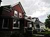
East Side Residential District |
|
September 5, 1979
(#79001411) |
Roughly bounded by I, Clark, E, and Park Sts.
45°39′53″N 110°33′07″W / 45.664722°N 110.551944°W / 45.664722; -110.551944 (East Side Residential District) |
Livingston |
|
| 12 |
Ebert Ranch |
|
September 5, 1979
(#79001412) |
U.S. Route 89
45°42′03″N 110°31′11″W / 45.700833°N 110.519722°W / 45.700833; -110.519722 (Ebert Ranch) |
Livingston |
|
| 13 |
Gardiner Jail |
|
August 3, 2015
(#15000486) |
2nd St.
45°01′55″N 110°42′21″W / 45.031830°N 110.705875°W / 45.031830; -110.705875 (Gardiner Jail) |
Gardiner |
|
| 14 |
Harvat Ranch |
|
September 5, 1979
(#79001413) |
Southeast of Livingston off U.S. Route 89
45°40′05″N 110°31′59″W / 45.668056°N 110.533056°W / 45.668056; -110.533056 (Harvat Ranch) |
Livingston |
|
| 15 |
John Hepburn Place |
|
October 19, 2005
(#05001177) |
626 E. River Rd.
45°17′40″N 110°49′53″W / 45.294444°N 110.831389°W / 45.294444; -110.831389 (John Hepburn Place) |
Emigrant |
|
| 16 |
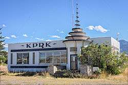
KPRK Radio |
|
September 5, 1979
(#79001414) |
East of Livingston off U.S. Route 89
45°40′22″N 110°32′24″W / 45.672778°N 110.54°W / 45.672778; -110.54 (KPRK Radio) |
Livingston |
|
| 17 |
Krohne Island House |
|
September 5, 1979
(#79001415) |
Krohne Island
45°40′15″N 110°32′30″W / 45.670833°N 110.541667°W / 45.670833; -110.541667 (Krohne Island House) |
Livingston |
|
| 18 |
Krohne Spring House |
|
September 5, 1979
(#79001416) |
329 S. H St.
45°39′47″N 110°32′53″W / 45.663056°N 110.548056°W / 45.663056; -110.548056 (Krohne Spring House) |
Livingston |
|
| 19 |
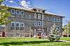
Livingston Memorial Hospital |
|
April 16, 2018
(#100002309) |
504 S. 13th St.
45°38′58″N 110°34′08″W / 45.649582°N 110.568792°W / 45.649582; -110.568792 (Livingston Memorial Hospital) |
Livingston |
|
| 20 |
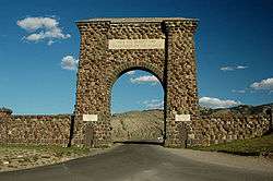
North Entrance Road Historic District |
|
May 22, 2002
(#02000529) |
Yellowstone National Park
45°00′24″N 110°41′58″W / 45.006667°N 110.699444°W / 45.006667; -110.699444 (North Entrance Road Historic District) |
Yellowstone National Park |
Road between North Entrance and Mammoth Hot Springs; extends into Park County, Wyoming. |
| 21 |
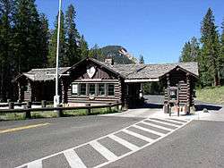
Northeast Entrance Station |
|
May 28, 1987
(#87001435) |
U.S. Route 212
45°00′17″N 110°00′33″W / 45.004722°N 110.009167°W / 45.004722; -110.009167 (Northeast Entrance Station) |
Yellowstone National Park |
|
| 22 |
Northside School |
|
September 5, 1979
(#79001417) |
118 W. Chinook St.
45°39′51″N 110°33′49″W / 45.664167°N 110.563611°W / 45.664167; -110.563611 (Northside School) |
Livingston |
|
| 23 |
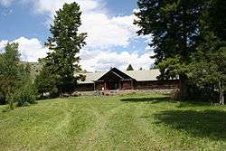
OTO Homestead and Dude Ranch |
|
October 12, 2004
(#99000054) |
15 miles north of Gardiner
45°08′41″N 110°21′13″W / 45.144722°N 110.353611°W / 45.144722; -110.353611 (OTO Homestead and Dude Ranch) |
Gardiner |
|
| 24 |
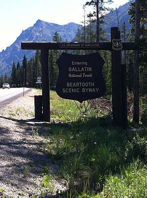
Red Lodge-Cooke City Approach Road Historic District |
|
May 8, 2014
(#14000219) |
US 212
45°01′06″N 109°56′25″W / 45.018237°N 109.940198°W / 45.018237; -109.940198 (Red Lodge-Cooke City Approach Road Historic District) |
Cooke City |
Extends into Carbon County, Montana and Park County, Wyoming |
| 25 |
Rolfson House |
|
September 5, 1979
(#79001418) |
West of Livingston on Bozeman Rd.
45°39′42″N 110°40′17″W / 45.661667°N 110.671389°W / 45.661667; -110.671389 (Rolfson House) |
Livingston |
|
| 26 |
Sixty-Three Ranch |
|
December 7, 1982
(#82000595) |
Address Restricted
|
Livingston |
|
| 27 |
Trowbridge Dairy |
|
September 5, 1979
(#79001419) |
207 S. M St.
45°40′04″N 110°32′40″W / 45.667778°N 110.544444°W / 45.667778; -110.544444 (Trowbridge Dairy) |
Livingston |
|
| 28 |
Urbach Cabin |
|
September 5, 1979
(#79001420) |
9th St. Island
45°38′54″N 110°33′34″W / 45.648333°N 110.559444°W / 45.648333; -110.559444 (Urbach Cabin) |
Livingston |
|
| 29 |
US Post Office-Livingston Main |
|
March 14, 1986
(#86000685) |
105 N. 2nd St.
45°39′39″N 110°33′40″W / 45.660833°N 110.561111°W / 45.660833; -110.561111 (US Post Office-Livingston Main) |
Livingston |
|
| 30 |
West Side Residential District |
|
September 5, 1979
(#79001421) |
Roughly bounded by Sacajawea Park, 7th, Park, and 3rd Sts.
45°39′26″N 110°33′42″W / 45.657222°N 110.561667°W / 45.657222; -110.561667 (West Side Residential District) |
Livingston |
|