| [3] |
Name on the Register[4] |
Image |
Date listed[5] |
Location |
City or town |
Description |
|---|
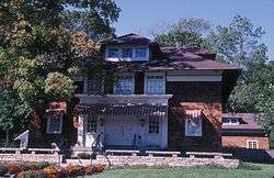
| 1 |
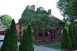
Belltown Historic District |
|
October 28, 1985
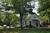
(#85003543) |
Roughly Main St. between W. High St. and CT 16, and portions of cross streets W. High, Barton Hill-Summit, and Skinner St.
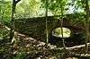
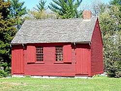
41°34′23″N 72°30′17″W / 41.573056°N 72.504722°W / 41.573056; -72.504722 (Belltown Historic District) |
East Hampton |
|
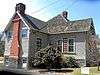
| 2 |
Black Horse Tavern |
|
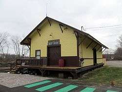
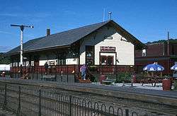
December 1, 1978
(#78002851) |
Southeast of Old Saybrook at 175 N. Cove Rd.
41°17′20″N 72°21′20″W / 41.288889°N 72.355556°W / 41.288889; -72.355556 (Black Horse Tavern) |
Old Saybrook |
|
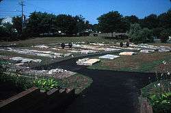
| 3 |
BOC Site |
|
October 15, 1987
(#87001218) |
Address Restricted
|
Haddam |
Archaeological site documented as part of the Lower Connecticut River Valley Woodland Period Archaeological TR. 0.1 acre. |
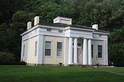
| 4 |
Bridge No. 1132 |
|
September 29, 2004
(#04001091) |
CT 80 at the Hammonasset River
41°21′26″N 72°36′45″W / 41.357222°N 72.612553°W / 41.357222; -72.612553 (Bridge No. 1132) |
Killingworth |
Open-spandrel concrete arch bridge built in 1934; extends into Madison in New Haven County |
| 5 |
Bridge No. 1603 |
|
July 29, 1993
(#93000641) |
Devil's Hopyard Rd. (Rt. 434) over an unnamed brook in Devil's Hopyard State Park
41°29′02″N 72°20′33″W / 41.483756°N 72.342370°W / 41.483756; -72.342370 (Bridge No. 1603) |
East Haddam |
Near Chapman Falls. |
| 6 |
Bridge No. 1604 |
|
July 29, 1993
(#93000642) |
Devil's Hopyard Rd. (Rt. 434) over unnamed brook in Devil's Hopyard State Park
41°28′39″N 72°20′31″W / 41.477417°N 72.341954°W / 41.477417; -72.341954 (Bridge No. 1604) |
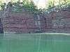
East Haddam |
|
| 7 |
Bridge No. 1605 |
|
July 29, 1993
(#93000643) |
Devil's Hopyard Rd. (Rt. 434) over Muddy Brook in Devil's Hopyard State Park
41°28′32″N 72°20′31″W / 41.475528°N 72.341911°W / 41.475528; -72.341911 (Bridge No. 1605) |
East Haddam |
|
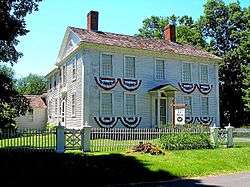
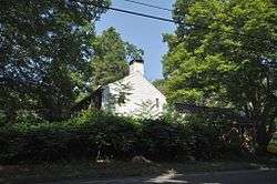
| 8 |
Benjamin Bushnell Farm |
|
May 10, 1990
(#90000761) |
52 Ingham Hill Rd.
41°19′49″N 72°25′14″W / 41.330278°N 72.420556°W / 41.330278; -72.420556 (Benjamin Bushnell Farm) |
Essex |
|
| 9 |
Elisha Bushnell House |
|
November 29, 1978
(#78002850) |
1445 Boston Post Rd.
41°17′14″N 72°24′31″W / 41.287222°N 72.408611°W / 41.287222; -72.408611 (Elisha Bushnell House) |
Old Saybrook |
|
| 10 |
Bushnell-Dickinson House |
|
August 28, 2013
(#13000289) |
170 Old Post Rd.
41°17′12″N 72°24′11″W / 41.286528°N 72.403087°W / 41.286528; -72.403087 (Bushnell-Dickinson House) |
Old Saybrook |
|
| 11 |
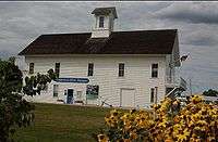
Camp Bethel |
|
December 11, 2007
(#07001246) |
124 Camp Bethel Rd.
41°27′11″N 72°28′24″W / 41.45309°N 72.473215°W / 41.45309; -72.473215 (Camp Bethel) |
Haddam |
|
| 12 |
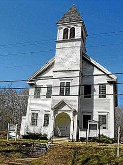
Centerbrook Congregational Church |
|
February 12, 1987
(#87000113) |
Main St.
41°21′06″N 72°24′53″W / 41.351667°N 72.414722°W / 41.351667; -72.414722 (Centerbrook Congregational Church) |
Essex |
|
| 13 |
Clinton Village Historic District |
|
July 29, 1994
(#94000788) |
Along Cemetery Rd., Church, E. Main and Liberty Sts., Old Post Rd., and Waterside Ln.
41°16′36″N 72°31′07″W / 41.276667°N 72.518611°W / 41.276667; -72.518611 (Clinton Village Historic District) |
Clinton |
|
| 14 |
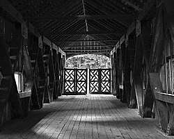
Comstock's Bridge |
|
January 1, 1976
(#76001978) |
Southeast of East Hampton off CT 16
41°33′11″N 72°26′57″W / 41.553056°N 72.449167°W / 41.553056; -72.449167 (Comstock's Bridge) |
East Hampton |
|
| 15 |
Comstock-Cheney Hall |
|
April 15, 1982
(#82003769) |
Main and Summit Sts.
41°20′55″N 72°26′32″W / 41.348642°N 72.442236°W / 41.348642; -72.442236 (Comstock-Cheney Hall) |
Essex |
Better known as Ivoryton Theatre, the first summer theatre in the U.S.? |
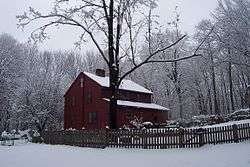
| 16 |
Connecticut Valley Railroad Roundhouse and Turntable Site |
|
April 28, 1994
(#94000395) |
Off Main St. in Fort Saybrook Monument Park in Saybrook Point
41°17′02″N 72°21′05″W / 41.283889°N 72.351389°W / 41.283889; -72.351389 (Connecticut Valley Railroad Roundhouse and Turntable Site) |
Old Saybrook |
|
| 17 |
Cypress Cemetery |
|
October 2, 2018
(#100003006) |
100 College St.
41°17′02″N 72°21′19″W / 41.2838°N 72.3553°W / 41.2838; -72.3553 (Cypress Cemetery) |
Old Saybrook |
|
| 18 |
Charles Daniels House |
|
February 19, 1988
(#88000094) |
43 Liberty St.
41°24′27″N 72°27′33″W / 41.4075°N 72.459167°W / 41.4075; -72.459167 (Charles Daniels House) |
Chester |
|
| 19 |
Amasa Day House |
|
September 22, 1972
(#72001315) |
Plains Rd.
41°30′07″N 72°27′09″W / 41.501944°N 72.4525°W / 41.501944; -72.4525 (Amasa Day House) |
East Haddam |
|
| 20 |
Deep River Freight Station |
|
December 21, 1994
(#94001445) |
152 River St.
41°23′38″N 72°25′37″W / 41.393889°N 72.426944°W / 41.393889; -72.426944 (Deep River Freight Station) |
Deep River |
|
| 21 |
Deep River Town Hall |
|
January 1, 1976
(#76001977) |
CT 80 and CT 9A
41°23′06″N 72°26′11″W / 41.385°N 72.436389°W / 41.385; -72.436389 (Deep River Town Hall) |
Deep River |
|
| 22 |
Doane's Sawmill/Deep River Manufacturing Company |
|
February 21, 1985
(#85000313) |
Horse Hill and Winthrop Rds.
41°20′17″N 72°29′02″W / 41.338056°N 72.483889°W / 41.338056; -72.483889 (Doane's Sawmill/Deep River Manufacturing Company) |
Westbrook and Deep River |
|
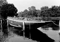
| 23 |
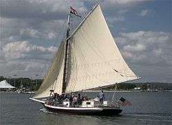
Doris (Sailing yacht) |
|
May 31, 1984
(#84001108) |
Connecticut River off River Rd.
41°23′00″N 72°23′34″W / 41.383333°N 72.392778°W / 41.383333; -72.392778 (Doris (Sailing yacht)) |
Deep River |
|
| 24 |
Jedidiah Dudley House |
|
April 12, 1982
(#82004339) |
Springbrook Rd.
41°18′54″N 72°21′51″W / 41.315°N 72.364167°W / 41.315; -72.364167 (Jedidiah Dudley House) |
Old Saybrook |
|
| 25 |
East Haddam Historic District |
|
April 29, 1983
(#83001273) |
CT 149, Broom, Norwich, Creamery, Lumberyard, and Landing Hill Rds.
41°27′23″N 72°27′45″W / 41.456389°N 72.4625°W / 41.456389; -72.4625 (East Haddam Historic District) |
East Haddam |
|
| 26 |
Samuel Eliot House |
|
November 9, 1972
(#72001316) |
500 Main St.
41°17′02″N 72°22′08″W / 41.283889°N 72.368889°W / 41.283889; -72.368889 (Samuel Eliot House) |
Old Saybrook |
|
| 27 |
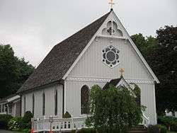
Emmanuel Church |
|
August 5, 1999
(#99000924) |
50 Emmanuel Church Rd.
41°23′34″N 72°36′33″W / 41.392778°N 72.609167°W / 41.392778; -72.609167 (Emmanuel Church) |
Killingworth |
|
| 28 |
Essex Freight Station |
|
April 19, 1994
(#94000337) |
1 Railroad Ave.
41°21′00″N 72°24′18″W / 41.350122°N 72.404917°W / 41.350122; -72.404917 (Essex Freight Station) |
Essex |
|
| 29 |
Fenwick Historic District |
|
April 13, 1995
(#95000437) |
Roughly, along Agawam, Neponset and Pettipaug Aves.
41°16′14″N 72°21′23″W / 41.270556°N 72.356389°W / 41.270556; -72.356389 (Fenwick Historic District) |
Old Saybrook |
|
| 30 |
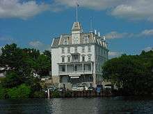
Goodspeed Opera House |
|
July 30, 1971
(#71000901) |
Norwich Rd.
41°27′07″N 72°27′47″W / 41.451944°N 72.463056°W / 41.451944; -72.463056 (Goodspeed Opera House) |
East Haddam |
|
| 31 |
Haddam Center Historic District |
|
February 9, 1989
(#89000012) |
Roughly 2.5 miles (4.0 km) along Walkley Rd. and CT 154/Saybrook Rd.
41°28′46″N 72°30′55″W / 41.479444°N 72.515278°W / 41.479444; -72.515278 (Haddam Center Historic District) |
Haddam |
|
| 32 |
Hadlyme North Historic District |
|
December 8, 1988
(#88002686) |
Roughly bounded by CT 82, Town St., Banning Rd., and Old Town St.
41°25′45″N 72°24′25″W / 41.429167°N 72.406944°W / 41.429167; -72.406944 (Hadlyme North Historic District) |
East Haddam |
|
| 33 |
Hammonasset Paper Mill Site |
|
February 23, 1996
(#96000128) |
Green Hill Road at the Hammonasset River[6]
41°19′27″N 72°35′36″W / 41.3241°N 72.5932°W / 41.3241; -72.5932 (Hammonasset Paper Mill Site) |
Killingworth |
Extends into Madison. |
| 34 |
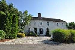
Gen. William Hart House |
|
November 9, 1972
(#72001318) |
350 Main St.
41°17′14″N 72°22′31″W / 41.287141°N 72.375235°W / 41.287141; -72.375235 (Gen. William Hart House) |
Old Saybrook |
|
| 35 |
James Hazelton House |
|
November 16, 1988
(#88001468) |
23 Hayden Hill Rd.
41°28′46″N 72°31′06″W / 41.479444°N 72.518333°W / 41.479444; -72.518333 (James Hazelton House) |
Haddam |
|
| 36 |
Hill's Academy |
|
August 23, 1985
(#85001831) |
22 Prospect St.
41°21′14″N 72°23′34″W / 41.353889°N 72.392778°W / 41.353889; -72.392778 (Hill's Academy) |
Essex |
|
| 37 |
Indian Hill Avenue Historic District |
|
May 26, 1983
(#83001274) |
Main St. and Indian Hill Ave. to the river
41°35′54″N 72°37′23″W / 41.598333°N 72.623056°W / 41.598333; -72.623056 (Indian Hill Avenue Historic District) |
Portland |
|
| 38 |
Ivoryton Historic District |
|
April 15, 2014
(#13000895) |
Roughly bounded by Main, N. Main, Oak, Blake & Summit Sts., Park Rd. & Comstock Ave.
41°20′54″N 72°26′27″W / 41.348311°N 72.440813°W / 41.348311; -72.440813 (Ivoryton Historic District) |
Essex |
Ivoryton, Connecticut |
| 39 |
James Pharmacy |
|
August 5, 1994
(#94000845) |
2 Pennywise Ln.
41°17′09″N 72°22′35″W / 41.285833°N 72.376389°W / 41.285833; -72.376389 (James Pharmacy) |
Old Saybrook |
|
| 40 |
Lay-Pritchett House |
|
October 11, 1978
(#78002854) |
North of Westbrook on CT 145
41°19′55″N 72°29′35″W / 41.331944°N 72.493056°W / 41.331944; -72.493056 (Lay-Pritchett House) |
Westbrook |
|
| 41 |
Daniel and Mary Lee House |
|
April 3, 1991
(#91000365) |
Pepperidge Rd. E of Jobs Pond Rd.
41°34′47″N 72°34′59″W / 41.579722°N 72.583056°W / 41.579722; -72.583056 (Daniel and Mary Lee House) |
Portland |
|
| 42 |
Little Haddam Historic District |
|
August 1, 1996
(#96000783) |
Roughly bounded by E. Haddam Rd., Orchard Rd., and Town St.
41°28′44″N 72°26′48″W / 41.478889°N 72.446667°W / 41.478889; -72.446667 (Little Haddam Historic District) |
East Haddam |
|
| 43 |
David Lyman II House |
|
February 6, 1986
(#86000149) |
5 Lyman Rd.
41°29′47″N 72°42′43″W / 41.496389°N 72.711944°W / 41.496389; -72.711944 (David Lyman II House) |
Middlefield |
|
| 44 |
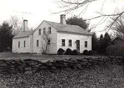
Thomas Lyman House |
|
November 20, 1975
(#75001921) |
105 Middlefield Rd.
41°29′18″N 72°41′16″W / 41.4883°N 72.6877°W / 41.4883; -72.6877 (Thomas Lyman House) |
Durham |
|
| 45 |
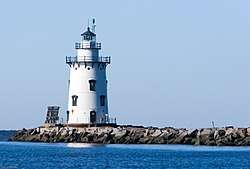
Lynde Point Lighthouse |
|
May 29, 1990
(#89001469) |
Southeastern terminus of Sequassen Ave.
41°16′16″N 72°20′38″W / 41.271111°N 72.343889°W / 41.271111; -72.343889 (Lynde Point Lighthouse) |
Old Saybrook |
|
| 46 |
Main Street Historic District |
|
October 24, 1985
(#85003389) |
Roughly bounded by Nooks Hill Rd., Prospect Hill Rd., Wall and West Sts. and New Ln., and Stevens Ln. and Main St.
41°36′07″N 72°38′56″W / 41.601944°N 72.648889°W / 41.601944; -72.648889 (Main Street Historic District) |
Cromwell |
|
| 47 |
Main Street Historic District |
|
September 4, 1986
(#86002837) |
Roughly Maple Ave. and Main St. between Talcott Ln. and Higganum Rd.
41°28′26″N 72°40′51″W / 41.473889°N 72.680833°W / 41.473889; -72.680833 (Main Street Historic District) |
Durham |
|
| 48 |
Marlborough Street Historic District |
|
March 20, 2012
(#12000130) |
58, 64, 69, 70, 78, 88, & 92 Marlborough St.
41°34′15″N 72°38′05″W / 41.570814°N 72.634825°W / 41.570814; -72.634825 (Marlborough Street Historic District) |
Portland |
|
| 49 |
Middle Haddam Historic District |
|
February 3, 1984
(#84001112) |
Moodus and Long Hill Rds.
41°33′11″N 72°33′06″W / 41.553056°N 72.551667°W / 41.553056; -72.551667 (Middle Haddam Historic District) |
East Hampton |
|
| 50 |
Middletown Upper Houses Historic District |
|
July 27, 1979
(#79002620) |
CT 99
41°35′19″N 72°38′28″W / 41.588611°N 72.641111°W / 41.588611; -72.641111 (Middletown Upper Houses Historic District) |
Cromwell |
Historic district of area that was in Middletown, until it was split to Cromwell in 1851 |
| 51 |
Millington Green Historic District |
|
July 25, 1996
(#96000782) |
Roughly bounded by Millington, Tater Hill, Haywardville, and Old Hopyard Rds.
41°29′06″N 72°21′28″W / 41.485°N 72.357778°W / 41.485; -72.357778 (Millington Green Historic District) |
East Haddam |
|
| 52 |
North Cove Historic District |
|
July 22, 1994
(#94000766) |
Roughly N. Cove Rd. from Church St. to the Connecticut River and adjacent properties on Cromwell Pl.
41°17′13″N 72°21′32″W / 41.286944°N 72.358889°W / 41.286944; -72.358889 (North Cove Historic District) |
Old Saybrook |
|
| 53 |
Oak Lodge |
|
September 4, 1986
(#86001734) |
Western side of Schreeder Pond, Chatfield Hollow State Park
41°22′11″N 72°35′27″W / 41.369722°N 72.590833°W / 41.369722; -72.590833 (Oak Lodge) |
Killingworth |
|
| 54 |
Old Saybrook South Green |
|
September 3, 1976
(#76001984) |
Old Boston Post Rd., Pennywise Lane, Main St.
41°17′17″N 72°22′36″W / 41.287933°N 72.376771°W / 41.287933; -72.376771 (Old Saybrook South Green) |
Old Saybrook |
|
| 55 |
Old Saybrook Town Hall and Theater |
|
June 21, 2007
(#07000558) |
300 Main St.
41°17′26″N 72°23′11″W / 41.290556°N 72.386389°W / 41.290556; -72.386389 (Old Saybrook Town Hall and Theater) |
Old Saybrook |
Now known as the Katharine Hepburn Cultural Arts Center |
| 56 |
Old Town Hall |
|
February 23, 1972
(#72001310) |
On the green between Liberty St. and Goose Hill Rd.
41°24′25″N 72°27′09″W / 41.406944°N 72.4525°W / 41.406944; -72.4525 (Old Town Hall) |
Chester |
|
| 57 |
Oriole Rockshelter |
|
October 15, 1987
(#87001222) |
Address Restricted
|
East Haddam |
|
| 58 |
Parker House |
|
November 29, 1978
(#78002853) |
680 Middlesex Turnpike
41°19′25″N 72°22′30″W / 41.323611°N 72.375°W / 41.323611; -72.375 (Parker House) |
Old Saybrook |
|
| 59 |
Parmelee House |
|
May 15, 2007
(#07000417) |
4 Beckwith Rd.
41°23′03″N 72°35′13″W / 41.384167°N 72.586944°W / 41.384167; -72.586944 (Parmelee House) |
Killingworth |
|
| 60 |
Portland Brownstone Quarries |
|
May 16, 2000
(#00000703) |
Brownstone Ave. and Silver St.
41°34′30″N 72°38′36″W / 41.575°N 72.643333°W / 41.575; -72.643333 (Portland Brownstone Quarries) |
Portland |
Quarried since 1690, source of vast quantities of brownstone for New York City, Philadelphia, Boston, other urban areas' buildings. |
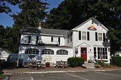
| 61 |
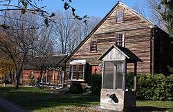
Pratt House |
|
August 23, 1985
(#85001824) |
19 West Ave.
41°21′13″N 72°23′40″W / 41.3536°N 72.3945°W / 41.3536; -72.3945 (Pratt House) |
Essex |
|
| 62 |
Dr. Ambrose Pratt House |
|
November 9, 1972
(#72001311) |
Pratt St.
41°24′01″N 72°26′43″W / 41.400278°N 72.445278°W / 41.400278; -72.445278 (Dr. Ambrose Pratt House) |
Chester |
|
| 63 |
Humphrey Pratt Tavern |
|
November 7, 1972
(#72001320) |
287 Main St.
41°17′18″N 72°22′35″W / 41.288333°N 72.376389°W / 41.288333; -72.376389 (Humphrey Pratt Tavern) |
Old Saybrook |
|
| 64 |
Pratt, Read and Company Factory Complex |
|
August 30, 1984
(#84001117) |
Main St. between Bridge and Spring Sts. and 5 Bridge St.
41°23′25″N 72°26′22″W / 41.390278°N 72.439444°W / 41.390278; -72.439444 (Pratt, Read and Company Factory Complex) |
Deep River |
|
| 65 |
Rapallo Viaduct |
|
August 21, 1986
(#86002728) |
Flat Brook and former Air Line railroad right-of-way
41°34′19″N 72°28′19″W / 41.571944°N 72.471944°W / 41.571944; -72.471944 (Rapallo Viaduct) |
East Hampton |
|
| 66 |
Roaring Brook I Site |
|
July 31, 1987
(#87001220) |
Address Restricted
|
East Haddam |
Archaeological site documented as part of the Lower Connecticut River Valley Woodland Period Archaeological TR. Less than 1 acre. |
| 67 |
Roaring Brook II Site |
|
July 31, 1987
(#87001221) |
Address Restricted
|
East Haddam |
Archaeological site documented as part of the Lower Connecticut River Valley Woodland Period Archaeological TR. Less than 1 acre. |
| 68 |
Sage-Kirby House |
|
April 29, 1982
(#82003767) |
93 Shunpike Rd.
41°36′41″N 72°40′36″W / 41.611389°N 72.676667°W / 41.611389; -72.676667 (Sage-Kirby House) |
Cromwell |
|
| 69 |
Saybrook Breakwater Lighthouse |
|
May 29, 1990
(#89001474) |
Southern terminus of Saybrook Jetty at the mouth of the Connecticut River
41°15′47″N 72°20′35″W / 41.263056°N 72.343056°W / 41.263056; -72.343056 (Saybrook Breakwater Lighthouse) |
Old Saybrook |
|
| 70 |
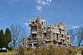
Seventh Sister |
|
July 31, 1986
(#86002103) |
67 River Rd.
41°25′25″N 72°25′53″W / 41.423611°N 72.431389°W / 41.423611; -72.431389 (Seventh Sister) |
East Haddam and Lyme |
Now Gillette Castle State Park. |
| 71 |
Steamboat Dock Site |
|
April 1, 1982
(#82003768) |
Main St.
41°21′04″N 72°23′06″W / 41.351111°N 72.385°W / 41.351111; -72.385 (Steamboat Dock Site) |
Essex |
Now the Connecticut River Museum |
| 72 |
William Stevens House |
|
May 30, 1985
(#85001163) |
131 Cow Hill Rd.
41°18′17″N 72°32′45″W / 41.3047°N 72.5457°W / 41.3047; -72.5457 (William Stevens House) |
Clinton |
|
| 73 |
William Tully House |
|
March 15, 1982
(#82004340) |
135 N. Cove Rd.
41°17′21″N 72°21′26″W / 41.289167°N 72.357222°W / 41.289167; -72.357222 (William Tully House) |
Old Saybrook |
|
| 74 |
Villa Bella Vista |
|
December 28, 2000
(#00001560) |
7 Old Depot Rd.
41°24′12″N 72°26′28″W / 41.403333°N 72.441111°W / 41.403333; -72.441111 (Villa Bella Vista) |
Chester |
|
| 75 |
William Ward Jr. House |
|
February 19, 1988
(#88000109) |
137 Powder Hill Rd.
41°30′14″N 72°43′47″W / 41.5040°N 72.7298°W / 41.5040; -72.7298 (William Ward Jr. House) |
Middlefield |
|
| 76 |
Warner House |
|
February 19, 1987
(#87000174) |
307 Town St.
41°27′12″N 72°26′27″W / 41.453333°N 72.440833°W / 41.453333; -72.440833 (Warner House) |
East Haddam |
|
| 77 |
Jonathan Warner House |
|
December 19, 1978
(#78002855) |
47 Kings Highway
41°25′00″N 72°26′27″W / 41.416667°N 72.440833°W / 41.416667; -72.440833 (Jonathan Warner House) |
Chester |
|
| 78 |
Westbrook Town Center Historic District |
|
October 16, 2017
(#100001732) |
Old Clinton at Hammock Rds., Boston Post Rd. at Bellstone Ave., Trolley Rd., Boston Post Rd. at Goodspeed Dr.
41°17′04″N 72°26′44″W / 41.284394°N 72.445492°W / 41.284394; -72.445492 (Westbrook Town Center Historic District) |
Westbrook |
|
| 79 |
White-Overton-Callander House |
|
May 21, 2014
(#13000896) |
492 Main Street
41°35′15″N 72°37′43″W / 41.5876°N 72.6285°W / 41.5876; -72.6285 (White-Overton-Callander House) |
Portland |
House museum of the Portland Historical Society |
| 80 |
Ambrose Whittlesey House |
|
August 23, 1985
(#85001830) |
14 Main St.
41°17′51″N 72°22′37″W / 41.2975°N 72.376944°W / 41.2975; -72.376944 (Ambrose Whittlesey House) |
Old Saybrook |
|
| 81 |
John Whittlesey Jr. House |
|
October 26, 1984
(#84002644) |
40 Ferry Rd.
41°18′49″N 72°21′33″W / 41.31366°N 72.35923°W / 41.31366; -72.35923 (John Whittlesey Jr. House) |
Old Saybrook |
|
| 82 |
Wickham Road Historic District |
|
July 25, 1996
(#96000781) |
Roughly the junction of Wickham and Geoffrey Rds.
41°30′16″N 72°22′46″W / 41.504444°N 72.379444°W / 41.504444; -72.379444 (Wickham Road Historic District) |
East Haddam |
|
| 83 |
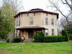
Williams and Stancliff Octagon Houses |
|
April 22, 1976
(#76001985) |
26 and 28 Marlborough St.
41°34′21″N 72°38′20″W / 41.5725°N 72.638889°W / 41.5725; -72.638889 (Williams and Stancliff Octagon Houses) |
Portland |
|
| 84 |
Working Girls' Vacation Society Historic District |
|
June 3, 1994
(#94000557) |
60, 64, and 66 Mill Rd.
41°26′31″N 72°23′43″W / 41.441944°N 72.395278°W / 41.441944; -72.395278 (Working Girls' Vacation Society Historic District) |
East Haddam |
|


.jpg)