| [3] |
Name on the Register[4] |
Image |
Date listed[5] |
Location |
City or town |
Description |
|---|
| 1 |
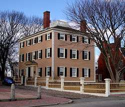
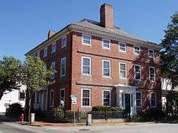
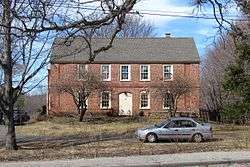
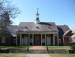
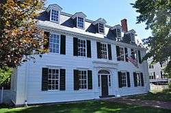
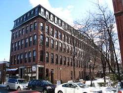
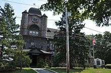
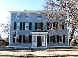
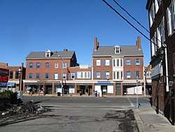
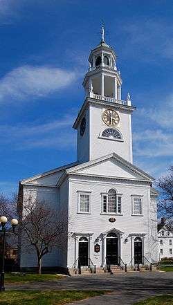
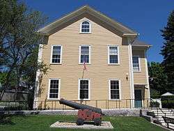
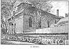
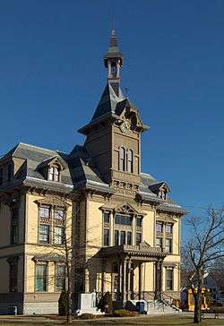
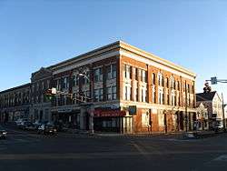
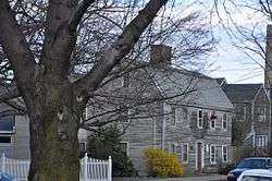
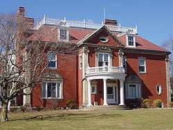
Abbot Hall |
|
September 6, 1974
(#74000374) |
Washington Sq.
42°30′09″N 70°51′10″W / 42.5025°N 70.8528°W / 42.5025; -70.8528 (Abbot Hall) |
Marblehead |
|
| 2 |
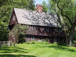
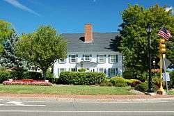
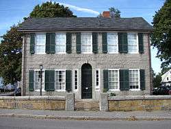
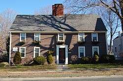
Abraham Adams House |
|
March 9, 1990
(#90000245) |
8 Pearson Dr.
42°45′17″N 70°55′43″W / 42.7547°N 70.9286°W / 42.7547; -70.9286 (Abraham Adams House) |
Newbury |
|
| 3 |
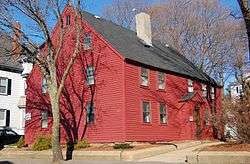
Adams-Clarke House |
|
March 9, 1990
(#90000211) |
93 W. Main St.
42°43′42″N 70°59′43″W / 42.728280°N 70.995344°W / 42.728280; -70.995344 (Adams-Clarke House) |
Georgetown |
|
| 4 |
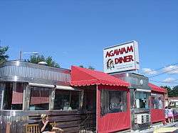
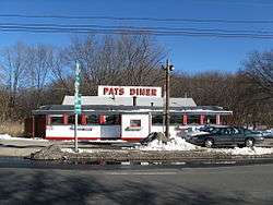
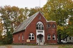
Agawam Diner |
|
September 22, 1999
(#99001124) |
166 Newburyport Turnpike
42°42′17″N 70°54′37″W / 42.7047°N 70.9103°W / 42.7047; -70.9103 (Agawam Diner) |
Rowley |
|
| 5 |
Amesbury and Salisbury Mills Village Historic District |
|
May 16, 1985
(#85001121) |
Market Sq. roughly bounded by Boardman, Water, Main and Pond Sts.
42°51′28″N 70°55′52″W / 42.8578°N 70.9311°W / 42.8578; -70.9311 (Amesbury and Salisbury Mills Village Historic District) |
Amesbury |
|
| 6 |
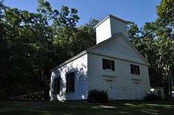
Amesbury Friends Meeting House |
|
April 18, 2002
(#02000376) |
120 Friend St.
42°51′18″N 70°56′19″W / 42.855°N 70.9386°W / 42.855; -70.9386 (Amesbury Friends Meeting House) |
Amesbury |
|
| 7 |
Ann's Diner |
|
December 10, 2003
(#03001264) |
11 Bridge Rd. (U.S. Route 1)
42°50′24″N 70°51′40″W / 42.84°N 70.8611°W / 42.84; -70.8611 (Ann's Diner) |
Salisbury |
|
| 8 |
Asbury Grove Historic District |
|
November 18, 2009
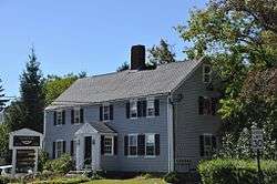
(#09000935) |
Around Asbury St.
42°37′35″N 70°53′09″W / 42.6263°N 70.8859°W / 42.6263; -70.8859 (Asbury Grove Historic District) |
Hamilton |
|
| 9 |
John Balch House |
|
February 23, 1973
(#73000275) |
448 Cabot St.
42°33′44″N 70°53′05″W / 42.5622°N 70.8847°W / 42.5622; -70.8847 (John Balch House) |
Beverly |
|
| 10 |
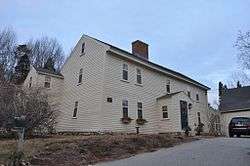
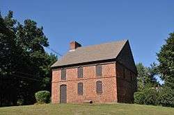
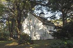
Parson Barnard House |
|
September 6, 1974
(#74000918) |
179 Osgood St.
42°41′23″N 71°07′02″W / 42.6896°N 71.1171°W / 42.6896; -71.1171 (Parson Barnard House) |
North Andover |
Once thought to belong to Simon and Anne Bradstreet |
| 11 |
Beverly Center Business District |
|
July 5, 1984
(#84002313) |
Roughly bounded by Chapman, Central, Brown, Dane, and Essex Sts.
42°32′54″N 70°52′41″W / 42.5483°N 70.8781°W / 42.5483; -70.8781 (Beverly Center Business District) |
Beverly |
|
| 12 |
Beverly Depot |
|
October 14, 1979
(#09000087) |
Park Street
42°32′51″N 70°53′07″W / 42.54760°N 70.88535°W / 42.54760; -70.88535 (Beverly Depot) |
Beverly |
|
| 13 |
Beverly Depot-Odell Park Historic District |
|
January 8, 2014
(#13001056) |
Roughly bounded by River, Rantoul & Pleasant Sts., Broadway
42°32′50″N 70°53′05″W / 42.547129°N 70.884606°W / 42.547129; -70.884606 (Beverly Depot-Odell Park Historic District) |
Beverly |
|
| 14 |
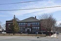
Beverly Grammar School |
|
March 9, 1990
(#90000198) |
50 Essex St.
42°33′06″N 70°52′34″W / 42.5517°N 70.8761°W / 42.5517; -70.8761 (Beverly Grammar School) |
Beverly |
|
| 15 |
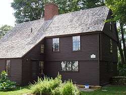
Boardman House |
|
October 15, 1966
(#66000131) |
Howard St.
42°28′20″N 71°02′17″W / 42.4722°N 71.0381°W / 42.4722; -71.0381 (Boardman House) |
Saugus |
|
| 16 |
John Boardman House |
|
March 9, 1990
(#90000361) |
28 Lawrence Rd.
42°39′56″N 71°01′28″W / 42.6656°N 71.0244°W / 42.6656; -71.0244 (John Boardman House) |
Boxford |
|
| 17 |
Boxford Village Historic District |
|
April 11, 1973
(#73000279) |
Middleton and Topsfield Rds. and Main and Elm Sts.
42°39′43″N 70°59′58″W / 42.6619°N 70.9994°W / 42.6619; -70.9994 (Boxford Village Historic District) |
Boxford |
|
| 18 |
Bradford Burial Ground |
|
June 15, 2015
(#15000351) |
326 Salem St.
42°45′34″N 71°03′49″W / 42.7594°N 71.0636°W / 42.7594; -71.0636 (Bradford Burial Ground) |
Haverhill |
|
| 19 |
Bradford Common Historic District |
|
September 14, 1977
(#77000179) |
S. Main St.
42°45′59″N 71°04′45″W / 42.7664°N 71.0792°W / 42.7664; -71.0792 (Bradford Common Historic District) |
Haverhill |
|
| 20 |
Breakheart Reservation Parkways-Metropolitan Park System of Greater Boston |
|
August 11, 2003
(#03000748) |
Forest St., Pine Tops, Elm and Hemlock Rds.
42°29′15″N 71°02′05″W / 42.4875°N 71.0347°W / 42.4875; -71.0347 (Breakheart Reservation Parkways-Metropolitan Park System of Greater Boston) |
Saugus |
Extends into Wakefield in Middlesex County. |
| 21 |
Briggs Carriage Company |
|
April 3, 2017
(#100000822) |
14 & 20 Cedar St.
42°51′41″N 70°55′40″W / 42.861304°N 70.927689°W / 42.861304; -70.927689 (Briggs Carriage Company) |
Amesbury |
|
| 22 |
Brown House |
|
March 9, 1990
(#90000223) |
76 Bridge St.
42°36′58″N 70°51′06″W / 42.6161°N 70.8517°W / 42.6161; -70.8517 (Brown House) |
Hamilton |
|
| 23 |
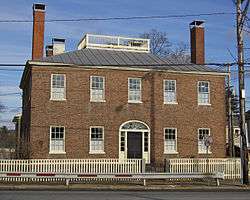
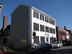
Brown Square House |
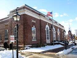
|
March 7, 1975
(#75000284) |
11 Brown Sq.
42°48′40″N 70°52′27″W / 42.8111°N 70.8742°W / 42.8111; -70.8742 (Brown Square House) |
Newburyport |
|
| 24 |
Austin Brown House |
|
March 9, 1990
(#90000222) |
1028 Bay Rd.
42°38′26″N 70°50′55″W / 42.6406°N 70.8486°W / 42.6406; -70.8486 (Austin Brown House) |
Hamilton |
|
| 25 |
David Burnham House |
|
July 30, 1983
(#83000574) |
Pond St.
42°36′57″N 70°48′07″W / 42.6158°N 70.8019°W / 42.6158; -70.8019 (David Burnham House) |
Essex |
|
| 26 |
Capt. John Cabot House |
|
April 16, 1975
(#75000246) |
117 Cabot St.
42°32′45″N 70°52′49″W / 42.5458°N 70.8803°W / 42.5458; -70.8803 (Capt. John Cabot House) |
Beverly |
|
| 27 |
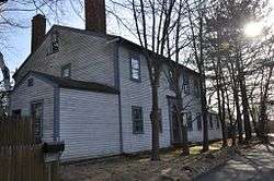
Parson Capen House |
|
October 15, 1966
(#66000139) |
Howlett St.
42°38′36″N 70°57′00″W / 42.6433°N 70.95°W / 42.6433; -70.95 (Parson Capen House) |
Topsfield |
|
| 28 |
Carlton-Frie-Tucker House |
|
March 9, 1990
(#90000251) |
140 Mill Rd.
42°39′28″N 71°06′00″W / 42.6578°N 71.1°W / 42.6578; -71.1 (Carlton-Frie-Tucker House) |
North Andover |
|
| 29 |
Chaplin-Clarke House |
|
May 10, 1979
(#79000343) |
109 Haverhill St.
42°42′33″N 70°53′32″W / 42.7092°N 70.8922°W / 42.7092; -70.8922 (Chaplin-Clarke House) |
Rowley |
|
| 30 |
Samuel Chase House |
|
March 9, 1990
(#90000273) |
154 Main St.
42°47′17″N 71°00′06″W / 42.7881°N 71.0017°W / 42.7881; -71.0017 (Samuel Chase House) |
West Newbury |
|
| 31 |
Claflin-Richards House |
|
April 3, 1973
(#73000853) |
132 Main St.
42°36′14″N 70°53′16″W / 42.6039°N 70.8878°W / 42.6039; -70.8878 (Claflin-Richards House) |
Wenham |
|
| 32 |
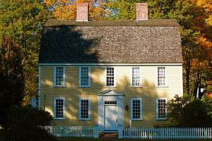
Cogswell's Grant |
|
April 19, 1990
(#90000666) |
60 Spring St.
42°38′18″N 70°46′22″W / 42.6383°N 70.7728°W / 42.6383; -70.7728 (Cogswell's Grant) |
Essex |
|
| 33 |
Benjamin Coker House |
|
March 9, 1990
(#90000247) |
172 State St.
42°48′05″N 70°52′31″W / 42.8014°N 70.8753°W / 42.8014; -70.8753 (Benjamin Coker House) |
Newburyport |
|
| 34 |
Community House |
|
May 11, 2011
(#11000265) |
284 Bay Rd.
42°36′47″N 70°52′21″W / 42.6131°N 70.8725°W / 42.6131; -70.8725 (Community House) |
Hamilton |
|
| 35 |
Exercise Conant House |
|
March 9, 1990
(#90000199) |
634 Cabot St.
42°34′33″N 70°53′47″W / 42.5758°N 70.8964°W / 42.5758; -70.8964 (Exercise Conant House) |
Beverly |
|
| 36 |
Samuel Corning House |
|
March 9, 1990
(#90000196) |
87 Hull St.
42°34′49″N 70°50′23″W / 42.5803°N 70.8397°W / 42.5803; -70.8397 (Samuel Corning House) |
Beverly |
|
| 37 |
Caleb Cushing House |
|
November 7, 1973
(#73000327) |
98 High St.
42°48′24″N 70°52′16″W / 42.8067°N 70.8711°W / 42.8067; -70.8711 (Caleb Cushing House) |
Newburyport |
|
| 38 |
Dalton House |
|
March 29, 1978
(#78000464) |
95 State St.
42°48′29″N 70°52′18″W / 42.8081°N 70.8717°W / 42.8081; -70.8717 (Dalton House) |
Newburyport |
|
| 39 |
Ephraim Davis House |
|
March 9, 1990
(#90000228) |
Merrimack Rd., north of its junction with Amesbury Line Rd.
42°48′45″N 71°00′33″W / 42.8125°N 71.0092°W / 42.8125; -71.0092 (Ephraim Davis House) |
Haverhill |
|
| 40 |
Derby Summerhouse |
|
November 24, 1968
(#68000020) |
Magna Estate, Ingersoll St.
42°34′22″N 70°58′00″W / 42.5728°N 70.9667°W / 42.5728; -70.9667 (Derby Summerhouse) |
Danvers |
|
| 41 |
Dickinson-Pillsbury-Witham House |
|
March 9, 1990
(#90000210) |
170 Jewett St.
42°43′44″N 70°56′42″W / 42.7289°N 70.945°W / 42.7289; -70.945 (Dickinson-Pillsbury-Witham House) |
Georgetown |
|
| 42 |
Dodge Building |
|
August 26, 1982
(#82001878) |
19-23 Pleasant St.
42°48′36″N 70°52′50″W / 42.81°N 70.8806°W / 42.81; -70.8806 (Dodge Building) |
Newburyport |
|
| 43 |
Dustin House |
|
March 9, 1990
(#90000227) |
665 Hilldale Ave.
42°47′47″N 71°06′41″W / 42.7964°N 71.1114°W / 42.7964; -71.1114 (Dustin House) |
Haverhill |
|
| 44 |
East Parish Meeting House |
|
March 29, 2011
(#11000149) |
150 Middle Rd.
42°48′01″N 71°02′01″W / 42.8003°N 71.0336°W / 42.8003; -71.0336 (East Parish Meeting House) |
Haverhill |
|
| 45 |
Emerson House |
|
March 9, 1990
(#90000229) |
5-9 Pentucket St.
42°46′44″N 71°04′47″W / 42.7789°N 71.0797°W / 42.7789; -71.0797 (Emerson House) |
Haverhill |
|
| 46 |
Essex Town Hall and TOHP Burnham Library |
|
September 12, 2007
(#07000946) |
30 Martin St.
42°37′54″N 70°47′00″W / 42.6316°N 70.7834°W / 42.6316; -70.7834 (Essex Town Hall and TOHP Burnham Library) |
Essex |
|
| 47 |
Estey Tavern |
|
October 12, 1989
(#89001587) |
Central and Maple Sts. at MA 114
42°35′43″N 71°00′57″W / 42.5953°N 71.0158°W / 42.5953; -71.0158 (Estey Tavern) |
Middleton |
|
| 48 |
Nathaniel Felton Houses |
|
April 1, 1982
(#82001882) |
43 Felton St. (Jr.) and 47 Felton St. (Sr.)
42°32′44″N 70°57′40″W / 42.5456°N 70.9611°W / 42.5456; -70.9611 (Nathaniel Felton Houses) |
Peabody |
|
| 49 |
First Religious Society Church and Parish Hall |
|
April 2, 1976
(#76000278) |
26 Pleasant St.
42°48′39″N 70°52′18″W / 42.8108°N 70.8717°W / 42.8108; -70.8717 (First Religious Society Church and Parish Hall) |
Newburyport |
|
| 50 |
First Unitarian Church |
|
September 18, 1989
(#88001091) |
7 Park St.
42°31′28″N 70°55′38″W / 42.5244°N 70.9272°W / 42.5244; -70.9272 (First Unitarian Church) |
Peabody |
|
| 51 |
Fish Flake Hill Historic District |
|
October 26, 1971
(#71000082) |
Northern and southern sides of Front St. from Cabot to Bartlett Sts.
42°32′29″N 70°53′02″W / 42.5414°N 70.8839°W / 42.5414; -70.8839 (Fish Flake Hill Historic District) |
Beverly |
|
| 52 |
Flint Public Library |
|
June 14, 2002
(#02000631) |
2 N. Main St.
42°35′41″N 71°01′01″W / 42.5947°N 71.0169°W / 42.5947; -71.0169 (Flint Public Library) |
Middleton |
|
| 53 |
Fort Sewall |
|
April 14, 1975
(#75001908) |
Fort Sewall Promontory
42°30′32″N 70°50′30″W / 42.5089°N 70.8417°W / 42.5089; -70.8417 (Fort Sewall) |
Marblehead |
|
| 54 |
Gen. Gideon Foster House |
|
June 23, 1976
(#76000287) |
35 Washington St.
42°31′22″N 70°55′30″W / 42.5228°N 70.925°W / 42.5228; -70.925 (Gen. Gideon Foster House) |
Peabody |
|
| 55 |
Phineas Foster House |
|
March 9, 1990
(#90000193) |
11 Old Topsfield Rd.
42°38′56″N 70°58′50″W / 42.6489°N 70.9806°W / 42.6489; -70.9806 (Phineas Foster House) |
Boxford |
Listed on the Register at 15 Old Topsfield Rd. |
| 56 |
Stephen Foster House |
|
March 9, 1990
(#90000262) |
109 North St.
42°39′35″N 70°56′02″W / 42.6597°N 70.9339°W / 42.6597; -70.9339 (Stephen Foster House) |
Topsfield |
|
| 57 |
Fowler House |
|
September 17, 1974
(#74000367) |
166 High St.
42°33′22″N 70°55′29″W / 42.5561°N 70.9247°W / 42.5561; -70.9247 (Fowler House) |
Danvers |
|
| 58 |
Rea Putnam Fowler House |
|
March 9, 1990
(#90000202) |
4 Elerton Pl.
42°34′37″N 70°56′09″W / 42.5769°N 70.9358°W / 42.5769; -70.9358 (Rea Putnam Fowler House) |
Danvers |
|
| 59 |
Fox Hill School |
|
February 10, 1988
(#87002554) |
81 Water St.
42°33′01″N 70°55′24″W / 42.5503°N 70.9233°W / 42.5503; -70.9233 (Fox Hill School) |
Danvers |
|
| 60 |
French-Andrews House |
|
March 9, 1990
(#90000263) |
86 Howlett Rd.
42°38′33″N 70°56′18″W / 42.6425°N 70.9383°W / 42.6425; -70.9383 (French-Andrews House) |
Topsfield |
|
| 61 |
James Friend House |
|
March 9, 1990
(#90000268) |
114 Cedar St.
42°35′46″N 70°54′23″W / 42.5961°N 70.9064°W / 42.5961; -70.9064 (James Friend House) |
Wenham |
|
| 62 |
Samuel Frye House |
|
March 9, 1990
(#90000252) |
920 Turnpike St.
42°39′25″N 71°06′14″W / 42.6569°N 71.1039°W / 42.6569; -71.1039 (Samuel Frye House) |
North Andover |
|
| 63 |
Joseph Fuller House |
|
March 9, 1990
(#90000244) |
161 Essex St.
42°37′03″N 71°02′11″W / 42.6175°N 71.0364°W / 42.6175; -71.0364 (Joseph Fuller House) |
Middleton |
|
| 64 |
Lieut. Thomas Fuller House |
|
March 9, 1990
(#90000242) |
Old S. Main St. between Mt. Vernon and Boston Sts.
42°35′32″N 71°00′49″W / 42.5921°N 71.0136°W / 42.5921; -71.0136 (Lieut. Thomas Fuller House) |
Middleton |
|
| 65 |
Georgetown Central School |
|
August 30, 2001
(#01000915) |
1 Library St.
42°43′21″N 70°59′38″W / 42.7225°N 70.9939°W / 42.7225; -70.9939 (Georgetown Central School) |
Georgetown |
Currently serves as Georgetown's Town Hall. |
| 66 |
Elbridge Gerry House |
|
July 2, 1973
(#73000304) |
44 Washington St.
42°30′24″N 70°50′52″W / 42.5067°N 70.8478°W / 42.5067; -70.8478 (Elbridge Gerry House) |
Marblehead |
|
| 67 |
George Giddings House and Barn |
|
March 9, 1990
(#90000206) |
66 Choate St.
42°38′47″N 70°48′24″W / 42.6464°N 70.8067°W / 42.6464; -70.8067 (George Giddings House and Barn) |
Essex |
|
| 68 |
Gen. John Glover House |
|
November 28, 1972
(#72001101) |
11 Glover St.
42°30′19″N 70°50′51″W / 42.5053°N 70.8475°W / 42.5053; -70.8475 (Gen. John Glover House) |
Marblehead |
|
| 69 |
Gott House |
|
March 9, 1990
(#90000255) |
Gott Ave. at Gott Ln.
42°41′14″N 70°37′53″W / 42.6872°N 70.6314°W / 42.6872; -70.6314 (Gott House) |
Rockport |
|
| 70 |
Capt. Joseph Gould House |
|
March 9, 1990
(#90000259) |
129 Washington St.
42°38′30″N 70°58′02″W / 42.6417°N 70.9672°W / 42.6417; -70.9672 (Capt. Joseph Gould House) |
Topsfield |
|
| 71 |
Zaccheus Gould House |
|
March 9, 1990
(#90000261) |
85 River Road
42°38′00″N 70°57′38″W / 42.6333°N 70.9606°W / 42.6333; -70.9606 (Zaccheus Gould House) |
Topsfield |
Listed on the register at 73 Prospect Street; property has been subdivided |
| 72 |
Granite Keystone Bridge |
|
August 27, 1981
(#81000117) |
Granite St.
42°40′01″N 70°37′33″W / 42.6669°N 70.6258°W / 42.6669; -70.6258 (Granite Keystone Bridge) |
Rockport |
|
| 73 |
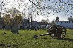
Greenlawn Cemetery |
|
May 11, 2000
(#00000481) |
195 Nahant Rd.
42°25′37″N 70°55′41″W / 42.4269°N 70.9281°W / 42.4269; -70.9281 (Greenlawn Cemetery) |
Nahant |
|
| 74 |
Reverend John Hale House |
|
October 9, 1974
(#74000364) |
39 Hale St.
42°32′56″N 70°52′30″W / 42.5489°N 70.875°W / 42.5489; -70.875 (Reverend John Hale House) |
Beverly |
|
| 75 |
Hale-Boynton House |
|
April 14, 1983
(#83000578) |
Middle St.
42°45′05″N 70°54′03″W / 42.7514°N 70.9008°W / 42.7514; -70.9008 (Hale-Boynton House) |
Newbury |
|
| 76 |
Hamilton Historic District |
|
April 13, 1973
(#73000300) |
540-700 and 563-641 Bay Rd.
42°37′21″N 70°51′14″W / 42.6225°N 70.8539°W / 42.6225; -70.8539 (Hamilton Historic District) |
Hamilton |
|
| 77 |
Joseph Hardy House |
|
March 9, 1990
(#90000219) |
69 King St.[6]
42°45′30″N 71°01′23″W / 42.758198°N 71.023171°W / 42.758198; -71.023171 (Joseph Hardy House) |
Groveland |
Listed at 93 King Street. |
| 78 |
Harris Farm |
|
March 9, 1990
(#90000241) |
3 Manataug Trail
42°30′27″N 70°52′09″W / 42.5075°N 70.8692°W / 42.5075; -70.8692 (Harris Farm) |
Marblehead |
|
| 79 |
Hart House |
|
March 9, 1990
(#90000239) |
172 Chestnut St.
42°32′26″N 71°03′46″W / 42.5406°N 71.0628°W / 42.5406; -71.0628 (Hart House) |
Lynnfield |
|
| 80 |
Hastings-Morse House |
|
March 14, 1991
(#90000225) |
595 E. Broadway
42°47′51″N 71°01′04″W / 42.7975°N 71.0178°W / 42.7975; -71.0178 (Hastings-Morse House) |
Haverhill |
|
| 81 |
Haverhill Board of Trade Building |
|
September 28, 2007
(#07001008) |
16-18 and 38-42 Walnut St.
42°46′32″N 71°05′22″W / 42.7756°N 71.0894°W / 42.7756; -71.0894 (Haverhill Board of Trade Building) |
Haverhill |
|
| 82 |
Haverhill Historical Society Historic District |
|
June 8, 2005
(#05000560) |
240 Water St.
42°46′21″N 71°04′03″W / 42.7725°N 71.0675°W / 42.7725; -71.0675 (Haverhill Historical Society Historic District) |
Haverhill |
|
| 83 |
Charles H. Hayes Building |
|
December 13, 2010
(#10001006) |
14-44 Granite St.
42°46′27″N 71°05′07″W / 42.7742°N 71.0853°W / 42.7742; -71.0853 (Charles H. Hayes Building) |
Haverhill |
|
| 84 |
Hazen-Kimball-Aldrich House |
|
March 9, 1990
(#90000209) |
225 E. Main St.
42°42′59″N 70°58′32″W / 42.7164°N 70.9756°W / 42.7164; -70.9756 (Hazen-Kimball-Aldrich House) |
Georgetown |
|
| 85 |
Hazen-Spiller House |
|
March 9, 1990
(#90000226) |
8 Groveland St.
42°46′13″N 71°03′49″W / 42.7704°N 71.0635°W / 42.7704; -71.0635 (Hazen-Spiller House) |
Haverhill |
|
| 86 |
Henfield House |
|
March 4, 1991
(#90000240) |
300 Main St.
42°32′06″N 71°03′34″W / 42.535°N 71.0594°W / 42.535; -71.0594 (Henfield House) |
Lynnfield |
|
| 87 |
Hickey-Osborne Block |
|
September 19, 1985
(#85002416) |
38-60 Main St.
42°31′32″N 70°55′33″W / 42.5256°N 70.9258°W / 42.5256; -70.9258 (Hickey-Osborne Block) |
Peabody |
|
| 88 |
High Street Cemetery |
|
May 9, 2003
(#03000382) |
45 High St.
42°33′50″N 70°56′04″W / 42.5639°N 70.9344°W / 42.5639; -70.9344 (High Street Cemetery) |
Danvers |
|
| 89 |
Oliver Wendell Holmes House |
|
November 28, 1972
(#72001301) |
868 Hale St.
42°33′52″N 70°48′23″W / 42.5644°N 70.8064°W / 42.5644; -70.8064 (Oliver Wendell Holmes House) |
Beverly |
|
| 90 |
Holyoke-French House |
|
April 26, 1972
(#72000123) |
Elm St. and Topsfield Rd.
42°39′41″N 70°59′50″W / 42.6614°N 70.9972°W / 42.6614; -70.9972 (Holyoke-French House) |
Boxford |
|
| 91 |
Robert "King" Hooper Mansion |
|
May 12, 1976
(#76000264) |
8 Hooper St.
42°28′34″N 70°51′01″W / 42.4761°N 70.8503°W / 42.4761; -70.8503 (Robert "King" Hooper Mansion) |
Marblehead |
|
| 92 |
George Hopkinson House |
|
March 9, 1990
(#90000220) |
362 Main St.
42°45′39″N 71°02′06″W / 42.7608°N 71.035°W / 42.7608; -71.035 (George Hopkinson House) |
Groveland |
|
| 93 |
Hose House No. 2 |
|
July 3, 1986
(#86001461) |
30 Rantoul St.
42°32′35″N 70°53′09″W / 42.5431°N 70.8858°W / 42.5431; -70.8858 (Hose House No. 2) |
Beverly |
|
| 94 |
Hospital Point Light Station |
|
September 28, 1987
(#87002031) |
Bayview Ave.
42°32′40″N 70°51′30″W / 42.5444°N 70.8583°W / 42.5444; -70.8583 (Hospital Point Light Station) |
Beverly |
|
| 95 |
House at 922 Dale Street |
|
March 9, 1990
(#90000248) |
922 Dale St.
42°41′40″N 71°04′07″W / 42.6944°N 71.0686°W / 42.6944; -71.0686 (House at 922 Dale Street) |
North Andover |
|
| 96 |
Howe Village Historic District |
|
April 3, 1973
(#73000282) |
Northeast of Boxford on MA 97
42°40′32″N 70°58′08″W / 42.6756°N 70.9689°W / 42.6756; -70.9689 (Howe Village Historic District) |
Boxford |
|
| 97 |
Sir John Humphreys House |
|
March 9, 1990
(#90000258) |
99 Paradise Rd.
42°28′21″N 70°55′06″W / 42.4725°N 70.9183°W / 42.4725; -70.9183 (Sir John Humphreys House) |
Swampscott |
|
| 98 |
Intervale Factory |
|
June 30, 1988
(#88000958) |
402 River St.
42°45′56″N 71°05′52″W / 42.7656°N 71.0978°W / 42.7656; -71.0978 (Intervale Factory) |
Haverhill |
|
| 99 |
Capt. Timothy Johnson House |
|
March 9, 1990
(#90000249) |
18-20 Stevens St.
42°41′55″N 71°06′41″W / 42.6986°N 71.1114°W / 42.6986; -71.1114 (Capt. Timothy Johnson House) |
North Andover |
|
| 100 |
Solomon Kimball House |
|
March 9, 1990
(#90000264) |
26 Maple St.
42°36′03″N 70°55′13″W / 42.6008°N 70.9203°W / 42.6008; -70.9203 (Solomon Kimball House) |
Wenham |
|
| 101 |
Kittredge Mansion |
|
December 12, 1976
(#76000282) |
56 Academy Rd.
42°41′26″N 71°06′51″W / 42.6906°N 71.1142°W / 42.6906; -71.1142 (Kittredge Mansion) |
North Andover |
|
| 102 |
George Kunhardt Estate |
|
April 22, 1976
(#76000284) |
29-49 Cochichewick Drive
42°42′39″N 71°05′44″W / 42.7108°N 71.0956°W / 42.7108; -71.0956 (George Kunhardt Estate) |
North Andover |
Listed on the register at 1518 Great Pond Road; since subdivided and converted to condominiums. |
| 103 |
Stanley Lake House |
|
March 9, 1990
(#90000260) |
95 River Rd.
42°38′02″N 70°57′47″W / 42.6339°N 70.9631°W / 42.6339; -70.9631 (Stanley Lake House) |
Topsfield |
|
| 104 |
Thomas Lambert House |
|
March 9, 1990
(#90000256) |
142 Main St.
42°42′54″N 70°52′51″W / 42.715°N 70.8808°W / 42.715; -70.8808 (Thomas Lambert House) |
Rowley |
|
| 105 |
Larch Farm |
|
March 9, 1990
(#90000266) |
38 Larch Rd.
42°36′08″N 70°52′45″W / 42.6022°N 70.8792°W / 42.6022; -70.8792 (Larch Farm) |
Wenham |
|
| 106 |
Jeremiah Lee House |
|
October 15, 1966
(#66000766) |
Washington St.
42°30′12″N 70°51′06″W / 42.5033°N 70.8517°W / 42.5033; -70.8517 (Jeremiah Lee House) |
Marblehead |
|
| 107 |
L.H. Hamel Leather Company Historic District |
|
February 18, 2009
(#09000032) |
Bounded by Essex, Locke, Duncan, and Winter Sts., and the former Boston and Maine railroad tracks
42°46′34″N 71°05′09″W / 42.7761°N 71.0858°W / 42.7761; -71.0858 (L.H. Hamel Leather Company Historic District) |
Haverhill |
|
| 108 |
William Livermore House |
|
March 9, 1990
(#90000197) |
271 Essex St.
42°34′00″N 70°51′41″W / 42.5667°N 70.8614°W / 42.5667; -70.8614 (William Livermore House) |
Beverly |
|
| 109 |
Henry Cabot Lodge House |
|
December 8, 1976
(#76001971) |
5 Cliff St.
42°25′18″N 70°54′39″W / 42.4217°N 70.9108°W / 42.4217; -70.9108 (Henry Cabot Lodge House) |
Nahant |
|
| 110 |
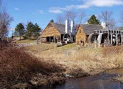
Lowell's Boat Shop |
|
June 9, 1988
(#88000706) |
459 Main St.
42°50′32″N 70°54′52″W / 42.8422°N 70.9144°W / 42.8422; -70.9144 (Lowell's Boat Shop) |
Amesbury |
|
| 111 |
Machine Shop Village District |
|
October 14, 1982
(#82000482) |
Roughly bounded by Main, Pleasant, Clarendon, Water, 2nd Sts., and B&M railroad line
42°41′59″N 71°07′37″W / 42.6997°N 71.1269°W / 42.6997; -71.1269 (Machine Shop Village District) |
North Andover |
|
| 112 |
Macy-Colby House |
|
June 16, 2008
(#08000531) |
257 Main St.
42°50′45″N 70°55′46″W / 42.8459°N 70.9295°W / 42.8459; -70.9295 (Macy-Colby House) |
Amesbury |
|
| 113 |
Main Street Historic District |
|
May 9, 2003
(#03000383) |
Main, Summer Sts.
42°46′42″N 71°04′42″W / 42.7783°N 71.0783°W / 42.7783; -71.0783 (Main Street Historic District) |
Haverhill |
|
| 114 |
Manchester Village Historic District |
|
January 8, 1990
(#89002156) |
Roughly Friend, School, North, Washington, Sea, Union, Central, Bennett, Bridge Sts., and Ashland Ave.
42°34′28″N 70°46′21″W / 42.5744°N 70.7725°W / 42.5744; -70.7725 (Manchester Village Historic District) |
Manchester |
|
| 115 |
Marblehead Historic District |
|
January 10, 1984
(#84002402) |
Roughly bounded by Marblehead Harbor, Waldron Court, Essex, Elm, Pond, and Norman Sts.
42°30′15″N 70°50′58″W / 42.5042°N 70.8494°W / 42.5042; -70.8494 (Marblehead Historic District) |
Marblehead |
|
| 116 |
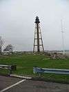
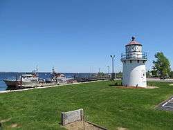
Marblehead Light |
|
June 15, 1987
(#87001479) |
Marblehead Neck
42°30′03″N 70°49′54″W / 42.5008°N 70.8317°W / 42.5008; -70.8317 (Marblehead Light) |
Marblehead |
|
| 117 |
Samuel March House |
|
March 9, 1990
(#90000272) |
444 Main St.
42°48′11″N 70°59′07″W / 42.8031°N 70.9853°W / 42.8031; -70.9853 (Samuel March House) |
West Newbury |
|
| 118 |
Market Square Historic District |
|
February 25, 1971
(#71000088) |
Market Sq. and properties fronting on State, Merrimac, Liberty, and Water Sts.
42°48′40″N 70°52′13″W / 42.8111°N 70.8703°W / 42.8111; -70.8703 (Market Square Historic District) |
Newburyport |
|
| 119 |
Meetinghouse Common District |
|
November 21, 1976
(#76000260) |
Summer, S. Common, and Main Sts.
42°32′21″N 71°03′01″W / 42.5392°N 71.0503°W / 42.5392; -71.0503 (Meetinghouse Common District) |
Lynnfield |
|
| 120 |
Merrimack Associates Building |
|
June 17, 2009
(#09000436) |
25 Locust St.
42°46′33″N 71°05′03″W / 42.7757°N 71.0842°W / 42.7757; -71.0842 (Merrimack Associates Building) |
Haverhill |
|
| 121 |
Moore-Hill House |
|
June 9, 1988
(#88000704) |
82 Franklin St.
42°31′41″N 70°56′07″W / 42.5281°N 70.9353°W / 42.5281; -70.9353 (Moore-Hill House) |
Peabody |
|
| 122 |
Timothy Morse House |
|
March 9, 1990
(#90000271) |
628 Main St.
42°48′25″N 70°58′06″W / 42.8069°N 70.9683°W / 42.8069; -70.9683 (Timothy Morse House) |
West Newbury |
|
| 123 |
Nahant Beach Boulevard-Metropolitan Park System of Greater Boston |
|
August 11, 2003
(#03000747) |
Nahant Beach Boulevard
42°26′12″N 70°56′17″W / 42.4367°N 70.9381°W / 42.4367; -70.9381 (Nahant Beach Boulevard-Metropolitan Park System of Greater Boston) |
Nahant |
Extends briefly into Lynn. |
| 124 |
Nahant Civic Historic District |
|
September 3, 1991
(#91001174) |
332 and 334 Nahant Rd. and 15 Pleasant St.
42°25′27″N 70°54′51″W / 42.4242°N 70.9142°W / 42.4242; -70.9142 (Nahant Civic Historic District) |
Nahant |
|
| 125 |
Nahant Life-Saving Station |
|
March 20, 2012
(#12000133) |
96 Nahant Rd.
42°25′51″N 70°56′01″W / 42.4308°N 70.9337°W / 42.4308; -70.9337 (Nahant Life-Saving Station) |
Nahant |
|
| 126 |
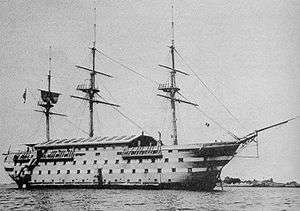
The New Hampshire |
|
October 29, 1976
(#76000261) |
Southeast of Manchester off Graves Island
42°34′14″N 70°44′44″W / 42.5706°N 70.7456°W / 42.5706; -70.7456 (The New Hampshire) |
Manchester |
Wreck of the USS New Hampshire |
| 127 |
Newbury Historic District |
|
May 24, 1976
(#76000275) |
Irregular pattern along High Rd., Green and Hanover Sts.
42°47′51″N 70°51′44″W / 42.7975°N 70.8622°W / 42.7975; -70.8622 (Newbury Historic District) |
Newbury |
|
| 128 |
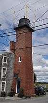
Newburyport Harbor Front Range Light |
|
June 15, 1987
(#87001486) |
Merrimack River Coast Guard Station
42°47′54″N 70°48′35″W / 42.7983°N 70.8097°W / 42.7983; -70.8097 (Newburyport Harbor Front Range Light) |
Newburyport |
|
| 129 |
Newburyport Harbor Light |
|
June 15, 1987
(#87001485) |
Northern Boulevard
42°48′55″N 70°49′08″W / 42.8152°N 70.8189°W / 42.8152; -70.8189 (Newburyport Harbor Light) |
Newburyport |
|
| 130 |
Newburyport Harbor Rear Range Light |
|
June 15, 1987
(#87000887) |
61½ Water St.
42°47′38″N 70°48′26″W / 42.7939°N 70.8072°W / 42.7939; -70.8072 (Newburyport Harbor Rear Range Light) |
Newburyport |
|
| 131 |
Newburyport Historic District |
|
August 2, 1984
(#84002411) |
Roughly bounded by the Merrimack River, Plummer Ave., Marlboro, Plummer, State, and High Sts.
42°48′41″N 70°52′40″W / 42.8114°N 70.8778°W / 42.8114; -70.8778 (Newburyport Historic District) |
Newburyport |
|
| 132 |
Newell Farm |
|
July 21, 1978
(#78001406) |
243 Main St.
42°47′33″N 70°59′50″W / 42.7925°N 70.9972°W / 42.7925; -70.9972 (Newell Farm) |
West Newbury |
|
| 133 |
Newman-Fiske-Dodge House |
|
March 9, 1990
(#90000267) |
162 Cherry St.
42°36′13″N 70°54′54″W / 42.6036°N 70.915°W / 42.6036; -70.915 (Newman-Fiske-Dodge House) |
Wenham |
|
| 134 |
North Andover Center Historic District |
|
March 5, 1979
(#79000336) |
Roughly bounded by Osgood, Pleasant, Stevens, Johnson, and Andover Sts. and Wood Lane
42°41′15″N 71°06′55″W / 42.6875°N 71.1153°W / 42.6875; -71.1153 (North Andover Center Historic District) |
North Andover |
|
| 135 |
James Noyes House |
|
March 9, 1990
(#90000246) |
7 Parker St.
42°47′51″N 70°51′46″W / 42.7975°N 70.8628°W / 42.7975; -70.8628 (James Noyes House) |
Newbury |
|
| 136 |
Odd Fellows' Hall |
|
November 20, 1978
(#78001408) |
188-194 Cabot St.
42°32′52″N 70°52′48″W / 42.5478°N 70.88°W / 42.5478; -70.88 (Odd Fellows' Hall) |
Beverly |
|
| 137 |
Old Castle |
|
September 1, 1978
(#78000466) |
North of Rockport on MA 127
42°40′35″N 70°37′31″W / 42.6764°N 70.6253°W / 42.6764; -70.6253 (Old Castle) |
Rockport |
|
| 138 |
Old Farm |
|
March 9, 1990
(#90000265) |
9 Maple St.
42°35′55″N 70°55′03″W / 42.5986°N 70.9175°W / 42.5986; -70.9175 (Old Farm) |
Wenham |
|
| 139 |
Old Garrison House |
|
March 4, 1991
(#90000254) |
188 Granite St.
42°40′51″N 70°37′41″W / 42.6808°N 70.6281°W / 42.6808; -70.6281 (Old Garrison House) |
Rockport |
|
| 140 |
Old Town House |
|
August 13, 1976
(#76000265) |
Town House Sq.
42°30′19″N 70°51′01″W / 42.5053°N 70.8503°W / 42.5053; -70.8503 (Old Town House) |
Marblehead |
|
| 141 |
Olmsted Subdivision Historic District |
|
July 1, 2002
(#02000696) |
Roughly bounded by New Ocean Paradise Rd., Swampscott Ave., Redington Rd. and Burrill St.
42°28′18″N 70°54′56″W / 42.4717°N 70.9156°W / 42.4717; -70.9156 (Olmsted Subdivision Historic District) |
Swampscott |
|
| 142 |
Prince Osborne House |
|
March 9, 1990
(#90000203) |
273 Maple St.
42°34′25″N 70°57′15″W / 42.5736°N 70.9542°W / 42.5736; -70.9542 (Prince Osborne House) |
Danvers |
|
| 143 |
Osgood Hill |
|
February 5, 1999
(#99000135) |
709 and 723 Osgood St.
42°42′35″N 71°06′45″W / 42.7097°N 71.1125°W / 42.7097; -71.1125 (Osgood Hill) |
North Andover |
Locally known as the Stevens Estate |
| 144 |
Col. John Osgood House |
|
March 9, 1990
(#90000250) |
547 Osgood St.
42°42′03″N 71°06′42″W / 42.7008°N 71.1117°W / 42.7008; -71.1117 (Col. John Osgood House) |
North Andover |
|
| 145 |
Samuel Osgood House |
|
December 30, 1974
(#74000380) |
440 Osgood St.
42°41′50″N 71°06′53″W / 42.6972°N 71.1147°W / 42.6972; -71.1147 (Samuel Osgood House) |
North Andover |
|
| 146 |
O'Shea Building |
|
January 11, 1980
(#09000710) |
1-15 Main St.
42°31′32″N 70°55′36″W / 42.52542°N 70.926695°W / 42.52542; -70.926695 (O'Shea Building) |
Peabody |
|
| 147 |
Palmer School |
|
February 20, 1998
(#98000122) |
33 Main St.
42°39′32″N 71°00′10″W / 42.6589°N 71.0028°W / 42.6589; -71.0028 (Palmer School) |
Boxford |
|
| 148 |
Emeline Patch House |
|
March 9, 1990
(#90000221) |
918 Bay Rd.
42°38′42″N 70°50′42″W / 42.645°N 70.845°W / 42.645; -70.845 (Emeline Patch House) |
Hamilton |
|
| 149 |
Peabody Central Fire Station |
|
April 11, 1979
(#79000344) |
41 Lowell St.
42°31′38″N 70°55′52″W / 42.5272°N 70.9311°W / 42.5272; -70.9311 (Peabody Central Fire Station) |
Peabody |
|
| 150 |
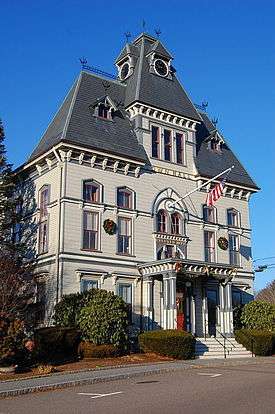
Peabody City Hall |
|
July 27, 1972
(#72000142) |
24 Lowell St.
42°31′35″N 70°55′44″W / 42.5264°N 70.9289°W / 42.5264; -70.9289 (Peabody City Hall) |
Peabody |
|
| 151 |
Peabody Civic Center Historic District |
|
November 25, 1980
(#80000477) |
Chestnut, Church, Foster, Franklin, and Lowell Sts.
42°31′32″N 70°55′48″W / 42.5256°N 70.93°W / 42.5256; -70.93 (Peabody Civic Center Historic District) |
Peabody |
|
| 152 |
Peabody Institute |
|
December 22, 1997
(#97001559) |
15 Sylvan St.
42°33′41″N 70°56′30″W / 42.5614°N 70.9417°W / 42.5614; -70.9417 (Peabody Institute) |
Danvers |
|
| 153 |
Peabody Institute Library |
|
June 4, 1973
(#73000311) |
Main St.
42°31′29″N 70°55′28″W / 42.5247°N 70.9244°W / 42.5247; -70.9244 (Peabody Institute Library) |
Peabody |
|
| 154 |
Peabody School |
|
October 23, 1986
(#86002900) |
170 Salem St.
42°45′48″N 71°04′15″W / 42.7633°N 71.0708°W / 42.7633; -71.0708 (Peabody School) |
Haverhill |
|
| 155 |
George Peabody House |
|
July 6, 1988
(#88000911) |
205 Washington St.
42°31′16″N 70°56′10″W / 42.5211°N 70.9361°W / 42.5211; -70.9361 (George Peabody House) |
Peabody |
|
| 156 |
John Perkins House |
|
March 9, 1990
(#90000269) |
75 Arbor St.
42°36′49″N 70°53′19″W / 42.6136°N 70.8886°W / 42.6136; -70.8886 (John Perkins House) |
Wenham |
Probably demolished. |
| 157 |
Platts-Bradstreet House |
|
September 27, 1980
(#80000645) |
Main St.
42°43′07″N 70°52′31″W / 42.7186°N 70.8753°W / 42.7186; -70.8753 (Platts-Bradstreet House) |
Rowley |
|
| 158 |
Primrose Street Schoolhouse |
|
June 23, 1983
(#83000582) |
71 Primrose St.
42°46′45″N 71°05′06″W / 42.7792°N 71.085°W / 42.7792; -71.085 (Primrose Street Schoolhouse) |
Haverhill |
|
| 159 |
John Proctor House |
|
March 9, 1990
(#90000253) |
348 Lowell St.
42°32′01″N 70°57′16″W / 42.5336°N 70.9544°W / 42.5336; -70.9544 (John Proctor House) |
Peabody |
|
| 160 |
Deacon Edward Putnam Jr. House |
|
March 9, 1990
(#90000243) |
9 Gregory St.
42°35′40″N 70°59′34″W / 42.5944°N 70.9928°W / 42.5944; -70.9928 (Deacon Edward Putnam Jr. House) |
Middleton |
Incorrectly listed on the register at 4 Gregory St. |
| 161 |
Gen. Israel Putnam House |
|
April 30, 1976
(#76000235) |
431 Maple St.
42°34′57″N 70°58′02″W / 42.5825°N 70.9672°W / 42.5825; -70.9672 (Gen. Israel Putnam House) |
Danvers |
|
| 162 |
James Putnam Jr. House |
|
March 9, 1990
(#90000205) |
42 Summer St.
42°34′33″N 70°56′58″W / 42.5758°N 70.9494°W / 42.5758; -70.9494 (James Putnam Jr. House) |
Danvers |
|
| 163 |
Rea-Proctor Homestead |
|
June 2, 1982
(#82001915) |
180 Conant Road
42°34′13″N 70°54′53″W / 42.5703°N 70.9147°W / 42.5703; -70.9147 (Rea-Proctor Homestead) |
Danvers |
|
| 164 |
Ridgewood Cemetery |
|
February 8, 2016
(#15001049) |
177 Salem St.
42°40′49″N 71°06′09″W / 42.6804°N 71.1026°W / 42.6804; -71.1026 (Ridgewood Cemetery) |
North Andover |
|
| 165 |
River Road-Cross Street Historic District |
|
May 26, 2005
(#05000465) |
Cross, Prospect Sts., River, Salem Rds.
42°37′59″N 70°57′35″W / 42.633°N 70.9597°W / 42.633; -70.9597 (River Road-Cross Street Historic District) |
Topsfield |
|
| 166 |
Rockport Downtown Main Street Historic District |
|
May 28, 1976
(#76000288) |
Portions of Main, Cleaves, Jewett, and School Sts.
42°39′29″N 70°37′11″W / 42.6581°N 70.6197°W / 42.6581; -70.6197 (Rockport Downtown Main Street Historic District) |
Rockport |
|
| 167 |
Rockport High School |
|
May 30, 1997
(#97000498) |
4 Broadway
42°39′28″N 70°37′03″W / 42.6578°N 70.6175°W / 42.6578; -70.6175 (Rockport High School) |
Rockport |
|
| 168 |
Old Rockport High School |
|
May 12, 2004
(#04000424) |
58 Broadway
42°39′19″N 70°37′22″W / 42.6553°N 70.6228°W / 42.6553; -70.6228 (Old Rockport High School) |
Rockport |
|
| 169 |
Rocks Village Historic District |
|
December 12, 1976
(#76001967) |
Northeast of Haverhill at the Merrimack River
42°48′33″N 71°00′08″W / 42.8092°N 71.0022°W / 42.8092; -71.0022 (Rocks Village Historic District) |
Haverhill |
|
| 170 |
Rocky Hill Meetinghouse and Parsonage |
|
April 11, 1972
(#72000115) |
4 Old Portsmouth Rd.
42°51′02″N 70°54′39″W / 42.850536°N 70.910853°W / 42.850536; -70.910853 (Rocky Hill Meetinghouse and Parsonage) |
Amesbury |
|
| 171 |
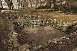
Rowley Village Forge Site |
|
March 2, 2001
(#01000201) |
Between Middleton and Topsfield Rds.[7]
42°38′52″N 70°59′25″W / 42.6478°N 70.9903°W / 42.6478; -70.9903 (Rowley Village Forge Site) |
Boxford |
|
| 172 |
St. Michael's Church |
|
June 18, 1973
(#73000305) |
26 Pleasant St.
42°30′15″N 70°51′05″W / 42.5042°N 70.8514°W / 42.5042; -70.8514 (St. Michael's Church) |
Marblehead |
|
| 173 |
Salem Village Historic District |
|
January 31, 1975
(#75000252) |
Irregular pattern along Centre, Hobart, Ingersoll, and Collins Sts., as far north as Brentwood Circle, and south to Mello Parkway
42°34′00″N 70°57′38″W / 42.5667°N 70.9606°W / 42.5667; -70.9606 (Salem Village Historic District) |
Danvers |
|
| 174 |
Samuel Brown School |
|
August 12, 2009
(#09000611) |
200 Lynn St.
42°30′13″N 70°57′08″W / 42.5036°N 70.9521°W / 42.5036; -70.9521 (Samuel Brown School) |
Peabody |
|
| 175 |
Saugus Iron Works National Historic Site |
|
October 15, 1966
(#66000047) |
Off U.S. Route 1
42°28′04″N 71°00′32″W / 42.4678°N 71.0089°W / 42.4678; -71.0089 (Saugus Iron Works National Historic Site) |
Saugus |
|
| 176 |
Saugus Town Hall |
|
June 20, 1985
(#85001332) |
Central St.
42°27′54″N 71°00′35″W / 42.465°N 71.0097°W / 42.465; -71.0097 (Saugus Town Hall) |
Saugus |
|
| 177 |
Sawyer House |
|
March 9, 1990
(#90000194) |
21 Endicott Rd.
42°37′41″N 70°58′39″W / 42.6281°N 70.9775°W / 42.6281; -70.9775 (Sawyer House) |
Boxford |
|
| 178 |
School Street School |
|
October 23, 1986
(#86002922) |
40 School St.
42°46′30″N 71°04′18″W / 42.775°N 71.0717°W / 42.775; -71.0717 (School Street School) |
Haverhill |
|
| 179 |
Seaside Park |
|
June 8, 2011
(#11000333) |
Atlantic Ave.
42°29′46″N 70°51′30″W / 42.4961°N 70.8583°W / 42.4961; -70.8583 (Seaside Park) |
Marblehead |
|
| 180 |
Second O'Shea Building |
|
March 27, 1980
(#80004237) |
9-13 Peabody Sq.
42°31′32″N 70°55′40″W / 42.5256°N 70.9278°W / 42.5256; -70.9278 (Second O'Shea Building) |
Peabody |
|
| 181 |
Sewall-Scripture House |
|
September 30, 1982
(#82001902) |
40 King St.
42°39′27″N 70°37′37″W / 42.6575°N 70.6269°W / 42.6575; -70.6269 (Sewall-Scripture House) |
Rockport |
|
| 182 |
Hazadiah Smith House |
|
March 9, 1990
(#90000200) |
337 Cabot St.
42°33′16″N 70°52′43″W / 42.554444°N 70.878611°W / 42.554444; -70.878611 (Hazadiah Smith House) |
Beverly |
|
| 183 |
Soldiers and Sailors Memorial Building |
|
August 22, 2016
(#16000544) |
363 Main St.
42°47′59″N 70°59′28″W / 42.799683°N 70.991185°W / 42.799683; -70.991185 (Soldiers and Sailors Memorial Building) |
West Newbury |
|
| 184 |
Southwick House |
|
November 29, 1983
(#83003974) |
151 Lowell St.
42°31′50″N 70°56′12″W / 42.530556°N 70.936667°W / 42.530556; -70.936667 (Southwick House) |
Peabody |
|
| 185 |
Spencer-Pierce-Little House |
|
November 24, 1968
(#68000043) |
Little's Lane
42°47′39″N 70°51′15″W / 42.7943°N 70.8543°W / 42.7943; -70.8543 (Spencer-Pierce-Little House) |
Newbury |
|
| 186 |
Spofford-Barnes House |
|
September 6, 1974
(#74000366) |
Kelsey Rd.
42°41′01″N 70°59′06″W / 42.6836°N 70.985°W / 42.6836; -70.985 (Spofford-Barnes House) |
Boxford |
|
| 187 |
Sprague House |
|
July 2, 1987
(#87001108) |
59 Endicott St.
42°33′00″N 70°55′38″W / 42.55°N 70.9272°W / 42.55; -70.9272 (Sprague House) |
Danvers |
|
| 188 |
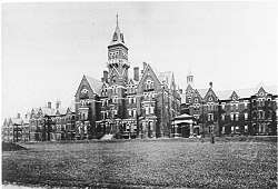
State Lunatic Hospital at Danvers |
|
January 26, 1984
(#84002436) |
450 Maple St.
42°34′58″N 70°58′30″W / 42.5828°N 70.975°W / 42.5828; -70.975 (State Lunatic Hospital at Danvers) |
Danvers |
|
| 189 |
Abiel Stevens House |
|
June 23, 1983
(#83000585) |
280 Salem St.
42°40′50″N 71°06′00″W / 42.6806°N 71.1°W / 42.6806; -71.1 (Abiel Stevens House) |
North Andover |
|
| 190 |
Story Grammar School |
|
March 13, 1986
(#86000378) |
140 Elm St.
42°30′16″N 70°51′19″W / 42.504444°N 70.855278°W / 42.504444; -70.855278 (Story Grammar School) |
Marblehead |
|
| 191 |
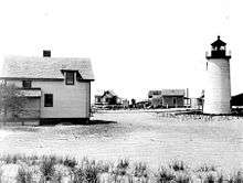
Straightsmouth Island Light |
|
June 15, 1987
(#87001487) |
Straightsmouth Island
42°39′31″N 70°35′10″W / 42.658611°N 70.586111°W / 42.658611; -70.586111 (Straightsmouth Island Light) |
Rockport |
|
| 192 |
Superior Courthouse and Bartlett Mall |
|
April 30, 1976
(#76000280) |
Bounded by High, Pond, Auburn, and Greenleaf Sts.
42°48′07″N 70°52′30″W / 42.801944°N 70.875°W / 42.801944; -70.875 (Superior Courthouse and Bartlett Mall) |
Newburyport |
|
| 193 |
Sutton Block |
|
September 5, 1985
(#85002012) |
76-78 Main St.
42°31′30″N 70°55′32″W / 42.525°N 70.925556°W / 42.525; -70.925556 (Sutton Block) |
Peabody |
|
| 194 |
Swampscott Cemetery |
|
March 6, 2013
(#13000051) |
400 Essex St.
42°29′00″N 70°54′47″W / 42.4832°N 70.9131°W / 42.4832; -70.9131 (Swampscott Cemetery) |
Swampscott |
|
| 195 |
Swampscott Fish House |
|
May 16, 1985
(#85001120) |
Humphrey St.
42°28′03″N 70°54′37″W / 42.4675°N 70.910278°W / 42.4675; -70.910278 (Swampscott Fish House) |
Swampscott |
|
| 196 |
Swampscott Railroad Depot |
|
August 28, 1998
(#98001106) |
10 Railroad Ave.
42°28′25″N 70°55′22″W / 42.473611°N 70.922778°W / 42.473611; -70.922778 (Swampscott Railroad Depot) |
Swampscott |
|
| 197 |
Tavern Acres Historic District |
|
September 29, 1995
(#95001134) |
Bounded by Bradstreet Rd., Green and Main Sts., and Park Way
42°41′42″N 71°07′34″W / 42.695°N 71.126111°W / 42.695; -71.126111 (Tavern Acres Historic District) |
North Andover |
|
| 198 |
Elihu Thomson House |
|
January 7, 1976
(#76002002) |
33 Elmwood Ave.
42°28′11″N 70°55′08″W / 42.469722°N 70.918889°W / 42.469722; -70.918889 (Elihu Thomson House) |
Swampscott |
|
| 199 |
Capt. John Thorndike House |
|
March 9, 1990
(#90000195) |
184 Hale St.
42°34′49″N 70°50′23″W / 42.580278°N 70.839722°W / 42.580278; -70.839722 (Capt. John Thorndike House) |
Beverly |
|
| 200 |
Benaiah Titcomb House |
|
March 9, 1990
(#90000208) |
189 John Wise Ave.
42°39′05″N 70°47′49″W / 42.6514°N 70.7969°W / 42.6514; -70.7969 (Benaiah Titcomb House) |
Essex |
|
| 201 |
Topsfield Town Common District |
|
June 7, 1976
(#03001488) |
N. Common, E. Common, S. Common, W. Common, High St. Ext., Washington, Main, High, and Howlett Sts.
42°38′32″N 70°57′04″W / 42.6422°N 70.9511°W / 42.6422; -70.9511 (Topsfield Town Common District) |
Topsfield |
|
| 202 |
Towne Farm |
|
August 1, 2012
(#12000455) |
55 Towne Rd.
42°39′28″N 71°01′35″W / 42.6578°N 71.0265°W / 42.6578; -71.0265 (Towne Farm) |
Boxford |
|
| 203 |
Rev. John Tufts House |
|
March 9, 1990
(#90000270) |
750 Main St.
42°48′29″N 70°57′24″W / 42.8081°N 70.9567°W / 42.8081; -70.9567 (Rev. John Tufts House) |
West Newbury |
|
| 204 |
Twin Lights Historic District-Cape Ann Light Station |
|
October 7, 1971
(#71000355) |
1 mi (1.6 km) east of Rockport on Thacher Island
42°38′15″N 70°34′36″W / 42.6375°N 70.5767°W / 42.6375; -70.5767 (Twin Lights Historic District-Cape Ann Light Station) |
Rockport |
|
| 205 |
Union Congregational Church |
|
November 5, 2014
(#14000894) |
350-354 Main St.
42°50′30″N 70°55′26″W / 42.8418°N 70.9240°W / 42.8418; -70.9240 (Union Congregational Church) |
Amesbury |
|
| 206 |
United Shoe Machinery Corporation Clubhouse |
|
November 26, 1982
(#82000484) |
134 McKay St.
42°33′52″N 70°53′43″W / 42.5644°N 70.8953°W / 42.5644; -70.8953 (United Shoe Machinery Corporation Clubhouse) |
Beverly |
|
| 207 |
US Customhouse |
|
February 25, 1971
(#71000089) |
25 Water St.
42°48′44″N 70°52′09″W / 42.8122°N 70.8692°W / 42.8122; -70.8692 (US Customhouse) |
Newburyport |
|
| 208 |
US Post Office-Beverly Main |
|
June 4, 1986
(#86001210) |
161 Rantoul St.
42°32′50″N 70°53′04″W / 42.5472°N 70.8844°W / 42.5472; -70.8844 (US Post Office-Beverly Main) |
Beverly |
|
| 209 |
US Post Office-Newburyport Main |
|
June 18, 1986
(#86001341) |
61 Pleasant St.
42°48′38″N 70°52′22″W / 42.8105°N 70.8729°W / 42.8105; -70.8729 (US Post Office-Newburyport Main) |
Newburyport |
|
| 210 |
Walker Body Company Factory |
|
September 28, 2007
(#07000512) |
Oak St. at River Court
42°51′10″N 70°55′27″W / 42.8529°N 70.9243°W / 42.8529; -70.9243 (Walker Body Company Factory) |
Amesbury |
|
| 211 |
Washington Street Historic District |
|
September 12, 1985
(#85002380) |
Washington, Main, Holton and Sewall Sts.
42°31′23″N 70°55′28″W / 42.5231°N 70.9244°W / 42.5231; -70.9244 (Washington Street Historic District) |
Peabody |
|
| 212 |
Washington Street Shoe District |
|
October 14, 1976
(#76000257) |
Washington, Wingate, Emerson Sts. Railroad and Washington Sqs.
42°46′25″N 71°05′05″W / 42.7736°N 71.0847°W / 42.7736; -71.0847 (Washington Street Shoe District) |
Haverhill |
|
| 213 |
Wenham Historic District |
|
April 13, 1973
(#73000852) |
Both sides of Main St. between Beverly and Hamilton city lines
42°35′53″N 70°53′20″W / 42.5981°N 70.8889°W / 42.5981; -70.8889 (Wenham Historic District) |
Wenham |
|
| 214 |
White-Preston House |
|
March 9, 1990
(#90000204) |
592 Maple St.
42°35′28″N 70°58′50″W / 42.5911°N 70.9806°W / 42.5911; -70.9806 (White-Preston House) |
Danvers |
|
| 215 |
John Greenleaf Whittier House |
|
October 15, 1966
(#66000792) |
86 Friend St.
42°51′20″N 70°56′08″W / 42.8556°N 70.9356°W / 42.8556; -70.9356 (John Greenleaf Whittier House) |
Amesbury |
|
| 216 |
Winter Street School |
|
April 10, 2017
(#100000849) |
165 Winter St.
42°46′40″N 71°05′02″W / 42.777901°N 71.083759°W / 42.777901; -71.083759 (Winter Street School) |
Haverhill |
|
| 217 |
Woodberry-Quarrels House |
|
March 9, 1990
(#90000224) |
180 Bridge St.
42°36′55″N 70°50′42″W / 42.6153°N 70.845°W / 42.6153; -70.845 (Woodberry-Quarrels House) |
Hamilton |
|
| 218 |
Peter Woodbury House |
|
March 9, 1990
(#90000201) |
82 Dodge St.
42°34′42″N 70°53′22″W / 42.5783°N 70.8894°W / 42.5783; -70.8894 (Peter Woodbury House) |
Beverly |
|
.jpg)
_101)_99)_hdr.jpg)
.jpg)
.jpg)
.jpg)
.jpg)
_-_Amesbury%2C_Massachusetts.JPG)
_-_Newbury%2C_Massachusetts.JPG)
.jpg)