| [3] |
Name on the Register[4] |
Image |
Date listed[5] |
Location |
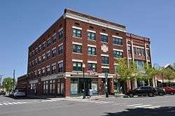
City or town |
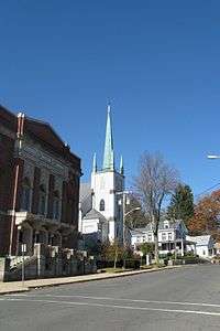
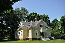
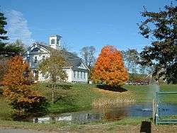
Description |
|---|
| 1 |
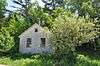
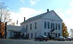
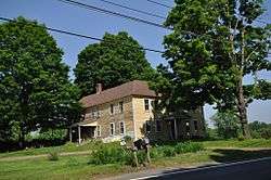
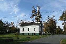
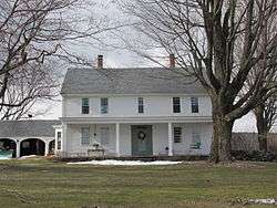
Simeon Alexander Jr. House |
|
May 28, 1991
(#91000598) |
496 Millers Falls Rd.
42°38′19″N 72°27′55″W / 42.6385°N 72.4652°W / 42.6385; -72.4652 (Simeon Alexander Jr. House) |
Northfield |
|
| 2 |
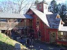
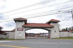
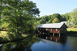
Alvah Stone Mill |
|
June 30, 1997
(#97000562) |
440 Greenfield Rd.
42°32′16″N 72°32′20″W / 42.537778°N 72.538889°W / 42.537778; -72.538889 (Alvah Stone Mill) |
Montague |
Now the Bookmill. |
| 3 |
Ashfield Plain Historic District |
|
September 20, 1991
(#91001373) |
Roughly along Main and South Sts. and adjacent parts of Buckland and Norton Hill Rds.
42°31′37″N 72°47′17″W / 42.526944°N 72.788056°W / 42.526944; -72.788056 (Ashfield Plain Historic District) |
Ashfield |
|
| 4 |
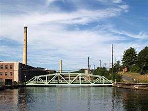
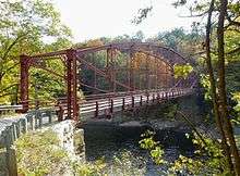
Bardwell's Ferry Bridge |
|
February 10, 2000
(#00000076) |
Bardwell's Ferry Rd. over the Deerfield River
42°33′20″N 72°40′41″W / 42.555556°N 72.678056°W / 42.555556; -72.678056 (Bardwell's Ferry Bridge) |
Conway |
|
| 5 |
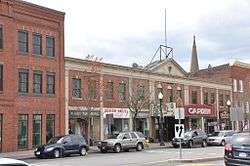
Benson's New Block and the Mohawk Chambers |
|
March 11, 2014
(#14000046) |
136-138 & 130-134 Main St. & 11 Wells St.
42°35′17″N 72°36′14″W / 42.588°N 72.604°W / 42.588; -72.604 (Benson's New Block and the Mohawk Chambers) |
Greenfield |
|
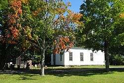
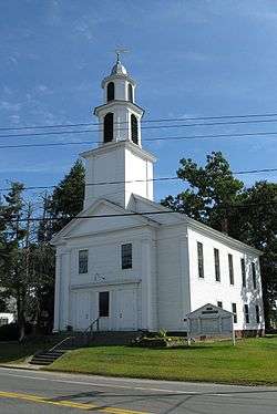
| 6 |
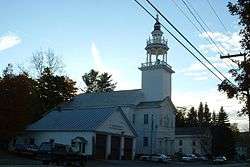
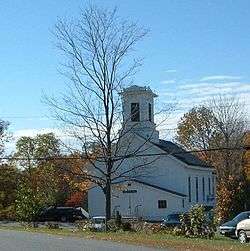
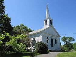
Bernardston Congregational Unitarian Church |
|
March 18, 1993
(#93000128) |
Junction of Church and Depot Sts.
42°40′14″N 72°33′00″W / 42.670556°N 72.55°W / 42.670556; -72.55 (Bernardston Congregational Unitarian Church) |
Bernardston |
|
| 7 |
Bissell Bridge |
|
February 26, 2004
(#04000083) |
Heath Rd., MA 8A over Mill Brook
42°37′57″N 72°52′10″W / 42.6325°N 72.869444°W / 42.6325; -72.869444 (Bissell Bridge) |
Charlemont |
|
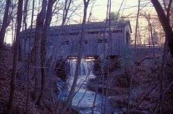
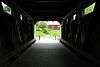
| 8 |
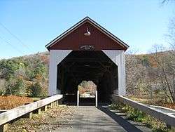
Burkeville Covered Bridge |
|
September 9, 1988
(#88001456) |
Main Poland Rd. over the South River
42°30′28″N 72°42′40″W / 42.5078°N 72.7111°W / 42.5078; -72.7111 (Burkeville Covered Bridge) |
Conway |
|
| 9 |
Charlemont Village Historic District |
|
February 10, 1988
(#87001880) |
MA 2 (Main St.) between South and Harmont Sts.
42°37′40″N 72°52′27″W / 42.627778°N 72.874167°W / 42.627778; -72.874167 (Charlemont Village Historic District) |
Charlemont |
|
| 10 |
Colrain Center Historic District |
|
November 15, 2006
(#06001057) |
Main, Greenfield, and Jacksonville Rds., Streeter Ln., and River and Coburn Sts.
42°40′24″N 72°41′52″W / 42.673333°N 72.697778°W / 42.673333; -72.697778 (Colrain Center Historic District) |
Colrain |
|
| 11 |
Conway Center Historic District |
|
September 10, 1999
(#99001043) |
5-38 Academy Hill Rd., 1-59 Elm St., and 8-98 Main St.
42°30′31″N 72°41′50″W / 42.508611°N 72.697222°W / 42.508611; -72.697222 (Conway Center Historic District) |
Conway |
|
| 12 |
Dedic Site |
|
July 16, 1980
(#80000504) |
Address Restricted
|
Deerfield |
Clovis-era paleo-indian site |
| 13 |
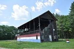
Deerfield Valley Agricultural Society Fairgrounds |
|
May 11, 2011
(#11000267) |
Park St.
42°37′51″N 72°52′03″W / 42.630833°N 72.8675°W / 42.630833; -72.8675 (Deerfield Valley Agricultural Society Fairgrounds) |
Charlemont |
|
| 14 |
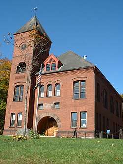
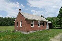
East Charlemont District School |
|
March 7, 2017
(#100000721) |
1811 MA 2
42°37′24″N 72°47′13″W / 42.623463°N 72.786845°W / 42.623463; -72.786845 (East Charlemont District School) |
Charlemont |
|
| 15 |
East Hawley Center Historic District |
|
July 24, 1992
(#92000951) |
East Hawley, Plainfield, Buckland, and Ashfield Rds.
42°33′48″N 72°52′43″W / 42.563333°N 72.878611°W / 42.563333; -72.878611 (East Hawley Center Historic District) |
Hawley |
|
| 16 |
East Leverett Historic District |
|
January 29, 2014
(#13001131) |
Shutesbury, January Hills, Still Corner & Cushman Rds.
42°26′18″N 72°28′58″W / 42.438281°N 72.482680°W / 42.438281; -72.482680 (East Leverett Historic District) |
Leverett |
|
| 17 |
East Main-High Street Historic District |
|
March 16, 1989
(#88002011) |
Roughly bounded by Church, High, E. Main, and Franklin Sts.
42°35′20″N 72°35′49″W / 42.588889°N 72.596944°W / 42.588889; -72.596944 (East Main-High Street Historic District) |
Greenfield |
|
| 18 |
Franklin County Fairgrounds |
|
June 15, 2011
(#11000359) |
89 Wisdom Way
42°34′44″N 72°36′42″W / 42.578889°N 72.611667°W / 42.578889; -72.611667 (Franklin County Fairgrounds) |
Greenfield |
|
| 19 |
Garden Theater Block |
|
September 1, 1983
(#83000591) |
353-367 Main St.
42°35′15″N 72°36′01″W / 42.5875°N 72.600278°W / 42.5875; -72.600278 (Garden Theater Block) |
Greenfield |
|
| 20 |
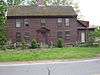
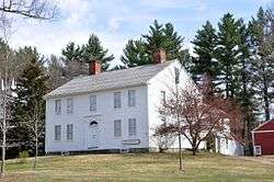
Maj. Joseph Griswold House |
|
February 23, 1972
(#72000130) |
Upper St.
42°35′26″N 72°47′39″W / 42.590468°N 72.794087°W / 42.590468; -72.794087 (Maj. Joseph Griswold House) |
Buckland |
|
| 21 |
Heath Center Historic District |
|
October 25, 2007
(#07001103) |
E. and W. Main Sts., 12 and 23 Avery Brook, 8 Taylor Brook, 1-51 Bray, Colrain Stage, 3-16 Ledges, and 15-48 South Rds.
42°40′25″N 72°49′19″W / 42.673603°N 72.821944°W / 42.673603; -72.821944 (Heath Center Historic District) |
Heath |
|
| 22 |
Hill Cemetery and Parson Hubbard House Historic District |
|
August 23, 2006
(#06000716) |
Old Village Rd., 72 Old Village Rd.
42°35′54″N 72°41′16″W / 42.598333°N 72.687778°W / 42.598333; -72.687778 (Hill Cemetery and Parson Hubbard House Historic District) |
Shelburne |
|
| 23 |
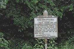
King Philip's Hill |
|
December 16, 1981
(#81000106) |
Old Bernardston Road
42°41′02″N 72°28′35″W / 42.683889°N 72.476389°W / 42.683889; -72.476389 (King Philip's Hill) |
Northfield |
|
| 24 |
Leavitt-Hovey House |
|
December 22, 1983
(#83003977) |
402 Main St.
42°35′17″N 72°35′58″W / 42.588056°N 72.599444°W / 42.588056; -72.599444 (Leavitt-Hovey House) |
Greenfield |
|
| 25 |
Leverett Center Historic District |
|
December 5, 2008
(#08001127) |
Amherst, Montague, Depot, and Shutesbury Rds.
42°27′05″N 72°30′06″W / 42.451286°N 72.501728°W / 42.451286; -72.501728 (Leverett Center Historic District) |
Leverett |
|
| 26 |
Main Street Historic District |
|
October 13, 1988
(#88001908) |
Main St. between Chapman and Hope Sts., also along Bank Row
42°35′13″N 72°36′05″W / 42.586944°N 72.601389°W / 42.586944; -72.601389 (Main Street Historic District) |
Greenfield |
|
| 27 |
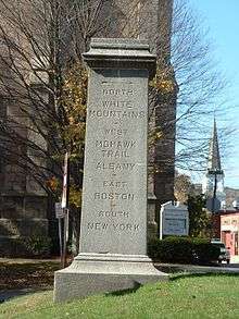
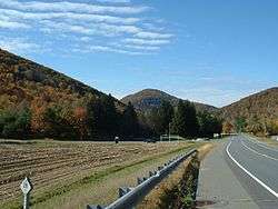
Mohawk Trail |
|
April 3, 1973
(#73000283) |
Along the bank of the Cold River
42°38′15″N 72°57′13″W / 42.6375°N 72.953611°W / 42.6375; -72.953611 (Mohawk Trail) |
Charlemont |
Extends into Florida and Savoy in Berkshire County |
| 28 |
Montague Center Historic District |
|
November 16, 2001
(#01001236) |
Center, Main, North, School, and Union Sts.
42°32′06″N 72°32′05″W / 42.535°N 72.534722°W / 42.535; -72.534722 (Montague Center Historic District) |
Montague |
|
| 29 |
Moore's Corner Historic District |
|
May 19, 2014
(#14000215) |
North Leverett, Dudleyville, Rattlesnake Gutter & Church Hill Rds.
42°29′40″N 72°28′06″W / 42.4945°N 72.4683°W / 42.4945; -72.4683 (Moore's Corner Historic District) |
Leverett |
|
| 30 |
New Salem Common Historic District |
|
April 12, 1978
(#78000443) |
S. Main St.
42°29′55″N 72°19′54″W / 42.498611°N 72.331667°W / 42.498611; -72.331667 (New Salem Common Historic District) |
New Salem |
|
| 31 |
Newton Street School |
|
October 27, 1988
(#88001907) |
70 Shelburne Rd.
42°35′08″N 72°36′52″W / 42.585556°N 72.614444°W / 42.585556; -72.614444 (Newton Street School) |
Greenfield |
|
| 32 |
North Leverett Historic District |
|
June 13, 2014
(#14000326) |
North Leverett, Chestnut Hill, Cave Hill, Jackson Hill, Hemenway & Dickinson Rds.
42°30′28″N 72°29′31″W / 42.5079°N 72.492°W / 42.5079; -72.492 (North Leverett Historic District) |
Leverett |
|
| 33 |
Northfield Center Cemetery |
|
November 13, 2004
(#04001220) |
Western terminus of Parker Ave.
42°41′41″N 72°27′40″W / 42.694722°N 72.461111°W / 42.694722; -72.461111 (Northfield Center Cemetery) |
Northfield |
|
| 34 |
Northfield Main Street Historic District |
|
July 8, 1982
(#82004965) |
Full length of Main St. from Millers Brook to Pauchaug Brook
42°41′50″N 72°27′16″W / 42.697222°N 72.454444°W / 42.697222; -72.454444 (Northfield Main Street Historic District) |
Northfield |
|
| 35 |
Odd Fellows' Hall |
|
May 10, 1979
(#79000345) |
1-5 State St.
42°36′13″N 72°44′29″W / 42.6035°N 72.7415°W / 42.6035; -72.7415 (Odd Fellows' Hall) |
Buckland |
In Shelburne Falls village of Buckland. |
| 36 |
Old Deerfield Village Historic District |
|
October 15, 1966
(#66000774) |
West of U.S. Route 5, bounded by Mill Village Rd., "The Street", Broughton's Pond Rd., and Pogues Hole Rd.
42°33′04″N 72°36′30″W / 42.551111°N 72.608333°W / 42.551111; -72.608333 (Old Deerfield Village Historic District) |
Deerfield |
|
| 37 |
Orange Center Historic District |
|
April 27, 1989
(#89000057) |
Roughly N. and S. Main St. from Prospect St. to River St.
42°35′24″N 72°18′39″W / 42.59°N 72.310833°W / 42.59; -72.310833 (Orange Center Historic District) |
Orange |
|
| 38 |
Pine Street School |
|
March 13, 2002
(#02000156) |
13 Pine St.
42°42′32″N 72°26′50″W / 42.708889°N 72.447222°W / 42.708889; -72.447222 (Pine Street School) |
Northfield |
|
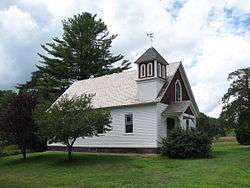
| 39 |
Powers Institute Historic District |
|
March 18, 1994
(#93000127) |
Church St. between South and Library Sts.
42°40′16″N 72°33′12″W / 42.671111°N 72.553333°W / 42.671111; -72.553333 (Powers Institute Historic District) |
Bernardston |
|
| 40 |
Riverside Archeological District |
|
July 9, 1975
(#75000256) |
Address Restricted
|
Greenfield and Gill |
|
| 41 |
Riverside Village Historic District |
|
September 18, 2017
(#100001617) |
0-77 French King Hwy., 0-61 Riverview Dr., 1-9 Grove, 2-9 Myrtle, 8 Meadow, 2-23 Oak, 1-4 Pine & 3-32 Walnut Sts.
42°36′41″N 72°32′52″W / 42.611417°N 72.54775°W / 42.611417; -72.54775 (Riverside Village Historic District) |
Gill |
|
| 42 |
Shelburne Falls Historic District |
|
January 28, 1988
(#87002548) |
Bridge and State Sts.
42°36′11″N 72°44′25″W / 42.603056°N 72.740278°W / 42.603056; -72.740278 (Shelburne Falls Historic District) |
Buckland and Shelburne |
Boundary Increase 2010 (listed April 7, 2010): Roughly bounded by Deerfield River, Bridge St., Massachusetts Route 2 and Arms Cemetery |
| 43 |
Shelburne Free Public Library |
|
July 18, 2016
(#16000453) |
233 Shelburne Center Rd.
42°35′20″N 72°41′19″W / 42.589010°N 72.688684°W / 42.589010; -72.688684 (Shelburne Free Public Library) |
Shelburne |
|
| 44 |
Arthur A. Smith Covered Bridge |
|
February 3, 1983
(#83000592) |
West of Colrain on Lyonsville Rd.
42°40′12″N 72°43′09″W / 42.67°N 72.719167°W / 42.67; -72.719167 (Arthur A. Smith Covered Bridge) |
Colrain |
|
| 45 |
South School |
|
December 26, 2007
(#07001312) |
6 Schoolhouse Rd.
42°25′11″N 72°26′00″W / 42.419722°N 72.433333°W / 42.419722; -72.433333 (South School) |
Shutesbury |
|
| 46 |
Sunderland Center Historic District |
|
March 15, 2002
(#02000157) |
Roughly along S. Main St.from Old Amherst Rd. to French's Ferry Rd.
42°27′59″N 72°34′46″W / 42.466397°N 72.579567°W / 42.466397; -72.579567 (Sunderland Center Historic District) |
Sunderland |
|
| 47 |
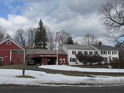
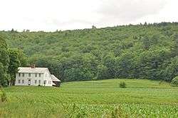
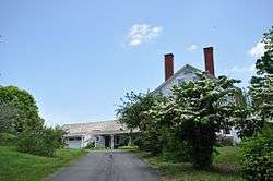
Old Tavern Farm |
|
March 10, 2005
(#05000120) |
817 Colrain Rd.
42°37′20″N 72°38′09″W / 42.622222°N 72.635833°W / 42.622222; -72.635833 (Old Tavern Farm) |
Greenfield |
|
| 48 |
Turners Falls Historic District |
|
May 2, 1982
(#82004966) |
Roughly bounded by the Connecticut River, Power Canal, and 9th and L Sts.
42°36′30″N 72°33′23″W / 42.608333°N 72.556389°W / 42.608333; -72.556389 (Turners Falls Historic District) |
Montague |
Listed as Turner Falls Historic District |
| 49 |
US Post Office-Greenfield Main |
|
December 20, 1985
(#85003224) |
442 Main St.
42°35′15″N 72°35′53″W / 42.5875°N 72.598056°W / 42.5875; -72.598056 (US Post Office-Greenfield Main) |
Greenfield |
|
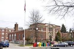
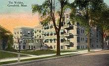
| 50 |
Weldon Hotel |
|
August 6, 1980
(#80000503) |
54 High St.
42°35′26″N 72°35′44″W / 42.590556°N 72.595556°W / 42.590556; -72.595556 (Weldon Hotel) |
Greenfield |
|
| 51 |
Wendell Town Common Historic District |
|
May 21, 1992
(#92000580) |
Junction of Depot, Lock's Village, Montague and Morse Village Rds.
42°32′55″N 72°23′51″W / 42.548611°N 72.3975°W / 42.548611; -72.3975 (Wendell Town Common Historic District) |
Wendell |
|
| 52 |
West Whately Historic District |
|
October 10, 2003
(#03001018) |
Address Restricted[6]
42°26′18″N 72°40′55″W / 42.4383°N 72.682°W / 42.4383; -72.682 (West Whately Historic District) |
Whately |
|
| 53 |
Whately Center Historic District |
|
September 11, 2003
(#03000920) |
155-215 Chestnut Plain Rd. and 330-348 Haydenville Rd.
42°26′18″N 72°38′09″W / 42.438333°N 72.635833°W / 42.438333; -72.635833 (Whately Center Historic District) |
Whately |
|
| 54 |
Whitaker-Clary House |
|
June 18, 1975
(#75000257) |
Elm St.
42°32′26″N 72°18′58″W / 42.540556°N 72.316111°W / 42.540556; -72.316111 (Whitaker-Clary House) |
New Salem |
Home of the Swift River Historical Society |
| 55 |
The Wilder Homestead |
|
January 24, 2011
(#10001178) |
Ashfield Rd.
42°35′59″N 72°46′44″W / 42.599722°N 72.778889°W / 42.599722; -72.778889 (The Wilder Homestead) |
Buckland |
About 1/4 mile south of the Upper Road/Ashfield Road junction. |
| 56 |
Robert Strong Woodward House and Studio |
|
January 11, 2018
(#100001961) |
43 Upper St.
42°35′16″N 72°47′44″W / 42.587723°N 72.795451°W / 42.587723; -72.795451 (Robert Strong Woodward House and Studio) |
Buckland |
|

.jpg)