| [3] |
Name on the Register[4] |
Image |
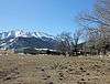
Date listed[5] |
Location |
City or town |
Description |
|---|
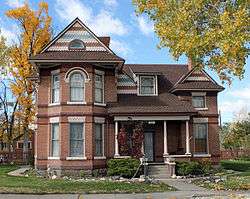
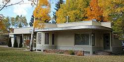
| 1 |
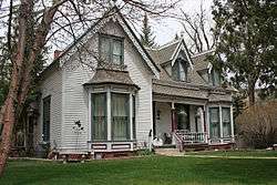
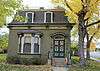
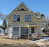
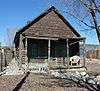
Alexander House |
|
November 7, 2007
(#07001148) |
846 F St.
38°31′47″N 105°59′52″W / 38.529722°N 105.997778°W / 38.529722; -105.997778 (Alexander House) |
Salida |
|
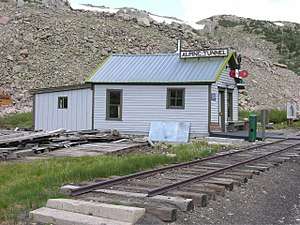
| 2 |
Alpine Tunnel Historic District |
|
April 1, 1996
(#80004632) |
Along the Denver, South Park and Pacific Railroad tracks from Quartz to Hancock
38°37′46″N 106°24′02″W / 38.629444°N 106.400556°W / 38.629444; -106.400556 (Alpine Tunnel Historic District) |
Hancock and Quartz |
|
| 3 |
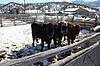
Behrman Ranch |
|
March 27, 2012
(#12000143) |
31715 U.S. Route 24 N.
38°52′48″N 106°09′40″W / 38.879909°N 106.161128°W / 38.879909; -106.161128 (Behrman Ranch) |
Buena Vista |
|
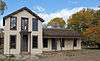
| 4 |
Bode-Stewart House |
|
April 29, 2008
(#08000344) |
803 F St.
38°31′49″N 105°59′52″W / 38.530292°N 105.997678°W / 38.530292; -105.997678 (Bode-Stewart House) |
Salida |
|
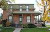
| 5 |
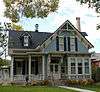
J. M. Bonney House |
|
December 19, 1994
(#94001469) |
408 Princeton Ave.
38°50′39″N 106°08′13″W / 38.844167°N 106.136944°W / 38.844167; -106.136944 (J. M. Bonney House) |
Buena Vista |
|
| 6 |
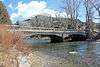
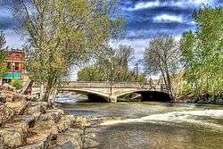
Bridge over Arkansas River |
|
February 4, 1985
(#85000190) |
U.S. Route 24
38°48′49″N 106°06′12″W / 38.813611°N 106.103333°W / 38.813611; -106.103333 (Bridge over Arkansas River) |
Buena Vista |
|
| 7 |
Brown's Canyon Bridge |
|
July 30, 2013
(#13000554) |
County Road 191 crossing the Arkansas River
38°36′46″N 106°03′43″W / 38.612738°N 106.061884°W / 38.612738; -106.061884 (Brown's Canyon Bridge) |
Salida |
|
| 8 |
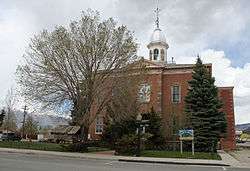
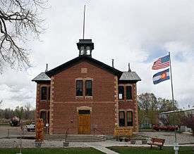
Chaffee County Courthouse and Jail Buildings |
|
September 10, 1979
(#79000575) |
501 E. Main St.
38°50′37″N 106°07′37″W / 38.843611°N 106.126944°W / 38.843611; -106.126944 (Chaffee County Courthouse and Jail Buildings) |
Buena Vista |
|
| 9 |
Chaffee County Poor Farm |
|
May 16, 1985
(#85001062) |
8495 County Road 160
38°33′07″N 106°01′57″W / 38.551944°N 106.0325°W / 38.551944; -106.0325 (Chaffee County Poor Farm) |
Salida |
|
| 10 |
Cleora Cemetery |
|
March 27, 2017
(#100000784) |
Southern side of U.S. Route 50, 1.4 miles (2.3 km) east of Salida
38°30′49″N 105°58′40″W / 38.513618°N 105.977906°W / 38.513618; -105.977906 (Cleora Cemetery) |
Salida |
|
| 11 |
Comanche Drive-In |
|
August 3, 2015
(#15000481) |
17063 County Road 106
38°49′24″N 106°11′02″W / 38.8232°N 106.1839°W / 38.8232; -106.1839 (Comanche Drive-In) |
Buena Vista |
|
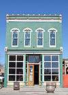
| 12 |
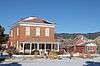
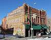
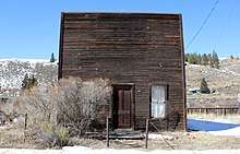
Commercial Hotel |
|
July 27, 2015
(#15000460) |
43255 County Road 397
39°02′37″N 106°15′53″W / 39.0437°N 106.2648°W / 39.0437; -106.2648 (Commercial Hotel) |
Granite |
|
| 13 |
E.W. Corbin House |
|
November 1, 1996
(#96001239) |
303 E. 5th St.
38°31′53″N 105°59′33″W / 38.531389°N 105.9925°W / 38.531389; -105.9925 (E.W. Corbin House) |
Salida |
|
| 14 |
Crescent Moly Mine No. 100 and Mining Camp |
|
October 11, 2003
(#03001005) |
Address Restricted
|
Granite |
Located in the vicinity of the Vicksburg Mining Camp |
| 15 |
F Street Bridge |
|
February 4, 1985
(#85000192) |
F St.
38°32′16″N 105°59′33″W / 38.537778°N 105.9925°W / 38.537778; -105.9925 (F Street Bridge) |
Salida |
|
| 16 |
William and Anna Fay House |
|
July 27, 2015
(#15000461) |
201 S. Colorado Ave.
38°50′30″N 106°07′43″W / 38.8416°N 106.1287°W / 38.8416; -106.1287 (William and Anna Fay House) |
Buena Vista |
|
| 17 |
Grace Episcopal Church |
|
January 20, 1978
(#78000834) |
Main and Park Ave.
38°50′27″N 106°07′57″W / 38.840833°N 106.1325°W / 38.840833; -106.1325 (Grace Episcopal Church) |
Buena Vista |
|
| 18 |
Garret and Julia Gray Cottage |
|
September 12, 1980
(#80000884) |
125 E. 5th St.
38°31′56″N 105°59′40″W / 38.532222°N 105.994444°W / 38.532222; -105.994444 (Garret and Julia Gray Cottage) |
Salida |
|
| 19 |
Head Lettuce Day-Collegiate Peaks Stampede Rodeo Grounds |
|
November 7, 2016
(#16000758) |
2001 Gregg Dr.
38°49′23″N 106°09′17″W / 38.823078°N 106.154833°W / 38.823078; -106.154833 (Head Lettuce Day-Collegiate Peaks Stampede Rodeo Grounds) |
Buena Vista |
|
| 20 |
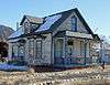
Heister House |
|
October 8, 2008
(#08000965) |
102 Poncha Boulevard
38°30′56″N 105°59′51″W / 38.515556°N 105.99745°W / 38.515556; -105.99745 (Heister House) |
Salida |
|
| 21 |
Hutchinson Ranch |
|
May 11, 1973
(#73000463) |
2 miles east of Poncha Springs on U.S. Route 50; also 8911 W. U.S. Route 50
38°30′56″N 106°02′33″W / 38.515556°N 106.0425°W / 38.515556; -106.0425 (Hutchinson Ranch) |
Poncha Springs |
Second address represents a boundary increase |
| 22 |
F.A. Jackson House |
|
April 15, 1999
(#99000445) |
401 E. 1st St.
38°32′02″N 105°59′17″W / 38.533889°N 105.988056°W / 38.533889; -105.988056 (F.A. Jackson House) |
Salida |
|
| 23 |
Jacobs Building |
|
December 22, 2011
(#11000946) |
414 Main St.
38°50′36″N 106°07′42″W / 38.8433°N 106.128369°W / 38.8433; -106.128369 (Jacobs Building) |
Buena Vista |
|
| 24 |
Kelley-McDonald House |
|
July 27, 2015
(#15000462) |
108 S. Pleasant Ave.
38°50′24″N 106°08′14″W / 38.8400°N 106.1371°W / 38.8400; -106.1371 (Kelley-McDonald House) |
Buena Vista |
|
| 25 |
Littlejohn Mine Complex |
|
December 27, 1978
(#78000835) |
Southwest of Granite
38°57′15″N 106°18′49″W / 38.954167°N 106.313611°W / 38.954167; -106.313611 (Littlejohn Mine Complex) |
Granite |
|
| 26 |
Manhattan Hotel |
|
April 21, 1983
(#83001302) |
225 F St.
38°31′54″N 105°59′10″W / 38.531667°N 105.986111°W / 38.531667; -105.986111 (Manhattan Hotel) |
Salida |
|
| 27 |
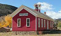
Maysville School |
|
April 29, 1999
(#99000484) |
South of U.S. Route 50
38°32′22″N 106°11′24″W / 38.539444°N 106.19°W / 38.539444; -106.19 (Maysville School) |
Maysville |
|
| 28 |
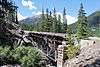
Morley Bridge |
|
August 14, 2003
(#03000744) |
County Road 297 at milepost 2.40
38°40′30″N 106°21′51″W / 38.675°N 106.364167°W / 38.675; -106.364167 (Morley Bridge) |
Romley |
|
| 29 |
Nachtrieb-Kelly Ranch |
|
March 27, 2017
(#100000785) |
25887 County Road 319
38°47′41″N 106°07′57″W / 38.794816°N 106.132497°W / 38.794816; -106.132497 (Nachtrieb-Kelly Ranch) |
Buena Vista |
Historic ranch |
| 30 |
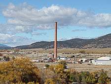
Ohio-Colorado Smelting and Refining Company Smokestack |
|
January 11, 1976
(#76000548) |
Northeast of Salida at the junction of County Roads 150 and 152
38°33′07″N 106°01′25″W / 38.551944°N 106.023611°W / 38.551944; -106.023611 (Ohio-Colorado Smelting and Refining Company Smokestack) |
Salida |
|
| 31 |
Pedro-Botz House |
|
July 27, 2015
(#15000463) |
7467 County Road 150
38°32′52″N 106°00′53″W / 38.5477°N 106.0147°W / 38.5477; -106.0147 (Pedro-Botz House) |
Salida |
|
| 32 |
Pine Hall |
|
November 7, 2016
(#16000759) |
43145 County Road 397
39°02′37″N 106°15′53″W / 39.043505°N 106.264832°W / 39.043505; -106.264832 (Pine Hall) |
Granite |
|
| 33 |
Poncha Springs Schoolhouse |
|
January 25, 1990
(#89002375) |
330 Burnett St.
38°30′53″N 106°04′17″W / 38.514722°N 106.071389°W / 38.514722; -106.071389 (Poncha Springs Schoolhouse) |
Poncha Springs |
|
| 34 |
Rock Ledge Ranch-Franzel Ranch |
|
July 27, 2015
(#15000464) |
17975 County Road 338
38°49′27″N 106°12′03″W / 38.8242°N 106.2009°W / 38.8242; -106.2009 (Rock Ledge Ranch-Franzel Ranch) |
Buena Vista |
|
| 35 |
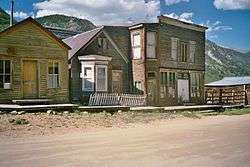
St. Elmo Historic District |
|
September 17, 1979
(#79000577) |
Pitkin, Gunnison, 1st, Main, and Poplar Sts.
38°42′17″N 106°20′42″W / 38.704722°N 106.345°W / 38.704722; -106.345 (St. Elmo Historic District) |
St. Elmo |
|
| 36 |
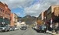
Salida Downtown Historic District |
|
June 14, 1984
(#84000800) |
Roughly bounded by the Arkansas River, railroad tracks, 3rd and D Sts.
38°32′08″N 105°59′26″W / 38.535556°N 105.990556°W / 38.535556; -105.990556 (Salida Downtown Historic District) |
Salida |
|
| 37 |
Salida Livestock Commission Company |
|
July 27, 2015
(#15000465) |
5005 E. U.S. Route 50
38°30′44″N 105°58′16″W / 38.5121°N 105.9711°W / 38.5121; -105.9711 (Salida Livestock Commission Company) |
Salida |
|
| 38 |
Smith-Friskey Ranch |
|
March 27, 2017
(#100000786) |
County Road 339, 0.5 miles west of the road
38°48′54″N 106°11′03″W / 38.815085°N 106.184223°W / 38.815085; -106.184223 (Smith-Friskey Ranch) |
Buena Vista |
|
| 39 |
Valley View School |
|
October 12, 2003
(#03001006) |
8465 County Road 140
38°32′09″N 106°02′33″W / 38.535833°N 106.0425°W / 38.535833; -106.0425 (Valley View School) |
Salida |
|
| 40 |
Vicksburg Mining Camp |
|
March 8, 1977
(#77000364) |
15 miles northwest of Buena Vista on Forest Service Route 390
38°59′55″N 106°22′34″W / 38.9986°N 106.3761°W / 38.9986; -106.3761 (Vicksburg Mining Camp) |
Granite |
Remnants of a 19th century mining community (population c. 800). |
| 41 |
Winfield Mining Camp |
|
March 10, 1980
(#80000883) |
19 miles northwest of Buena Vista on Forest Service Route 390
38°59′08″N 106°26′24″W / 38.9856°N 106.44°W / 38.9856; -106.44 (Winfield Mining Camp) |
Granite |
Remnants of a 19th century mining community (population c. 1500). |
.JPG)

.JPG)
.JPG)
_vicinity_(Chaffee_County%2C_Colorado).jpg)