| [3] |
Name on the Register[4] |
Image |
Date listed[5] |
Location |
City or town |
Description |
|---|
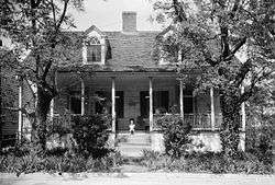
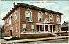
| 1 |
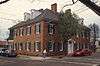
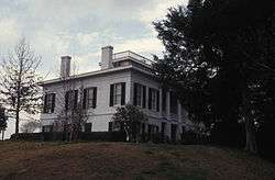
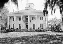
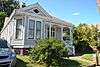
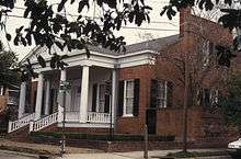
William Ailes House |
|
March 12, 1980
(#80002190) |
657 S. Canal St.
31°33′08″N 91°24′40″W / 31.552222°N 91.411111°W / 31.552222; -91.411111 (William Ailes House) |
Natchez |
|
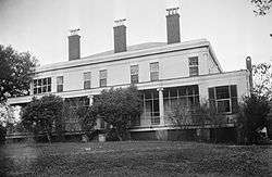
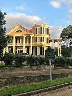
| 2 |
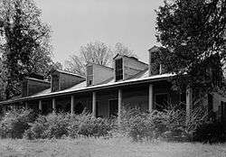
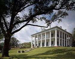
Airlie |
|
October 29, 1982
(#82000566) |
9 Elm St.
31°34′09″N 91°23′40″W / 31.569167°N 91.394444°W / 31.569167; -91.394444 (Airlie) |
Natchez |
|
| 3 |
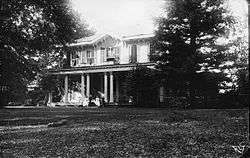
Anna Site |
|
September 14, 1993
(#93001606) |
10 miles (16 km) north of Natchez
31°41′43″N 91°20′59″W / 31.69538°N 91.34977°W / 31.69538; -91.34977 (Anna Site) |
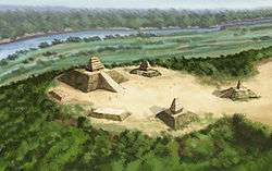
Natchez |
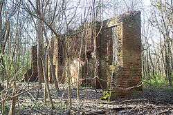
A Plaquemine culture archeological site that is a U.S. National Historic Landmark |
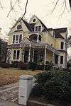
| 4 |
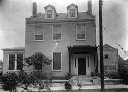
Arlington |
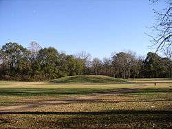
|
December 12, 1973
(#73000999) |
Main St.
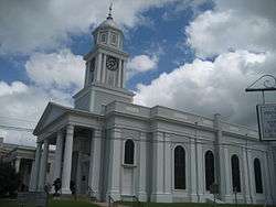
31°33′10″N 91°23′33″W / 31.552778°N 91.3925°W / 31.552778; -91.3925 (Arlington) |
Natchez |
|
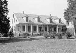
| 5 |
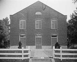
Assembly Hall |
|
April 19, 1978
(#78001587) |
Assembly and Main Sts.
31°34′44″N 91°17′54″W / 31.578889°N 91.298333°W / 31.578889; -91.298333 (Assembly Hall) |
Washington |
|
| 6 |
Auburn |
|
May 30, 1974
(#74001047) |
Duncan Park
31°32′42″N 91°23′33″W / 31.545°N 91.3925°W / 31.545; -91.3925 (Auburn) |
Natchez |
|
| 7 |
John Baynton House |
|
October 16, 1974
(#74001048) |
821 Main St.
31°33′24″N 91°23′53″W / 31.556667°N 91.398056°W / 31.556667; -91.398056 (John Baynton House) |
Natchez |
|
| 8 |
Bedford Plantation |
|
November 16, 1978
(#78001576) |
Northeast of Natchez off U.S. Route 61
31°37′00″N 91°11′52″W / 31.616667°N 91.197778°W / 31.616667; -91.197778 (Bedford Plantation) |
Natchez |
|
| 9 |
Beechland |
|
November 4, 1982
(#82000567) |
South of Natchez off U.S. Route 61
31°23′41″N 91°19′11″W / 31.394722°N 91.319722°W / 31.394722; -91.319722 (Beechland) |
Natchez |
|
| 10 |
Belvidere |
|
April 8, 1980
(#80002191) |
70 Homochitto St.
31°33′03″N 91°24′01″W / 31.550833°N 91.400278°W / 31.550833; -91.400278 (Belvidere) |
Natchez |
|
| 11 |
Brandon Hall |
|
June 12, 1980
(#80002198) |
Northeast of Washington on U.S. Route 61
31°36′53″N 91°15′10″W / 31.614722°N 91.252778°W / 31.614722; -91.252778 (Brandon Hall) |
Washington |
|
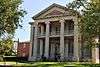
| 12 |
Gerard Brandon IV House |
|
March 19, 1982
(#82003094) |
708 N Union St.
31°33′53″N 91°23′48″W / 31.564722°N 91.396667°W / 31.564722; -91.396667 (Gerard Brandon IV House) |
Natchez |
|
| 13 |
Briars |
|
August 24, 1977
(#77000778) |
Southwest of Natchez
31°33′06″N 91°25′10″W / 31.551667°N 91.419444°W / 31.551667; -91.419444 (Briars) |
Natchez |
|
| 14 |
Brumfield High School |
|
October 21, 1993
(#93001139) |
100 St. Catherine St.
31°33′26″N 91°23′33″W / 31.557222°N 91.3925°W / 31.557222; -91.3925 (Brumfield High School) |
Natchez |
|
| 15 |
Buie House |
|
July 13, 1983
(#83000948) |
Northeast of Natchez
31°38′06″N 91°16′13″W / 31.635°N 91.270278°W / 31.635; -91.270278 (Buie House) |
Natchez |
|
| 16 |
The Burn |
|
July 3, 1979
(#79001280) |
307 Oak St.
31°33′55″N 91°23′46″W / 31.565278°N 91.396111°W / 31.565278; -91.396111 (The Burn) |
Natchez |
|
| 17 |
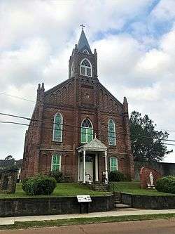
Carmel Presbyterian Church |
|
October 31, 1985
(#85003441) |
Carmel Church Rd.
31°25′53″N 91°19′34″W / 31.431389°N 91.326111°W / 31.431389; -91.326111 (Carmel Presbyterian Church) |
Natchez |
|
| 18 |
Cedar Grove |
|
March 19, 1982
(#82003088) |
Southeast of Natchez
31°25′44″N 91°17′42″W / 31.428889°N 91.295°W / 31.428889; -91.295 (Cedar Grove) |
Natchez |
|
| 19 |
Cemetery Bluff District |
|
October 24, 1980
(#80002192) |
Cemetery Rd.
31°34′37″N 91°23′39″W / 31.576944°N 91.394167°W / 31.576944; -91.394167 (Cemetery Bluff District) |
Natchez |
|
| 20 |
Cherry Grove Plantation |
|
March 31, 1983
(#83000949) |
South of Natchez off Kingston Rd.
31°27′55″N 91°21′03″W / 31.465278°N 91.350833°W / 31.465278; -91.350833 (Cherry Grove Plantation) |
Natchez |
|
| 21 |
China Grove Plantation |
|
April 7, 1982
(#82003089) |
South of Natchez
31°24′54″N 91°22′49″W / 31.415°N 91.380278°W / 31.415; -91.380278 (China Grove Plantation) |
Natchez |
|
| 22 |
Cliffs Plantation |
|
September 18, 1980
(#80002193) |
South of Natchez
31°27′39″N 91°24′56″W / 31.460833°N 91.415556°W / 31.460833; -91.415556 (Cliffs Plantation) |
Natchez |
|
| 23 |
Clifton Heights Historic District |
|
November 12, 1982
(#82000568) |
Roughly bounded by Ridge and Mulberry Alley, Natchez Bluff, Park Ave., and Maple St.
31°34′07″N 91°24′00″W / 31.568611°N 91.4°W / 31.568611; -91.4 (Clifton Heights Historic District) |
Natchez |
|
| 24 |
Commercial Bank and Banker's House |
|
May 30, 1974
(#74002252) |
206 Main St. and 107 Canal St.
31°33′39″N 91°24′18″W / 31.560833°N 91.405°W / 31.560833; -91.405 (Commercial Bank and Banker's House) |
Natchez |
|
| 25 |
Cottage Gardens |
|
July 5, 1979
(#79001281) |
816 Myrtle Ave.
31°34′08″N 91°23′43″W / 31.568889°N 91.395278°W / 31.568889; -91.395278 (Cottage Gardens) |
Natchez |
|
| 26 |
D'Evereux |
|
January 13, 1972
(#72000683) |
D'Evereaux Dr.
31°33′20″N 91°22′40″W / 31.555556°N 91.377778°W / 31.555556; -91.377778 (D'Evereux) |
Natchez |
|
| 27 |
John Dicks House |
|
March 25, 1982
(#82003090) |
802 N. Union St.
31°33′57″N 91°23′41″W / 31.565833°N 91.394722°W / 31.565833; -91.394722 (John Dicks House) |
Natchez |
|
| 28 |
Dixon Building |
|
May 30, 1979
(#79001282) |
514 Main St.
31°33′33″N 91°24′08″W / 31.559167°N 91.402222°W / 31.559167; -91.402222 (Dixon Building) |
Natchez |
|
| 29 |
Downriver Residential Historic District |
|
March 25, 1999
(#99000385) |
Roughly bounded by S. Canal St., Orleans St., the Illinois Central railroad tracks, and the bayou between Union and Rankin Sts.
31°33′18″N 91°24′25″W / 31.555°N 91.406944°W / 31.555; -91.406944 (Downriver Residential Historic District) |
Natchez |
|
| 30 |
Dr. Charles H. Dubs Townhouse |
|
May 5, 1978
(#78001577) |
311 N. Pearl St.
31°33′44″N 91°24′02″W / 31.562222°N 91.400556°W / 31.562222; -91.400556 (Dr. Charles H. Dubs Townhouse) |
Natchez |
|
| 31 |
Dunleith |
|
September 14, 1972
(#72000684) |
84 Homochitto St.
31°32′52″N 91°24′03″W / 31.547778°N 91.400833°W / 31.547778; -91.400833 (Dunleith) |
Natchez |
|
| 32 |
Edgewood |
|
March 30, 1979
(#79001283) |
North of Natchez on Mississippi Highway 554
31°38′01″N 91°20′18″W / 31.633611°N 91.338333°W / 31.633611; -91.338333 (Edgewood) |
Natchez |
|
| 33 |
Elgin |
|
January 19, 1979
(#79001284) |
South of Natchez off U.S. Route 61
31°29′01″N 91°22′56″W / 31.483611°N 91.382222°W / 31.483611; -91.382222 (Elgin) |
Natchez |
|
| 34 |
Elizabeth Female Academy Site (No. 101-3X) |
|
May 6, 1977
(#77000109) |
East of Natchez on U.S. Routes 84/98
31°34′30″N 91°17′36″W / 31.575°N 91.293333°W / 31.575; -91.293333 (Elizabeth Female Academy Site (No. 101-3X)) |
Natchez |
Ruins of the defunct Elizabeth Female Academy. |
| 35 |
Elms Court |
|
December 2, 1977
(#77000780) |
42 John R. Junkin Dr.
31°31′52″N 91°23′42″W / 31.531111°N 91.395°W / 31.531111; -91.395 (Elms Court) |
Natchez |
|
| 36 |
The Elms |
|
November 7, 1976
(#76001083) |
215 S. Pine St.
31°33′20″N 91°23′48″W / 31.555556°N 91.396667°W / 31.555556; -91.396667 (The Elms) |
Natchez |
|
| 37 |
Emerald Mound Site (22AD504) |
|
November 18, 1988
(#88002618) |
10 miles northeast of Natchez, off the Natchez Trace Parkway[6]
31°38′10″N 91°14′50″W / 31.636111°N 91.247222°W / 31.636111; -91.247222 (Emerald Mound Site (22AD504)) |
Stanton |
|
| 38 |
Eola Hotel |
|
January 11, 1979
(#79001285) |
Main and Pearl Sts.
31°33′38″N 91°24′11″W / 31.560556°N 91.403056°W / 31.560556; -91.403056 (Eola Hotel) |
Natchez |
|
| 39 |
Fair Oaks |
|
November 13, 1976
(#76001084) |
South of Natchez on U.S. Route 61
31°27′00″N 91°23′03″W / 31.45°N 91.384167°W / 31.45; -91.384167 (Fair Oaks) |
Natchez |
|
| 40 |
Fairchild's Creek Bridge |
|
June 8, 2005
(#05000562) |
County Road 555
31°43′31″N 91°18′49″W / 31.725278°N 91.313611°W / 31.725278; -91.313611 (Fairchild's Creek Bridge) |
Natchez |
|
| 41 |
First Presbyterian Church of Natchez |
|
December 22, 1978
(#78001578) |
117 S. Pearl St.
31°33′32″N 91°24′13″W / 31.558889°N 91.403611°W / 31.558889; -91.403611 (First Presbyterian Church of Natchez) |
Natchez |
|
| 42 |
Fort Dearborn Site |
|
September 17, 1974
(#74001054) |
North of Washington off U.S. Route 61
31°35′14″N 91°17′40″W / 31.587222°N 91.294444°W / 31.587222; -91.294444 (Fort Dearborn Site) |
Washington |
|
| 43 |
Foster's Mound |
|
September 2, 1982
(#82003091) |
Northeast of Natchez off U.S. Route 61
31°35′58″N 91°19′39″W / 31.599444°N 91.3275°W / 31.599444; -91.3275 (Foster's Mound) |
Natchez |
|
| 44 |
Glen Aubin |
|
August 29, 1985
(#85001930) |
Off U.S. Route 61
31°23′04″N 91°26′12″W / 31.384444°N 91.436667°W / 31.384444; -91.436667 (Glen Aubin) |
Natchez |
|
| 45 |
Glen Mary Plantation and Tenant House |
|
July 6, 1979
(#79003380) |
Foster Mound Rd.
31°35′41″N 91°19′38″W / 31.594722°N 91.327222°W / 31.594722; -91.327222 (Glen Mary Plantation and Tenant House) |
Natchez |
|
| 46 |
Glenburnie |
|
December 19, 1978
(#78001579) |
551 John R. Junkin Dr.
31°32′08″N 91°23′33″W / 31.535556°N 91.3925°W / 31.535556; -91.3925 (Glenburnie) |
Natchez |
|
| 47 |
Glencannon |
|
February 8, 1990
(#89002322) |
Junction of Providence Rd. and Gov. Fleet Rd.
31°32′30″N 91°25′00″W / 31.541667°N 91.416667°W / 31.541667; -91.416667 (Glencannon) |
Natchez |
Also known as Glencannon |
| 48 |
Gloucester |
|
November 7, 1976
(#76001085) |
South of Natchez on Lower Woodville Rd.
31°31′54″N 91°24′07″W / 31.531667°N 91.401944°W / 31.531667; -91.401944 (Gloucester) |
Natchez |
|
| 49 |
Grand Village of the Natchez Indians |
|
October 15, 1966
(#66000408) |
3 miles southeast of Natchez
31°31′25″N 91°22′46″W / 31.523597°N 91.379428°W / 31.523597; -91.379428 (Grand Village of the Natchez Indians) |
Natchez |
|
| 50 |
Hawthorne Place |
|
July 3, 1979
(#79001286) |
Lower Woodville Rd.
31°32′18″N 91°24′04″W / 31.538333°N 91.401111°W / 31.538333; -91.401111 (Hawthorne Place) |
Natchez |
|
| 51 |
Wharlest and Exerlena Jackson House |
|
June 5, 2017
(#100001027) |
13 Matthews St.
31°34′05″N 91°23′22″W / 31.568169°N 91.389434°W / 31.568169; -91.389434 (Wharlest and Exerlena Jackson House) |
Natchez |
|
| 52 |
Henderson-Britton House |
|
June 9, 1978
(#78001580) |
215 S. Pearl St.
31°33′30″N 91°24′15″W / 31.558333°N 91.404167°W / 31.558333; -91.404167 (Henderson-Britton House) |
Natchez |
|
| 53 |
Hillside |
|
September 15, 1987
(#87000617) |
Hutchins Landing Rd.
31°29′47″N 91°16′54″W / 31.496389°N 91.281667°W / 31.496389; -91.281667 (Hillside) |
Natchez |
|
| 54 |
Holy Family Catholic Church Historic District |
|
July 14, 1995
(#95000855) |
Roughly along Aldrich, Old D'Evereux, St. Catherine, Abbott, and Byrne Sts.
31°33′34″N 91°23′46″W / 31.559444°N 91.396111°W / 31.559444; -91.396111 (Holy Family Catholic Church Historic District) |
Natchez |
|
| 55 |
Hope Farm |
|
August 22, 1975
(#75001037) |
147 Homochitto St.
31°32′42″N 91°23′48″W / 31.545°N 91.396667°W / 31.545; -91.396667 (Hope Farm) |
Natchez |
|
| 56 |
House on Ellicott's Hill |
|
May 30, 1974
(#74001050) |
N. Canal and Jefferson Sts.
31°33′45″N 91°24′13″W / 31.5625°N 91.403611°W / 31.5625; -91.403611 (House on Ellicott's Hill) |
Natchez |
|
| 57 |
Institute Hall |
|
June 20, 1979
(#79001287) |
111 S. Pearl St.
31°33′34″N 91°24′12″W / 31.559444°N 91.403333°W / 31.559444; -91.403333 (Institute Hall) |
Natchez |
|
| 58 |
Jefferson College |
|
August 25, 1970
(#70000316) |
North St.
31°34′52″N 91°18′01″W / 31.58111°N 91.30025°W / 31.58111; -91.30025 (Jefferson College) |
Washington |
|
| 59 |
William Johnson House |
|
June 16, 1976
(#76001086) |
210 State St.
31°33′34″N 91°23′29″W / 31.559444°N 91.391389°W / 31.559444; -91.391389 (William Johnson House) |
Natchez |
|
| 60 |
Keyhole House |
|
March 25, 1982
(#82003092) |
1016 Main St.
31°33′43″N 91°23′46″W / 31.561944°N 91.396111°W / 31.561944; -91.396111 (Keyhole House) |
Natchez |
|
| 61 |
King's Tavern |
|
May 6, 1971
(#71000444) |
611 Jefferson St.
31°33′38″N 91°23′57″W / 31.560556°N 91.399167°W / 31.560556; -91.399167 (King's Tavern) |
Natchez |
|
| 62 |
Kingston Methodist Church |
|
May 13, 1982
(#82003093) |
Southeast of Natchez
31°23′21″N 91°16′43″W / 31.389167°N 91.278611°W / 31.389167; -91.278611 (Kingston Methodist Church) |
Natchez |
|
| 63 |
Koontz House |
|
March 29, 1979
(#79001288) |
303 S. Rankin St.
31°33′21″N 91°24′07″W / 31.555833°N 91.401944°W / 31.555833; -91.401944 (Koontz House) |
Natchez |
|
| 64 |
Lansdowne |
|
July 24, 1978
(#78001581) |
North of Natchez on Pine Ridge Rd.
31°35′04″N 91°21′47″W / 31.584444°N 91.363056°W / 31.584444; -91.363056 (Lansdowne) |
Natchez |
|
| 65 |
Laurel Hill Plantation |
|
October 26, 1982
(#82000569) |
South of Natchez off U.S. Route 61
31°25′20″N 91°24′35″W / 31.422222°N 91.409722°W / 31.422222; -91.409722 (Laurel Hill Plantation) |
Natchez |
|
| 66 |
Linden |
|
September 1, 1978
(#78001582) |
1 Linden Pl.
31°33′04″N 91°23′01″W / 31.551111°N 91.383611°W / 31.551111; -91.383611 (Linden) |
Natchez |
|
| 67 |
Lisle-Shields Town House |
|
March 29, 1979
(#79001289) |
701 N. Union St.
31°33′50″N 91°23′47″W / 31.563889°N 91.396389°W / 31.563889; -91.396389 (Lisle-Shields Town House) |
Natchez |
|
| 68 |
Longwood |
|
December 16, 1969
(#69000079) |
1.5 miles southeast of Natchez
31°32′12″N 91°24′17″W / 31.536667°N 91.404722°W / 31.536667; -91.404722 (Longwood) |
Natchez |
Octagonal, unfinished antebellum mansion, known also as Nutt's Folly |
| 69 |
Magnolia Hill |
|
March 30, 1979
(#79001290) |
Southeast of Natchez
31°26′40″N 91°16′40″W / 31.444444°N 91.277778°W / 31.444444; -91.277778 (Magnolia Hill) |
Natchez |
|
| 70 |
The Manse |
|
March 7, 1979
(#79001291) |
307 S. Rankin St.
31°33′20″N 91°24′09″W / 31.555556°N 91.4025°W / 31.555556; -91.4025 (The Manse) |
Natchez |
|
| 71 |
Mazique Archeological Site |
|
October 23, 1991
(#91001529) |
Address Restricted
|
Natchez |
|
| 72 |
Meadvilla |
|
November 17, 1982
(#82000570) |
Address Restricted
|
Washington |
|
| 73 |
Melrose |
|
May 30, 1974
(#74002253) |
Melrose Ave.
31°32′32″N 91°22′56″W / 31.542222°N 91.382222°W / 31.542222; -91.382222 (Melrose) |
Natchez |
|
| 74 |
Mercer House |
|
August 9, 1979
(#79001292) |
118 S. Wall St.
31°33′37″N 91°24′18″W / 31.560278°N 91.405°W / 31.560278; -91.405 (Mercer House) |
Natchez |
|
| 75 |
Mistletoe |
|
October 10, 1973
(#73001000) |
Northeast of Natchez on Mississippi Highway 554
31°37′31″N 91°19′00″W / 31.625278°N 91.316667°W / 31.625278; -91.316667 (Mistletoe) |
Natchez |
|
| 76 |
Monmouth |
|
April 26, 1973
(#73001001) |
E. Franklin St. and Melrose Ave.
31°33′38″N 91°23′10″W / 31.560556°N 91.386111°W / 31.560556; -91.386111 (Monmouth) |
Natchez |
|
| 77 |
Montaigne |
|
December 11, 1974
(#74001052) |
Liberty Rd.
31°33′01″N 91°22′46″W / 31.550278°N 91.379444°W / 31.550278; -91.379444 (Montaigne) |
Natchez |
|
| 78 |
Montpellier |
|
December 18, 1979
(#79001293) |
Southeast of Natchez on Mississippi Highway 551
31°32′08″N 91°21′03″W / 31.535556°N 91.350833°W / 31.535556; -91.350833 (Montpellier) |
Natchez |
|
| 79 |
Mount Olive |
|
November 28, 1980
(#80002194) |
Northeast of Natchez
31°37′14″N 91°20′27″W / 31.620556°N 91.340833°W / 31.620556; -91.340833 (Mount Olive) |
Natchez |
|
| 80 |
Mount Repose |
|
June 19, 1979
(#79001294) |
North of Natchez on Mississippi Highway 555
31°38′12″N 91°20′40″W / 31.636667°N 91.344444°W / 31.636667; -91.344444 (Mount Repose) |
Natchez |
|
| 81 |
Myrtle Bank |
|
December 22, 1978
(#78001583) |
408 N. Pearl St.
31°33′48″N 91°24′02″W / 31.563333°N 91.400556°W / 31.563333; -91.400556 (Myrtle Bank) |
Natchez |
|
| 82 |
Natchez On-Top-of-the-Hill Historic District |
|
September 17, 1979
(#79003381) |
U.S. Routes 61, 84, and 98
31°33′34″N 91°24′09″W / 31.559444°N 91.4025°W / 31.559444; -91.4025 (Natchez On-Top-of-the-Hill Historic District) |
Natchez |
|
| 83 |
Natchez Bluffs and Under-the-Hill Historic District |
|
April 11, 1972
(#72000685) |
Bounded by S. Canal St., Broadway, and Mississippi River
31°33′32″N 91°25′36″W / 31.558889°N 91.426667°W / 31.558889; -91.426667 (Natchez Bluffs and Under-the-Hill Historic District) |
Natchez |
|
| 84 |
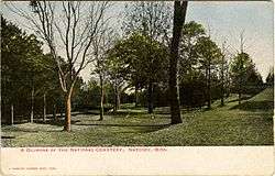
Natchez National Cemetery |
|
November 22, 1999
(#99001387) |
41 Cemetery Rd.
31°34′51″N 91°23′42″W / 31.580833°N 91.395°W / 31.580833; -91.395 (Natchez National Cemetery) |
Natchez |
|
| 85 |
Natchez National Historical Park |
|
October 7, 1988
(#01000276) |
PO Box 1208
31°32′36″N 91°22′59″W / 31.5433°N 91.3831°W / 31.5433; -91.3831 (Natchez National Historical Park) |
Natchez |
|
| 86 |
Neibert-Fisk House |
|
January 22, 1979
(#79001295) |
310 N. Wall St.
31°33′48″N 91°24′07″W / 31.563333°N 91.401944°W / 31.563333; -91.401944 (Neibert-Fisk House) |
Natchez |
|
| 87 |
Oakland |
|
October 21, 1976
(#76001087) |
9 Oakhurst Dr.
31°33′00″N 91°22′30″W / 31.55°N 91.375°W / 31.55; -91.375 (Oakland) |
Natchez |
|
| 88 |
Oakland |
|
June 29, 1989
(#89000781) |
Lower Woodville Rd.
31°24′42″N 91°24′21″W / 31.411667°N 91.405833°W / 31.411667; -91.405833 (Oakland) |
Natchez |
|
| 89 |
Oakwood |
|
May 9, 1985
(#85000968) |
Off Kingston Rd.
31°25′01″N 91°16′28″W / 31.416944°N 91.274444°W / 31.416944; -91.274444 (Oakwood) |
Natchez |
|
| 90 |
Charles Patterson House |
|
June 24, 1994
(#94000645) |
506 S. Union St.
31°33′17″N 91°24′20″W / 31.554722°N 91.405556°W / 31.554722; -91.405556 (Charles Patterson House) |
Natchez |
|
| 91 |
Pine Ridge Church |
|
December 13, 1979
(#79001296) |
Northeast of Natchez at Pine Ridge Rd. and Mississippi Highway 554
31°37′51″N 91°20′57″W / 31.630833°N 91.349167°W / 31.630833; -91.349167 (Pine Ridge Church) |
Natchez |
|
| 92 |
Pleasant Hill |
|
March 28, 1979
(#79001297) |
310 Pearl St.
31°33′28″N 91°24′20″W / 31.557778°N 91.405556°W / 31.557778; -91.405556 (Pleasant Hill) |
Natchez |
|
| 93 |
Prentiss Club |
|
April 17, 1979
(#79001298) |
Pearl and Jefferson Sts.
31°33′42″N 91°24′06″W / 31.561667°N 91.401667°W / 31.561667; -91.401667 (Prentiss Club) |
Natchez |
|
| 94 |
Ratcliffe Mound Site |
|
December 30, 2004
(#04001406) |
Address Restricted
|
Washington |
|
| 95 |
Ravenna |
|
November 4, 1982
(#82004975) |
601 S. Union St.
31°33′12″N 91°24′19″W / 31.553333°N 91.405278°W / 31.553333; -91.405278 (Ravenna) |
Natchez |
|
| 96 |
Ravennaside |
|
July 5, 1979
(#79001299) |
601 S. Union St.
31°32′47″N 91°24′33″W / 31.546389°N 91.409167°W / 31.546389; -91.409167 (Ravennaside) |
Natchez |
|
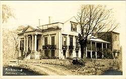
| 97 |
Richmond |
|
November 16, 1978
(#78001584) |
Government Fleet Rd.
31°32′47″N 91°24′33″W / 31.546389°N 91.409167°W / 31.546389; -91.409167 (Richmond) |
Natchez |
|
| 98 |
Roos House |
|
November 8, 1979
(#79001300) |
208 Linton Ave.
31°34′08″N 91°23′57″W / 31.568889°N 91.399167°W / 31.568889; -91.399167 (Roos House) |
Natchez |
|
| 99 |
Rosalie |
|
August 16, 1977
(#77000781) |
100 Orleans St.
31°33′32″N 91°24′30″W / 31.558889°N 91.408333°W / 31.558889; -91.408333 (Rosalie) |
Natchez |
|
| 100 |
Routhland |
|
August 22, 1977
(#77000782) |
92 Winchester Rd.
31°33′04″N 91°23′42″W / 31.551241°N 91.394970°W / 31.551241; -91.394970 (Routhland) |
Natchez |
|
| 101 |
Saragossa |
|
November 24, 1980
(#80002196) |
South of Natchez on Saragossa Rd.
31°29′30″N 91°24′06″W / 31.491667°N 91.401667°W / 31.491667; -91.401667 (Saragossa) |
Natchez |
|
| 102 |
Selma Plantation House |
|
June 15, 1989
(#89000207) |
467 Selma Rd.
31°36′01″N 91°16′12″W / 31.600278°N 91.27°W / 31.600278; -91.27 (Selma Plantation House) |
Natchez |
|
| 103 |
Shadyside |
|
March 29, 1979
(#79001301) |
107 Shadyside St.
31°33′49″N 91°23′27″W / 31.563611°N 91.390833°W / 31.563611; -91.390833 (Shadyside) |
Natchez |
|
| 104 |
Smart-Griffin House |
|
May 18, 1979
(#79001302) |
180 St. Catherine St.
31°33′22″N 91°23′15″W / 31.556111°N 91.3875°W / 31.556111; -91.3875 (Smart-Griffin House) |
Natchez |
|
| 105 |
Smith-Bontura-Evans House |
|
March 29, 1978
(#78001585) |
107 Broadway St.
31°33′40″N 91°24′22″W / 31.561111°N 91.406111°W / 31.561111; -91.406111 (Smith-Bontura-Evans House) |
Natchez |
|
| 106 |
Smithland |
|
April 2, 1987
(#87000575) |
1 mile south of Kingston-Hutchins Rd.
31°23′03″N 91°21′13″W / 31.384167°N 91.353611°W / 31.384167; -91.353611 (Smithland) |
Natchez |
|
| 107 |
Stanton Hall |
|
May 30, 1974
(#74002254) |
High St. between Pearl and Commerce Sts.
31°33′45″N 91°24′01″W / 31.5625°N 91.400278°W / 31.5625; -91.400278 (Stanton Hall) |
Natchez |
|
| 108 |
Texada Tavern |
|
April 17, 1979
(#79001303) |
222 S. Wall St.
31°33′23″N 91°24′06″W / 31.556389°N 91.401667°W / 31.556389; -91.401667 (Texada Tavern) |
Natchez |
|
| 109 |
Tillman House |
|
April 17, 1979
(#79001304) |
506 High St.
31°33′42″N 91°24′00″W / 31.561667°N 91.4°W / 31.561667; -91.4 (Tillman House) |
Natchez |
|
| 110 |
Traveller's Rest |
|
May 3, 1984
(#84002110) |
Address Restricted
|
Natchez |
|
| 111 |
Upriver Residential District |
|
December 1, 1983
(#83004371) |
Roughly bounded by Pine, Monroe, Elm-Bishop, and Ridge-Maple Sts.
31°34′00″N 91°23′49″W / 31.566667°N 91.396944°W / 31.566667; -91.396944 (Upriver Residential District) |
Natchez |
|
| 112 |
Van Court Town House |
|
July 9, 1980
(#80004474) |
510 Washington St.
31°33′25″N 91°24′28″W / 31.556944°N 91.407778°W / 31.556944; -91.407778 (Van Court Town House) |
Natchez |
|
| 113 |
Warren-Erwin House |
|
March 19, 1982
(#82003095) |
Palestine Rd.
31°33′26″N 91°17′53″W / 31.557222°N 91.298056°W / 31.557222; -91.298056 (Warren-Erwin House) |
Washington |
|
| 114 |
Washington Methodist Church |
|
September 4, 1986
(#86002168) |
Main and Church Sts.
31°34′41″N 91°18′08″W / 31.578056°N 91.302222°W / 31.578056; -91.302222 (Washington Methodist Church) |
Washington |
|
| 115 |
Weymouth Hall |
|
March 12, 1980
(#80002197) |
1 Cemetery Rd.
31°34′30″N 91°23′38″W / 31.575°N 91.393889°W / 31.575; -91.393889 (Weymouth Hall) |
Natchez |
|
| 116 |
White Cottage |
|
October 13, 1983
(#83003937) |
71 Homochitto St.
31°33′02″N 91°23′19″W / 31.550556°N 91.388611°W / 31.550556; -91.388611 (White Cottage) |
Natchez |
|
| 117 |
Winchester House |
|
January 31, 1979
(#79001305) |
816 Main St.
31°33′25″N 91°23′55″W / 31.556944°N 91.398611°W / 31.556944; -91.398611 (Winchester House) |
Natchez |
|
| 118 |
Woodlawn Historic District |
|
November 7, 1995
(#95001250) |
Roughly bounded by Martin Luther King St., E. Stiers and Old College Lns., and Elm and Bishop Sts.
31°34′03″N 91°23′24″W / 31.5675°N 91.39°W / 31.5675; -91.39 (Woodlawn Historic District) |
Natchez |
|
| 119 |
Woodstock |
|
June 29, 1989
(#89000782) |
Carmel Church Rd., 12 miles southeast of Natchez
31°25′33″N 91°19′30″W / 31.425833°N 91.325°W / 31.425833; -91.325 (Woodstock) |
Natchez |
|

.JPG)
.jpg)
.JPG)
.jpg)
.JPG)