Briers, Mississippi
| Briers | |
|---|---|
| Ghost town | |
 Briers | |
| Coordinates: 31°23′01″N 91°32′00″W / 31.38361°N 91.53333°WCoordinates: 31°23′01″N 91°32′00″W / 31.38361°N 91.53333°W | |
| Country | United States |
| State | Mississippi |
| County | Adams |
| Elevation | 62 ft (19 m) |
| Time zone | UTC-6 (Central (CST)) |
| • Summer (DST) | UTC-5 (CDT) |
| GNIS feature ID | 685916[1] |
Briers is a ghost town located in Adams County, Mississippi, United States.[1] Briar Landing (also Briers Landing)[2] was its port, located directly on the Mississippi River.
Briars had a post office from 1892 to 1923.[3][4]
Briars was located on a stretch of the river called "Deer Park Bend". In 1933, the U.S. Army Corps of Engineers constructed the "Glasscock Cutoff", which removed Briers from the contiguous flow of the Mississippi River.[5]
All that remains at the hamlet's former location is an abandoned landing strip for light aircraft.
References
- 1 2 U.S. Geological Survey Geographic Names Information System: Briers (historical)
- ↑ U.S. Geological Survey Geographic Names Information System: Briar Landing
- ↑ Rowland, Dunbar (1907). Mississippi: Comprising Sketches of Counties, Towns, Events, Institutions, and Persons, Arranged in Cyclopedic Form. 1. Southern Historical Publishing Association. p. 295.
- ↑ "Post Offices". Postalhistory.com. Retrieved December 15, 2017.
- ↑ Bragg, Marion (1977). "Historic Names and Places on the Lower Mississippi River" (PDF). Mississippi River Commission. Archived from the original (PDF) on 2013-02-24.
Municipalities and communities of Adams County, Mississippi, United States | ||
|---|---|---|
| Cities | 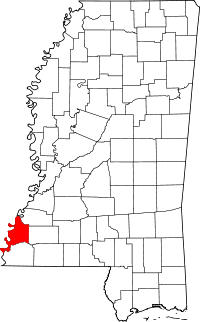 | |
| CDPs | ||
| Other unincorporated communities | ||
| Ghost towns | ||
This article is issued from
Wikipedia.
The text is licensed under Creative Commons - Attribution - Sharealike.
Additional terms may apply for the media files.