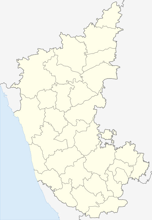
Naregal, Gadag
| Naregal, Gadag Naregal | |
|---|---|
| city | |
 Naregal, Gadag Location in Karnataka, India  Naregal, Gadag Naregal, Gadag (India) | |
| Coordinates: 15°35′N 75°49′E / 15.58°N 75.82°ECoordinates: 15°35′N 75°49′E / 15.58°N 75.82°E | |
| Country |
|
| State | Karnataka |
| District | Gadag |
| Elevation | 628 m (2,060 ft) |
| Population (2001) | |
| • Total | 16,652 |
| Languages | |
| • Official | Kannada |
| Time zone | UTC+5:30 (IST) |
| PIN | 582119 |
| Telephone code | 08381 |
Naregal is a panchayat town in Gadag district in the Indian state of Karnataka. It is about 27 kilometers from Gajendragad and 28 kilometers from Gadag.
History
Padmabbarasi basadi
Padmabbarasi basadi at Naregal[1][2][3][4] ,[5] Jaina temple (called Narayana temple) at Naregal in Ron taluk of Gadag District, North Karnataka, was built during the period of Krishna III, by Padmabbarasi, the queen of Ganga Permadi Bhutayya in 950 AD. It is the biggest Rashtrakuta temple in Karnataka,
About temple
Padmabbarasi basadi has a shikhara of Dravida vimana type over the garbhagriha. It is a trikuta. The main garbhagriha of this temple was meant for a Jina, and is square. The other two garbhagriha are rectangular, and have rectangular pedestals from wall to wall with twenty-four holes indicating that both of them were meant for establishing 24 Tirthankara sculptures. This is also a unique feature of this basadi. This became common in the 11th century.
Narayana Temple
Narayana temple is one of the attractions of Naregal. Narayana temple is the ancient temple built by Rashtrakutas in the 13th century.
Geography
Naregal is located at 15°35′N 75°49′E / 15.58°N 75.82°E.[6] It has an average elevation of 628 metres (2060 feet).
School and colleges
- S. A. College Naregal
- Shrii Annadhaneshwar Pre-University college Naregal.
- S A V Boy's High School
- S A V Girls High School
- School for hearing impaired
- Shree Basaveshwara Primary school Naregal
- SAVVP samiti C B S E school
- Syber Tech Computers Naregal
- SIAT Distance Education Center Naregal (Study Center: Syber Tech)
- Keonics Franchese Center Naregal (A Branch of Syber Tech Ron)
- Tally Academy Naregal (A Branch of Zero Gravity Computer Gajendragad)
- Om Shikshana Saumsthe Naregal
- Shree Mallikarjuna Shivacharya Shikshana samithi.Naregal
- SMBK Govt first grade college Naregal
- SKRK govt high school Naregal
- GOVT P U College Naregal
- PSS English Medium School, the only English medium school in Naregal
- KSS College Naregal.
- Vishwachetana high school Naregal
- Sri Kotturuswamy Industrial Training Center Naregal
Temples
- Shree Kalikadevi ( Devasthana ) Temple, Naregal
- Shree Kodikoppa Huchhirappajjanavara gadduge Kodikoppa
- Shree Annadaneshwar temple Naregal and Halakere
- Shree Veerabhadreshwar temple
- Shree Moolabrahmma Temple, Kodikoppa
- shree kalmeshwara tempel , naregal
- shree Tripurantakeshwara temal naregal
Demographics
As of 2001 India census,[7] Naregal had a population of 16,652. Males constitute 51% of the population and females 49%. Naregal has an average literacy rate of 61%, higher than the national average of 59.5%: male literacy is 73%, and female literacy is 49%. In Naregal, 13% of the population is under 6 years of age.
Transport
Naregal is well connected by road. State Highway passes through the city connecting to Gadag and Kushtagi. The nearest railway station to Naregal is Gadag.
See also
References
- ↑ "Jaina Monuments in North Karnataka". Dr. A. V. Narasimha Murthy. Archived from the original on 2008-03-23. Retrieved 2008-08-21.
- ↑ "A history of the Rastrakutas of Malkhed and Jainism". Dr. Hampa Nagarajaiah. Retrieved 2008-08-21.
- ↑ "Naregal". Retrieved 2008-08-21.
- ↑ "Naregal, BOMBAY-KARNATAKA INSCRIPTIONS". Retrieved 2008-08-21.
- ↑ "KOTUMACHAGI". Archived from the original on 2008-09-07. Retrieved 2008-08-21.
- ↑ Falling Rain Genomics, Inc - Naregal
- ↑ "Census of India 2001: Data from the 2001 Census, including cities, villages and towns (Provisional)". Census Commission of India. Archived from the original on 2004-06-16. Retrieved 2008-11-01.