Ron, Karnataka
| Rona | |
|---|---|
| Town | |
 Rona Location in Karnataka, India  Rona Rona (India) | |
| Coordinates: 15°40′N 75°44′E / 15.67°N 75.73°ECoordinates: 15°40′N 75°44′E / 15.67°N 75.73°E | |
| Country |
|
| State | Karnataka |
| District | Gadag |
| Lok Sabha Constituency | Haveri |
| Founded by |
Dronacharya . Instead of Dhronapura, established Ron |
| Elevation | 592 m (1,942 ft) |
| Population (2011)[1] | |
| • Total | 23,311 |
| Time zone | UTC+5:30 (IST) |
| PIN | 582 209 |
| ISO 3166 code | IN-KA |
| Vehicle registration | KA 26 |
Ron is a taluka headquarters in Gadag district, Karnataka in India. Of historical importance, the town was termed Dronapur in ancient times. The temples are believed to be constructed by the ancient architect and warrior-priest Dronacharya.[2]
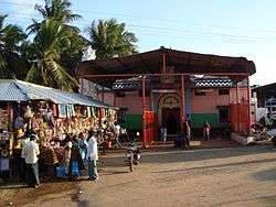
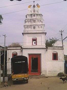
Historical monuments at Ron
There are many historic monuments in the town of Ron, including:
- Sadguru Siddharudha Swami Temple
- Anantashayana temple
- Ishvara temple near Anantashayana temple
- Ishvara Temple
- Kalla Gudi (stone temple) Ishwar Nagar
- Lokanatha Temple
- Mallikarjuna Temple
- Parshvanatha Jain Temple
- Somlingeshvara Temple near Tank
Tourism in Ron Taluka
- Siddharudha Swami temple - The famous temple/matha known as Siddharudha Matha at Ron. On the eve of Ramanavami the birth anniversary of Shri Siddharudha swami is celebrated by pulling the famous carved car of the temple. Annadana is performed for thousounds of devotees on this day. Seven days of saptaha is conducted at this famous temple.
Itagi Bhimambika Temple, near Gajendragad, Karnataka
- Itagi Bhimambika temple - The famous temple known as Itagi Bheemavva at Itagi, is about 13 km away from Kalkaleshwara temple Gajendragad. Hundreds and thousands of believers throng everyday to this place to get their wishes fulfilled by a female deity. They tie coconuts and wish for their desires to be fulfilled. There is a historical shiva temple.
- Sudi (ಸೂಡಿ),- is a panchayat town in the Gadag District of Karnataka, India. At one time it was a key town of the Kalyani Chalukyas during 1000 AD. It is famous for rare stone carved monuments like twin towered temple and large well built of stone and carvings, and few other structural temples. For long time these amazing structures were abandoned, but recently they caught the eye of the Indian Archeological Department.
- Belavanaki (ಬೆಳವಣಿಕಿ) - History of Belavanaki goes back to ancient time,According to the Ron inscription introduces the Ganga subordinate Mahamandalika Butayya as the governor of Gangavadi-96,000,Belvola-300, Puligere-300 provinces in Saka 864 (=A..D. 942) while his Kurtakoti inscription mentions the chief as holding charge of the same provinces in Saka 868 (=A.D. 946) therefore scriptures of Rastrakuta and Chalukyas of Kalyana dynasties shows the existence of this village goes back to ninth and 10th century and it is also ruled by Maratha king Shivaji and Peshwas of 17th and 18th century.This village name may be derived from old name of ‘Belavala-nadu 300’(Deccan Plains)or Belvola-300 means region consist of 300 villages and also mean fertile land. in Belavanaki the statue of Veerabadra is consider to be best kind sculpture in Karnataka, therefore it has mentioned in Dharwad District Gazetter(English-M R Palande.1959.Kannada-Suryanath Kamath.1995).It is also a birthplace of S. R. Hiremath social activist and Founder President of Samaja Parivarthana Samudaya,National Committee for Protection of Natural Resources and India Development Service.
Nearest Tourist places
Rayara Temple in Belavanaki
- Banashankari Temple is a Hindu temple located near Badami, in Bagalkot District, Karnataka, India. The temple is dedicated to the Shakambhari (also known as Banashankari Amma), an incarnation of the Goddess Parvati.
- Badami (ಬದಾಮಿ), formerly known as Vatapi, is a panchayat town in the Bagalkot District of Karnataka, India. It was the regal capital of the Badami Chalukyas from 540 to 757 AD. It is famous for rock cut and other structural temples. It is located in a ravine at the foot of a rugged, red sandstone outcrop that surrounds Agastya lake.
- Aihole (ಐಹೊಳೆ) is a town in the Bagalkot district of Karnataka, India. Early inscriptions call this town Ayyavole and Aryapura. Aihole has its own historical significance and is called as cradle of Hindu rock architecture. Many temples and caves of historical importance can be found at Aihole. It is a very popular tourist spot in north Karnataka.
- Pattadakal - World heritage site (ಪಟ್ಟದಕಲ್) is a town in the Indian state of Karnataka famous for its group of monuments that are the culmination of earliest experiments in the so-called vesara style of Hindu temple architecture. The temples were built in the 8th century CE. The uniqueness of this place derives from the presence of both the Dravidian architecture of the South and the Nagara or the Northern (Indo-Aryan) styles of temple architecture.
- Mahakuta Group of Temples is 16 km away from Badami is the archaeological site of Mahakoota where there are several temples from the Early Chalukya period.
Geography
Ron is located at 15°40′N 75°44′E / 15.67°N 75.73°E.[3] It has an average elevation of 592 metres (1,942 ft).
See also
References
- ↑ "Census of India Search details". censusindia.gov.in. Retrieved 10 May 2015.
- ↑ http://www.indiastudychannel.com/india/cities/32978-Ron.aspx
- ↑ Falling Rain Genomics, Inc - Ron
This article is issued from
Wikipedia.
The text is licensed under Creative Commons - Attribution - Sharealike.
Additional terms may apply for the media files.