Nam Từ Liêm
| South Từ Liêm District Quận Nam Từ Liêm | |
|---|---|
| Urban district | |
 A new urban township in Nam Từ Liêm | |
| Nickname(s): Mỹ Đình | |
| Country |
|
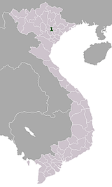
| Province | Hanoi |
| Number of wards | 10 |
| Seat | Cầu Diễn ward |
| Area | |
| • Total | 32.27 km2 (12.46 sq mi) |
| Population (2013) | |
| • Total | 232,894[1] |
| Time zone | UTC+7 (ICT) |
| Website | Official website (in Vietnamese) |
Nam Từ Liêm (South Từ Liêm) is an urban district (quận) of Hanoi, the capital city of Vietnam. It was formed on 27 December 2013, when the rural Từ Liêm District was split into two urban districts: Bắc Từ Liêm and Nam Từ Liêm.[1] Its population was 232,894 as of 2013.
The district is known for a large number of new urban developments and several skyscrapers. [2]
Geography
Nam Từ Liêm is bordered by Bắc Từ Liêm to the north, Cầu Giấy to the east, Thanh Xuân to the southeast, Hà Đông to the south and Hoài Đức to the west.
Administrative division
Nam Từ Liêm is divided into 10 wards (phường):[3]
Education
Transportation
- Mỹ Đình Bus Station - a major bus terminal in western Hanoi, with metropolitan buses and long distance buses to provinces North and Northwest of Hanoi[4]
Notable buildings
 AON Landmark 72, one of the highest buildings Vietnam


References
Districts of the Red River Delta | ||
|---|---|---|
| Hanoi city |  | |
| Haiphong city | ||
| Bắc Ninh Province | ||
| Hà Nam Province | ||
| Hải Dương Province | ||
| Hưng Yên Province | ||
| Nam Định Province | ||
| Ninh Bình Province | ||
| Thái Bình Province | ||
| Vĩnh Phúc Province |
| |
※ denotes provincial seat. | ||
This article is issued from
Wikipedia.
The text is licensed under Creative Commons - Attribution - Sharealike.
Additional terms may apply for the media files.