Nakhon Luang District
| Nakhon Luang นครหลวง | |
|---|---|
| District | |
 Famous Arunyik Knife Grandiosely Nakhonluang Castle Booming in industry And Agriculture Excellence Thai intellect | |
| Coordinates: 14°27′51″N 100°36′20″E / 14.46417°N 100.60556°ECoordinates: 14°27′51″N 100°36′20″E / 14.46417°N 100.60556°E | |
| Country | Thailand |
| Province | Ayutthaya |
| Seat | Nakhon Luang |
| Area | |
| • Total | 198.917 km2 (76.802 sq mi) |
| Population (2015) | |
| • Total | 36,705 |
| • Density | 166.9/km2 (432/sq mi) |
| Time zone | UTC+7 (ICT) |
| Postal code | 13260 |
| Geocode | 1403 |
Nakhon Luang (Thai: นครหลวง, pronounced [ná(ʔ).kʰɔ̄ːn lǔa̯ŋ]) is a district (amphoe) in the northeastern part of Ayutthaya Province, central Thailand.
History
The district was originally part of Nakhon Luang Noi District (now named Bang Pahan), and was established as a separate district in 1895.
In 1903 the district office was moved into Nakhon Luang Sub-district, and therefore the district was renamed from Nakhon Klang to Nakhon Luang.[1]
Geography
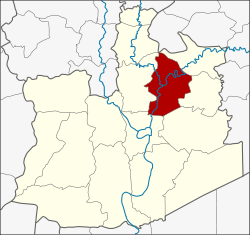
Neighboring districts are (from the north clockwise) Don Phut of Saraburi Province and Tha Ruea, Phachi, Uthai, Phra Nakhon Si Ayutthaya and Bang Pahan of Ayutthaya Province.
Administration
Central administration
Nakhon Luang is divided into 12 sub-districts (tambon), which are further subdivided into 74 administrative villages (muban).
| No. | Name | Thai | Villages | Pop.[2] |
|---|---|---|---|---|
| 1. | Nakhon Luang | นครหลวง | 9 | 4,644 |
| 2. | Tha Chang | ท่าช้าง | 8 | 4,544 |
| 3. | Bo Phong | บ่อโพง | 7 | 5,296 |
| 4. | Ban Chung | บ้านชุ้ง | 7 | 3,663 |
| 5. | Pak Chan | ปากจั่น | 6 | 3,447 |
| 6. | Bang Rakam | บางระกำ | 6 | 3,112 |
| 7. | Bang Phra Khru | บางพระครู | 4 | 2,243 |
| 8. | Mae La | แม่ลา | 6 | 1,984 |
| 9. | Nong Pling | หนองปลิง | 5 | 2,147 |
| 10. | Khlong Sakae | คลองสะแก | 5 | 2,236 |
| 11. | Sam Thai | สามไถ | 4 | 1,297 |
| 12. | Phra Non | พระนอน | 7 | 2,092 |
Local administration
There are two sub-district municipalities (thesaban tambon) in the district:
- Nakhon Luang (Thai: เทศบาลตำบลนครหลวง) consisting of the sub-district Nakhon Luang and parts of the sub-districts Bang Rakam and Bang Phra Khru.
- Aranyik (Thai: เทศบาลตำบลอรัญญิก) consisting of the sub-districts Tha Chang, Sam Thai, and Phra Non.
There are six sub-district administrative organizations (SAO) in the district:
- Bo Phong (Thai: องค์การบริหารส่วนตำบลบ่อโพง) consisting of the sub-district Bo Phong.
- Ban Chung (Thai: องค์การบริหารส่วนตำบลบ้านชุ้ง) consisting of the sub-district Ban Chung.
- Pak Chan (Thai: องค์การบริหารส่วนตำบลปากจั่น) consisting of the sub-district Pak Chan.
- Mae La (Thai: องค์การบริหารส่วนตำบลแม่ลา) consisting of the sub-district Mae La and parts of sub-districts Bang Rakam and Bang Phra Khru.
- Nong Pling (Thai: องค์การบริหารส่วนตำบลหนองปลิง) consisting of the sub-district Nong Pling.
- Khlong Sakae (Thai: องค์การบริหารส่วนตำบลคลองสะแก) consisting of the sub-district Khlong Sakae.
References
- ↑ แจ้งความกระทรวงมหาดไทย เรื่อง เปลี่ยนนามอำเภอนครกลาง เป็นอำเภอนครหลวง (PDF). Royal Gazette (in Thai). 20 (22): 352–353. 1903-08-30.
- ↑ "Population statistics 2014" (in Thai). Department of Provincial Administration. Retrieved 2015-09-29.
External links
- amphoe.com (Thai)