Na Yung District
| Na Yung นายูง | |
|---|---|
| Amphoe | |
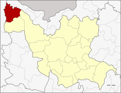 Amphoe location in Udon Thani Province | |
| Coordinates: 17°53′48″N 102°9′0″E / 17.89667°N 102.15000°ECoordinates: 17°53′48″N 102°9′0″E / 17.89667°N 102.15000°E | |
| Country | Thailand |
| Province | Udon Thani |
| Seat | Ban Kong |
| Area | |
| • Total | 524.0 km2 (202.3 sq mi) |
| Population (2005) | |
| • Total | 25,701 |
| • Density | 49.0/km2 (127/sq mi) |
| Time zone | UTC+7 (ICT) |
| Postal code | 41380 |
| Geocode | 4122 |
Na Yung (Thai: นายูง, pronounced [nāː jūːŋ]) is the northwesternmost district (amphoe) of Udon Thani Province, northeastern Thailand.
History
The area was separated from Nam Som District and created as a minor district (king amphoe) on 1 January 1988.[1] It was upgraded to a full district on 7 September 1995.[2]
Geography
Neighboring districts are (from the southeast clockwise) Ban Phue and Nam Som of Udon Thani Province, Pak Chom of Loei Province, Sangkhom and Pho Tak of Nong Khai Province.
Administration
The district is divided into four sub-districts (tambon), which are further subdivided into 40 villages (muban). There are no municipal (thesaban) areas, and four tambon administrative organizations (TAO).
| No. | Name | Thai name | Villages | Pop. | |
|---|---|---|---|---|---|
| 1. | Na Yung | นายูง | 10 | 7,602 | |
| 2. | Ban Kong | บ้านก้อง | 11 | 6,627 | |
| 3. | Na Khae | นาแค | 8 | 4,148 | |
| 4. | Non Thong | โนนทอง | 11 | 7,324 |
References
- ↑ ประกาศกระทรวงมหาดไทย เรื่อง แบ่งเขตท้องที่อำเภอน้ำโสม จังหวัดอุดรธานี ตั้งเป็นกิ่งอำเภอนายูง (PDF). Royal Gazette (in Thai). 105 (5 ง): 108. January 7, 1988.
- ↑ พระราชกฤษฎีกาตั้งอำเภอด่านมะขามเตี้ย อำเภอแก่งหางแมว อำเภอภักดีชุมพล อำเภอเวียงแก่น อำเภอแม่วาง อำเภอถ้ำพรรณรา อำเภอบ่อเกลือ อำเภอโนนสุวรรณ อำเภอห้วยราช อำเภอแม่ลาน อำเภอบางแก้ว อำเภอป่าพะยอม อำเภอหนองม่วงไข่ อำเภอยางสีสุราช อำเภอจังหาร อำเภอบ้านธิ อำเภอภูสิงห์ อำเภอบางกล่ำ อำเภอวังม่วง และอำเภอนายูง พ.ศ. ๒๕๓๘ (PDF). Royal Gazette (in Thai). 112 (32 ก): 1–3. August 8, 1995.
External links
This article is issued from
Wikipedia.
The text is licensed under Creative Commons - Attribution - Sharealike.
Additional terms may apply for the media files.