Mutěnice (Hodonín District)
- See other locations named Mutěnice.
| Mutěnice | |||
| Village | |||
 Mutěnice | |||
|
|||
| Country | Czech Republic | ||
|---|---|---|---|
| Region | South Moravian | ||
| District | Hodonín | ||
| Commune | Hodonín | ||
| Elevation | 183 m (600 ft) | ||
| Coordinates | 48°54′14″N 17°1′44″E / 48.90389°N 17.02889°ECoordinates: 48°54′14″N 17°1′44″E / 48.90389°N 17.02889°E | ||
| Area | 32.37 km2 (12.50 sq mi) | ||
| Population | 3,704 (2011) | ||
| Density | 114/km2 (295/sq mi) | ||
| Timezone | CET (UTC+1) | ||
| - summer (DST) | CEST (UTC+2) | ||
| Postal code | 696 11 | ||
  Location in the Czech Republic | |||
| Wikimedia Commons: Mutěnice | |||
| Website: www.mutenice.cz | |||


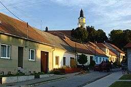
Mutěnice is a village in the South Moravian Region of the Czech Republic, with about 3,650 inhabitants.
External links
![]()
This article is issued from
Wikipedia.
The text is licensed under Creative Commons - Attribution - Sharealike.
Additional terms may apply for the media files.