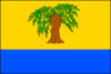
Hrubá Vrbka
| Hrubá Vrbka | |||
|---|---|---|---|
| Municipality | |||
.jpg) Protestant church | |||
| |||
 Hrubá Vrbka | |||
| Coordinates: 48°52′2″N 17°28′2″E / 48.86722°N 17.46722°ECoordinates: 48°52′2″N 17°28′2″E / 48.86722°N 17.46722°E | |||
| Country |
| ||
| Region | South Moravian | ||
| District | Hodonín | ||
| Area | |||
| • Total | 13.18 km2 (5.09 sq mi) | ||
| Elevation | 257 m (843 ft) | ||
| Population (2008) | |||
| • Total | 663 | ||
| • Density | 50/km2 (130/sq mi) | ||
| Postal code | 696 73 | ||
| Website | http://www.hrubavrbka.cz | ||
Hrubá Vrbka (German Gross Wrbka) is a village and municipality (obec) in Hodonín District in the South Moravian Region of the Czech Republic.
The municipality covers an area of 13.18 square kilometres (5.09 sq mi), and has a population of 663 (as at 1 January 2008).
Hrubá Vrbka, a part of traditional ethnographic region Horňácko, lies approximately 25 kilometres (16 mi) east of Hodonín, 73 km (45 mi) south-east of Brno, and 259 km (161 mi) south-east of Prague.
References
| Wikimedia Commons has media related to Hrubá Vrbka. |
This article is issued from
Wikipedia.
The text is licensed under Creative Commons - Attribution - Sharealike.
Additional terms may apply for the media files.