Kannur East
| Kannur East | |
|---|---|
| city | |
 Varam village | |
| Coordinates: 11°53′0″N 75°24′0″E / 11.88333°N 75.40000°ECoordinates: 11°53′0″N 75°24′0″E / 11.88333°N 75.40000°E | |
| Country |
|
| State | Kerala |
| District | Kannur |
| Area | |
| • Total | 11.57 km2 (4.47 sq mi) |
| Population (2001) | |
| • Total | 31,545 |
| • Density | 2,700/km2 (7,100/sq mi) |
| Languages | |
| • Official | Malayalam, English |
| Time zone | UTC+5:30 (IST) |
| ISO 3166 code | IN-KL |
.jpg)
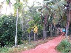
Edachovva Canal Road

Munderikkadavu Bird Sanctuary

Munderi Motta
Kannur East is suburb of Kannur city in Kerala, India.
Townships and villages
Important Landmarks
- Koodali Higher Secondary School
- CHMHSS Elayavoor
- Vivekananda Vidyalayam
- Regional Paultry farm or Central Hatchery
- Kadakkara Sri Dharmasastha kshetram
- Valannur Rishieswara Kshetram
- chelora someshwary kshetram
- Chelora Govt. Higher Secondary School
- Mini industrial estate, Chelora
- Mundayad indoor stadium
- Mundayad Juma Masjid
- Elayavoor Kshetram
- VARAM SREE VISWAKARMMA DHEVI KSHETRAM
Munderi Bird Sanctuary
Munderi Kavu bird sanctuary is famous for migratory birds. The area is rich in bio diversity and is waiting for getting developed as an Eco-tourism hot spot.[1]
Elayavoor
Elayavoor is an adjasent suburb to Kannur city.This place was formerly a village famous for its paddy field but due to fast urbanization most of the paddy fields have disappeared.
Location
Areas Of Kannur East | ||||||||||
|---|---|---|---|---|---|---|---|---|---|---|
| ||||||||||
References
| Wikimedia Commons has media related to Kannur East. |
This article is issued from
Wikipedia.
The text is licensed under Creative Commons - Attribution - Sharealike.
Additional terms may apply for the media files.