Mayyil
| Mayyil | |
|---|---|
| Town | |
| Coordinates: 12°02′N 75°28′E / 12.04°N 75.46°ECoordinates: 12°02′N 75°28′E / 12.04°N 75.46°E | |
| Country |
|
| State | Kerala |
| District | Kannur |
| Population (2001) | |
| • Total | 12,656 |
| Languages | |
| • Official | Malayalam, English |
| Time zone | UTC+5:30 (IST) |
| PIN | 670602 |
| ISO 3166 code | IN-KL |
Mayyil is a Grama Panchayat in Kannur District of Kerala State, established in 1962 by merging the villages of Kayaralam, Mayyil and Kandakkai. It belongs to Irikkur block and Taliparamba assembly constituency.
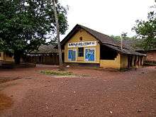
Educational institutions
- IMNS GHSS, Mayyil
- MAYYIL ALP School,Mayyil
- Institute of Technology,Mayyil
- ITM Arts & Science College, Mayyil
- Kayaralam AUP School
- Kayaralam North ALP School
- ITM Public School, Mayyil
- Mayyil Teacher Training Institute, Mayyil
- Mullakkodi AUP School, Arimbra, Mullakkodi
- Mullakkodi LP School, Mullakkodi
- Kandakkai K V A L P school,Kandakkai
- Kandakai LP School, Kandakai
- Thayampoyil ALP School, Thayampoyi
- Perumachery AUP school, Perumachery
- Pavannur ALP School, Pavannur
- Peruvangoor ALP Schoo , Peruvangoor
- Spangle Academy,Professional Training, Kambil
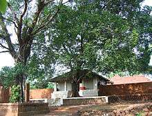
Temples
- Velam maha ganapathi temple
- Chekiyattu sree darmashata temple
- Chekiyattu sree maha vishnu temple
- Nechikottu kavu
- Chalagottu kavu
- Arimbra Subhramanya Temple
- Sree Puthiya Bhagavathi Kaavu, Kaavinmoola
- Kandanaar Poyil Sree Muchilott Bhagavathi Kshethram, Cherupazhassi
- Kadoor Sree Ganapathi Shethram,Kadoor
- udayam kottam shiva kshethram,kadoor ambalam
- Nambram Sree Muchilott Bhagavathi Kshethram ,Naniyoor Nambram
Transportation
The national highway passes through Valapattanam town. Goa and Mumbai can be accessed on the northern side and Cochin and Thiruvananthapuram can be accessed on the southern side. The road to the east of Iritty connects to Mysore and Bangalore. The nearest railway station is Kannur on Mangalore-Palakkad line. Trains are available to almost all parts of India subject to advance booking over the internet. There are airports at Mattanur, Mangalore and Calicut. All of them are international airports but direct flights are available only to Middle Eastern countries.
Nearby Villages
- Kuttiattoor,12,794 people
- Kayaralam. 16,208 people
- Kolacherry. 15,844 people
- Kayaralam
- Pavannur Motta
- Kadoor
- Valiyannur
- Nayattupara
- Kololam
- Kolachery
- Kambil
- Narath
- Kannadiparamba
- Perumachery
- Kottappoyil
- Peruvangoor
- Arakkavu
- Mullakkodi
- Arimbra
- Kattampally
- Maloth-Narath
- Pullooppi
- Therlai
- Koralai
- Peruvangoor
External links
| Wikimedia Commons has media related to Mayyil. |