Muhajbib
| Muhajbib محيبيب | |
|---|---|
| Village | |
 Muhajbib Location within Lebanon | |
| Coordinates: 33°09′17″N 35°30′20″E / 33.15472°N 35.50556°ECoordinates: 33°09′17″N 35°30′20″E / 33.15472°N 35.50556°E | |
| Grid position | 197/284 PAL |
| Country |
|
| Governorate | Nabatieh Governorate |
| District | Marjeyoun District |
| Time zone | UTC+2 (EET) |
| • Summer (DST) | UTC+3 (EEST) |
| Dialing code | +961 |
Muhajbib, Mhaibib, (Arabic: محيبيب) is a small village in the Marjeyoun District in southern Lebanon.
Name
E. H. Palmer wrote that the name Neby Muheibîb meant "the prophet Muheibîb", "beloved".[1]
History
In 1881, the Palestine Exploration Fund's Survey of Western Palestine (SWP) described Neby Muheibib as: "a small village round the stone Neby, containing about seventy Moslems, situated on top of ridge, with olives and arable land; there are two cisterns in the village."[2]
References
Bibliography
- Conder, C.R.; Kitchener, H.H. (1881). The Survey of Western Palestine: Memoirs of the Topography, Orography, Hydrography, and Archaeology. 1. London: Committee of the Palestine Exploration Fund.
- Palmer, E.H. (1881). The Survey of Western Palestine: Arabic and English Name Lists Collected During the Survey by Lieutenants Conder and Kitchener, R. E. Transliterated and Explained by E.H. Palmer. Committee of the Palestine Exploration Fund.
External links
- Survey of Western Palestine, Map 4: IAA, Wikimedia commons
| Capital | 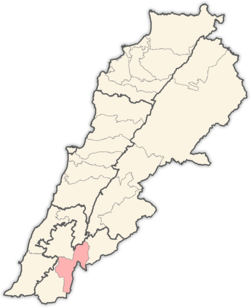 | |
|---|---|---|
| Towns and villages | ||
| Other | ||
This article is issued from
Wikipedia.
The text is licensed under Creative Commons - Attribution - Sharealike.
Additional terms may apply for the media files.