Blida, Lebanon
| Blida بليدا | |
|---|---|
| Village | |
 Blida's mosque after reconstructing 2013 | |
 Blida Location within Lebanon | |
| Coordinates: 33°08′0″N 35°31′0″E / 33.13333°N 35.51667°ECoordinates: 33°08′0″N 35°31′0″E / 33.13333°N 35.51667°E | |
| Grid position | 198/282 PAL |
| Country |
|
| Governorate | Nabatieh Governorate |
| District | Marjeyoun District |
| Elevation | 630 m (2,070 ft) |
| Time zone | UTC+2 (EET) |
| • Summer (DST) | UTC+3 (EEST) |
| Dialing code | +961 |
Blida ( بليدا) is a village Marjeyoun District in southern Lebanon.
Location
The municipality of Blida is located in the Kaza of Marjaayoun one of is one of the eight mohafazats (governorates) of Lebanon. Blida is 118 kilometers (73.3252 mi) away from Beyrouth (Beirut) the capital of Lebanon. Its elevation is 630 meters (2067.03 ft - 688.968 yd) above sea level. Blida surface stretches for 1330 hectares (13.3 km² - 5.1338 mi²) .
Name
E. H. Palmer wrote that the name Belidet meant "The little village".[1]
History
In 1881, the Palestine Exploration Fund's Survey of Western Palestine (SWP) described it as: "A village, built of stone, containing mosque, and having about 150 Moslem inhabitants, situated on a ridge, with figs, olives, and arable land. One cistern and a good spring one mile south-east of the village give the water supply."[2]
They further noted: "Here are several columns and remains of ruins. Double triangles are cut on either side of door of mosque."[3]
Educational Establishments
| Educational establishments | Blida (2005-2006) | Lebanon (2005-2006) |
|---|---|---|
| Number of Schools | 2 | 2788 |
| Public School | 2 | 1763 |
| Private School | 0 | 1025 |
| Students schooled in the public schools | 200 | 439905 |
| Students schooled in the private schools | Not available | 471409 |
References
Bibliography
- Conder, C.R.; Kitchener, H.H. (1881). The Survey of Western Palestine: Memoirs of the Topography, Orography, Hydrography, and Archaeology. 1. London: Committee of the Palestine Exploration Fund.
- Palmer, E.H. (1881). The Survey of Western Palestine: Arabic and English Name Lists Collected During the Survey by Lieutenants Conder and Kitchener, R. E. Transliterated and Explained by E.H. Palmer. Committee of the Palestine Exploration Fund.
External links
- Blida Localliban: Centre de resource sur le developpement local
- Survey of Western Palestine, Map 4: IAA, Wikimedia commons
| Capital | 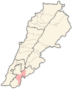 | |
|---|---|---|
| Towns and villages | ||
| Other | ||