Mueang Phitsanulok District
| Mueang Phitsanulok เมืองพิษณุโลก | |
|---|---|
| Amphoe | |
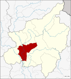 Amphoe location in Phitsanulok Province | |
| Coordinates: 16°49′29″N 100°15′34″E / 16.82472°N 100.25944°ECoordinates: 16°49′29″N 100°15′34″E / 16.82472°N 100.25944°E | |
| Country |
|
| Province | Phitsanulok |
| Seat | Nai Mueang |
| Area | |
| • Total | 750.810 km2 (289.889 sq mi) |
| Population (2005) | |
| • Total | 264,387 |
| • Density | 352.1/km2 (912/sq mi) |
| Time zone | UTC+7 (THA) |
| Postal code | 65000 |
| Geocode | 6501 |
Mueang Phitsanulok (Thai: เมืองพิษณุโลก, pronounced [mɯ̄a̯ŋ pʰít.sā.nú.lôːk]) is the capital district (amphoe mueang) of Phitsanulok Province, central Thailand.
History
Mueang Phitsanulok was the first class city in the northern part of Ayutthaya kingdom till the end of the kingdom in 1767. Also in the reign of King Taksin the Great, Phitsanulok was the first class city. In the Thesaphiban administrative reforms of King Chulalongkorn (Rama V) the city became the center of Monthon Phitsanulok. Also during these reforms the district was created in 1898. Luang Udom Khet Borihan became the first district head officer.
Geography
Neighboring districts are (from the north clockwise) Phrom Phiram, Wat Bot, Wang Thong, Bang Krathum and Bang Rakam of Phitsanulok Province.
For all practical purposes, Mueang Phitsanulok lies within the Nan Basin, although the district's western border with Amphoe Bang Rakam is essentially the booundary between the Nan Basin and the Yom Basin as well. The distinction between the basins is blurry in this region, as the terrain is flat, and residents have diverted much of the water flow for agriculture over the years. Both basins are part of the Chao Phraya Watershed. The important water resource is the Nan River, and the Khwae Noi River also flows through the district.
Administration
The district is subdivided into 20 subdistricts (tambon), which are further subdivided into 173 villages (muban). Phitsanulok is a city (thesaban nakhon) which covers the whole tambon Nai Mueang. The township (thesaban tambon) of Ban Mai covers parts of the tambon Wang Nam Khu and Wat Phrik. There are further 19 Tambon administrative organizations (TAO).
| No. | Name | Thai name | Villages | Inh. | |
|---|---|---|---|---|---|
| 1. | Nai Mueang | ในเมือง | - | 80,254 | |
| 2. | Wang Nam Khu | วังน้ำคู้ | 8 | 4,373 | |
| 3. | Wat Chan | วัดจันทร์ | 10 | 6,392 | |
| 4. | Wat Phrik | วัดพริก | 13 | 7,671 | |
| 5. | Tha Thong | ท่าทอง | 11 | 11,811 | |
| 6. | Tha Pho | ท่าโพธิ์ | 10 | 9,626 | |
| 7. | Samo Khae | สมอแข | 8 | 13,232 | |
| 8. | Don Thong | ดอนทอง | 14 | 12,456 | |
| 9. | Ban Pa | บ้านป่า | 10 | 5,600 | |
| 10. | Pak Thok | ปากโทก | 7 | 4,554 | |
| 11. | Hua Ro | หัวรอ | 12 | 17,732 | |
| 12. | Chom Thong | จอมทอง | 9 | 3,660 | |
| 13. | Ban Krang | บ้านกร่าง | 12 | 12,103 | |
| 14. | Ban Khlong | บ้านคลอง | 5 | 12,216 | |
| 15. | Phlai Chumphon | พลายชุมพล | 5 | 5,689 | |
| 16. | Makham Sung | มะขามสูง | 9 | 5,696 | |
| 17. | Aranyik | อรัญญิก | 7 | 29,327 | |
| 18. | Bueng Phra | บึงพระ | 10 | 14,563 | |
| 19. | Phai Kho Don | ไผ่ขอดอน | 6 | 4,071 | |
| 20. | Ngio Ngam | งิ้วงาม | 7 | 3,361 |
Infrastructure
Temples
Amphoe Mueang Phitsanulok is home to at least 105 active Buddhist temples.
Radio
There are 8 radio station broadcast from within the district:[1]
- Sathaanii Witthayu Krajaisiang Thahaan Aakaat (Air Force Radio Station), 954 AM and 95.75, in the City of Phitsanulok
- Sathaanii Witthayu Krajaisiang Haeng Pratheet Thai (Radio Thailand, Government Public Relations Department, PRD), 1026 AM and 94.25 FM, in Ban Khlong
- Kong Thap Phaak Thii Saam (3rd Army Area), 1116 AM and 1188 AM, in Aranyik
- Witthayu Kong Phon Thahaan Raap Thii Sii (4th Infantry Division), 1377 AM, at Fort Somdet Phra Naresuan Maharat
- Sathaanii Witthayu Phitaksantiraat (Communications Division, Royal Thai Police), 1422 AM, in Phitsanulok City
- Sathaanii Withayu Krom Utiniyom Witthayaa (Meteorological Department), 104.25 FM, in Tha Thong
- Ongkaan Suesaan Muanchon Haeng Pratheet Thai (Mass Communications Organization of Thailand, MCOT), 106.25 FM, in Bueng Phra
- Mahaawitthayalai Naresuan (Naresuan University), 107.25 FM, in Tha Pho
Flooding
In 2006, there were reported cases of leptospirosis among residents of Mueang Phitsanulok, contracted due to the amount of standing water.[2]
References
External links
- Amphoe.com (Thai)