Bang Rakam District
| Bang Rakam บางระกำ | |
|---|---|
| Amphoe | |
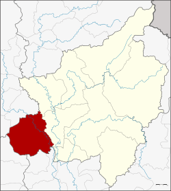 Amphoe location in Phitsanulok Province | |
| Coordinates: 16°45′30″N 100°7′5″E / 16.75833°N 100.11806°ECoordinates: 16°45′30″N 100°7′5″E / 16.75833°N 100.11806°E | |
| Country | Thailand |
| Province | Phitsanulok |
| Seat | Bang Rakam |
| Area | |
| • Total | 936.040 km2 (361.407 sq mi) |
| Population (2005) | |
| • Total | 94,854 |
| • Density | 101.3/km2 (262/sq mi) |
| Time zone | UTC+7 (ICT) |
| Postal code | 65140 |
| Geocode | 6504 |
Bang Rakam (Thai: บางระกำ, pronounced [bāːŋ rā.kām]) is a district (amphoe) in the western part of Phitsanulok Province, central Thailand.
History
The district was established on 10 December 1905, then named Chum Saeng (ชุมแสง) District. Khun Phadet Prachadun was the first district head officer. Later King Rama VI ordered the district name to be changed to be the same as the central tambon, thus the district name was changed to Bang Rakam on 24 April 1917.
Geography
Neighboring districts are (from the north clockwise) Phrom Phiram, Mueang Phitsanulok, and Bang Krathum of Phitsanulok Province, Sam Ngam and Wachirabarami of Phichit Province, Lan Krabue of Kamphaeng Phet Province, Khiri Mat and Kong Krailat of Sukhothai Province.
The district's chief water resources are the Yom River, and the secondary Khlong Bang Kaeo and Khlong Grung Grak. Bang Rakam lies within the Yom Basin, although the district's eastern border with Amphoe Mueang Phitsanulok is essentially the boundary between the Yom Basin and the Nan Basin. The distinction between the basins is blurry in this region, as the terrain is flat, and residents have diverted much of the water flow for agriculture over the years. Both basins are part of the Chao Phraya Watershed.
Administration
The district is divided into 11 sub-districts (tambon), which are further subdivided into 135 villages (muban). Bang Rakam and Plak Raet are townships (thesaban tambon), covering parts of the same-named tambon. There are a further 11 tambon administrative organizations (TAO).
| No. | Name | Thai name | Villages | Pop. | |
|---|---|---|---|---|---|
| 1. | Bang Rakam | บางระกำ | 17 | 17,728 | |
| 2. | Plak Raet | ปลักแรด | 10 | 8,329 | |
| 3. | Phan Sao | พันเสา | 11 | 6,108 | |
| 4. | Wang Ithok | วังอิทก | 10 | 4,652 | |
| 5. | Bueng Kok | บึงกอก | 11 | 9,688 | |
| 6. | Nong Kula | หนองกุลา | 21 | 14,273 | |
| 7. | Chum Saeng Songkhram | ชุมแสงสงคราม | 11 | 8,026 | |
| 8. | Nikhom Phatthana | นิคมพัฒนา | 12 | 8,936 | |
| 9. | Bo Thong | บ่อทอง | 10 | 4,321 | |
| 10. | Tha Nang Ngam | ท่านางงาม | 12 | 5,531 | |
| 11. | Khui Muang | คุยม่วง | 10 | 7,262 |
Significant settlements
Of the numerous villages that comprise Bang Rakam District, those significant in size as to occupy multiple muban are as follows:
- Ban Rai
- Ban Plak Raet
- Ban Phan Sao
- Ban Khlong Grap Phuang
Flooding
During the rainy season of 2006, 24,400 Bang Rakam residents were affected by flooding, including 1,122 residents who contracted conjunctivitis.[1] In late-September, 2006, Princess Siribha Chudhabhorn sent trucks of food from the Princess Pa Foundation to assist 11 of the district's villages.[1] In 2006, there were also reported cases of leptospirosis among residents of Bang Rakam, contracted due to the amount of standing water.[2]
Geology
The Thung Yai oil field is in Bang Rakam.[3]
References
- 1 2 "The Nation-Wet Season Woes". Archived from the original on 2007-10-17. Retrieved 2007-10-20.
- ↑ "Leptospirosis Kills 31 In Past Eight Months". The Nation. 2006-09-12. Retrieved 30 September 2017 – via Food and Drug Administration (FDA) Resource Center.
- ↑ "Environmental, Safety, and Occupational Health Impacts". Archived from the original on 2008-09-16. Retrieved 2007-10-20.
External links
- amphoe.com (Thai)