Mount Vernon Township, Jefferson County, Illinois
| Mount Vernon Township | |
|---|---|
| Township | |
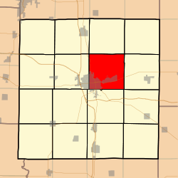 Location in Jefferson County | |
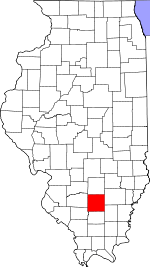 Jefferson County's location in Illinois | |
| Coordinates: 38°21′N 88°52′W / 38.350°N 88.867°WCoordinates: 38°21′N 88°52′W / 38.350°N 88.867°W | |
| Country | United States |
| State | Illinois |
| County | Jefferson |
| Area | |
| • Total | 37.21 sq mi (96.4 km2) |
| • Land | 36.95 sq mi (95.7 km2) |
| • Water | 0.26 sq mi (0.7 km2) 0.70% |
| Elevation | 528 ft (161 m) |
| Population (2010) | |
| • Estimate (2016)[1] | 13,216 |
| • Density | 362/sq mi (140/km2) |
| Time zone | UTC-6 (CST) |
| • Summer (DST) | UTC-5 (CDT) |
| ZIP codes | 62864, 62872 |
| FIPS code | 17-081-51193 |
Mount Vernon Township is one of sixteen townships in Jefferson County, Illinois, USA. As of the 2010 census, its population was 13,374 and it contained 6,422 housing units.[2]
Geography
According to the 2010 census, the township has a total area of 37.21 square miles (96.4 km2), of which 36.95 square miles (95.7 km2) (or 99.30%) is land and 0.26 square miles (0.67 km2) (or 0.70%) is water.[2] The township is centered at 38°21′N 88°52′W (38.349,-88.859). It is traversed north-south by State Route 37, east-west by State Route 15, and diagonally across its southwest corner by State Route 142.
Cities, towns, villages
Unincorporated towns
- Camp Ground at 38°20′20″N 88°50′10″W / 38.339°N 88.836°W
- Idlewood at 38°22′48″N 88°55′20″W / 38.380°N 88.9223°W
- Summersville at 38°19′41″N 88°52′01″W / 38.328°N 88.867°W
(This list is based on USGS data and may include former settlements.)
Adjacent townships
- Field Township (north)
- Farrington Township (northeast)
- Webber Township (east)
- Pendleton Township (southeast)
- Dodds Township (south)
- Shiloh Township (west)
- Rome Township (northwest)
Cemeteries
The township contains these nine cemeteries: Atkinson, East Salem, Etheridge Farm, Hopewell, Oakwood, Old Union, Saint Mary's, Sursa and Williams.
Major highways
Airports and landing strips
- Good Samaritan Regional Health Care Center Heliport
- Mount Vernon/Outland Airport
Demographics
| Historical population | |||
|---|---|---|---|
| Census | Pop. | %± | |
| Est. 2016 | 13,216 | [1] | |
| U.S. Decennial Census[3] | |||
Political districts
- Illinois' 19th congressional district
- State House District 107
- State Senate District 54
References
- "Mount Vernon Township, Jefferson County, Illinois". Geographic Names Information System. United States Geological Survey. Retrieved 2010-01-17.
- United States Census Bureau 2007 TIGER/Line Shapefiles
- United States National Atlas
- 1 2 "Population and Housing Unit Estimates". Retrieved June 9, 2017.
- 1 2 "Population, Housing Units, Area, and Density: 2010 - County -- County Subdivision and Place -- 2010 Census Summary File 1". United States Census. Retrieved 2013-05-28.
- ↑ "Census of Population and Housing". Census.gov. Retrieved June 4, 2016.
External links
Municipalities and communities of Jefferson County, Illinois, United States | ||
|---|---|---|
| Cities | ||
| Villages | ||
| Townships | ||
| CDP | ||
| Other unincorporated communities | ||
| Footnotes | ‡This populated place also has portions in an adjacent county or counties | |