Dodds Township, Jefferson County, Illinois
| Dodds Township | |
|---|---|
| Township | |
 Location in Jefferson County | |
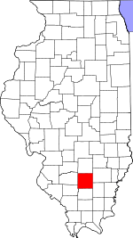 Jefferson County's location in Illinois | |
| Coordinates: 38°15′N 88°52′W / 38.250°N 88.867°WCoordinates: 38°15′N 88°52′W / 38.250°N 88.867°W | |
| Country | United States |
| State | Illinois |
| County | Jefferson |
| Area | |
| • Total | 36.96 sq mi (95.7 km2) |
| • Land | 36.77 sq mi (95.2 km2) |
| • Water | 0.2 sq mi (0.5 km2) 0.54% |
| Elevation | 440 ft (134 m) |
| Population (2010) | |
| • Estimate (2016)[1] | 2,604 |
| • Density | 72/sq mi (28/km2) |
| Time zone | UTC-6 (CST) |
| • Summer (DST) | UTC-5 (CDT) |
| ZIP codes | 62816, 62864, 62872 |
| FIPS code | 17-081-20227 |
Dodds Township is one of sixteen townships in Jefferson County, Illinois, USA. As of the 2010 census, its population was 2,647 and it contained 1,163 housing units.[2]
Dodds Township bears the name of James Dodds, a pioneer settler.[3]
Geography
According to the 2010 census, the township has a total area of 36.96 square miles (95.7 km2), of which 36.77 square miles (95.2 km2) (or 99.49%) is land and 0.2 square miles (0.52 km2) (or 0.54%) is water.[2] The township is centered at 38°15'N 88°52'W (38.255,-89.875). It is traversed north-south by Interstate Route 57 and State Route 37, east-west by Interstate 64 and also by portions of State Routes 142 and 148.
Cities, towns, villages
- Mount Vernon (south edge)
Unincorporated towns
- Bakerville at 38°15′29″N 88°53′53″W / 38.258°N 88.898°W
- Morganville at 38°16′48″N 88°54′07″W / 38.280°N 88.902°W
- Shirley at 38°17′06″N 88°50′17″W / 38.285°N 88.838°W
(This list is based on USGS data and may include former settlements.)
Adjacent townships
- Mt. Vernon Township (north)
- Pendleton Township (east)
- Moore's Prairie Township (southeast)
- Spring Garden Township (south)
- Elk Prairie Township (southwest)
- McClellan Township (west)
- Shiloh Township (northwest)
Cemeteries
The township contains these seven cemeteries: Arnold, Bethel Memorial, Cub Prairie, Hams Grove, Meddows, Old Orchard and Warren.
Major highways
Airports and landing strips
- Davy Jones Airport
Demographics
| Historical population | |||
|---|---|---|---|
| Census | Pop. | %± | |
| Est. 2016 | 2,604 | [1] | |
| U.S. Decennial Census[4] | |||
Political districts
- Illinois' 19th congressional district
- State House District 107
- State Senate District 54
References
- "Dodds Township, Jefferson County, Illinois". Geographic Names Information System. United States Geological Survey. Retrieved 2010-01-17.
- United States Census Bureau 2007 TIGER/Line Shapefiles
- United States National Atlas
- 1 2 "Population and Housing Unit Estimates". Retrieved June 9, 2017.
- 1 2 "Population, Housing Units, Area, and Density: 2010 - County -- County Subdivision and Place -- 2010 Census Summary File 1". United States Census. Retrieved 2013-05-28.
- ↑ Callary, Edward (29 September 2008). Place Names of Illinois. University of Illinois Press. p. 94. ISBN 978-0-252-09070-7.
- ↑ "Census of Population and Housing". Census.gov. Retrieved June 4, 2016.
External links
Municipalities and communities of Jefferson County, Illinois, United States | ||
|---|---|---|
| Cities | ||
| Villages | ||
| Townships | ||
| CDP | ||
| Other unincorporated communities | ||
| Footnotes | ‡This populated place also has portions in an adjacent county or counties | |