Mount Lymburner

Location of Sentinel Range in Western Antarctica.
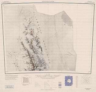
Northern Sentinel Range map.
Mount Lymburner (77°26′S 86°30′W / 77.433°S 86.500°WCoordinates: 77°26′S 86°30′W / 77.433°S 86.500°W) is a mountain, 1,940 metres (6,360 ft) high, standing 4 nautical miles (7 km) west-northwest of Mount Weems near the north end of the Sentinel Range in the Ellsworth Mountains of Antarctica. It was discovered by Lincoln Ellsworth on his trans-Antarctic flight of November 23, 1935, and was named by the Advisory Committee on Antarctic Names for J.H. Lymburner, an assistant pilot on Ellsworth's expedition.[1]
See also
References
- ↑ "Mount Lymburner". Geographic Names Information System. United States Geological Survey. Retrieved 2013-07-12.
![]()
| General |
| .svg.png) |
|---|---|---|
| Geographic regions | ||
| Waterways | ||
| Famous explorers | ||
This article is issued from
Wikipedia.
The text is licensed under Creative Commons - Attribution - Sharealike.
Additional terms may apply for the media files.