Mount Ellen (Vermont)
| Mount Ellen | |
|---|---|
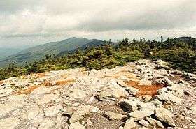 Mount Ellen seen from Mount Abraham | |
| Highest point | |
| Elevation | 4,083 ft (1,244 m) |
| Prominence | 2,132 ft (650 m) |
| Listing | New England 4000 footers |
| Coordinates | 44°9.59′N 72°55.73′W / 44.15983°N 72.92883°WCoordinates: 44°9.59′N 72°55.73′W / 44.15983°N 72.92883°W |
| Geography | |
| Location | Warren, Vermont, U.S. |
| Parent range | Green Mountains |
| Topo map | USGS Mount Ellen 1:24,000 |
| Climbing | |
| Easiest route | Maintained Hiking Trail: Long Trail |
Mount Ellen is a 4,083-foot (1,244 m) high mountain in Vermont. It is located in the Green Mountains in Washington County. Mount Ellen is flanked to the south by Cutts Peak (4,020 ft / 1,225 m), and to the north by Stark Mountain (3,662 ft / 1,116 m).
The area is often referred to as the Mad River Valley. Mount Ellen, together with Lincoln Peak, are home to the slopes of Sugarbush Resort. Located nearby is Mad River Glen ski area, famous for its historic single chairlift and focus on skiing.
The Long Trail, a 272-mile (438-km) hiking trail running the length of Vermont, traverses the summit ridge of Mount Ellen.
External links
- U.S. Geological Survey Geographic Names Information System: Mount Ellen
- Peakbagger,com: Mount Ellen
- Summitpost.org: Mount Ellen
This article is issued from
Wikipedia.
The text is licensed under Creative Commons - Attribution - Sharealike.
Additional terms may apply for the media files.