Mount Hale (New Hampshire)
| Mount Hale | |
|---|---|
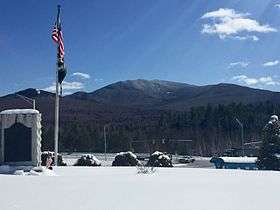 View of Mt. Hale from village of Twin Mountain | |
| Highest point | |
| Elevation | 4,054 ft (1,236 m) [1] |
| Prominence | 614 ft (187 m) [1] |
| Listing | White Mountain 4000-Footers |
| Coordinates | 44°13′18″N 71°30′43″W / 44.2217314°N 71.5120241°WCoordinates: 44°13′18″N 71°30′43″W / 44.2217314°N 71.5120241°W [2] |
| Geography | |
| Location | Grafton County, New Hampshire, U.S. |
| Parent range | Twin Range |
| Topo map | USGS South Twin Mountain |
Mount Hale is a mountain located in Grafton County, New Hampshire. The mountain is named after Reverend Edward Everett Hale (1822–1909), and is part of the Twin Range of the White Mountains. The western and eastern sides of Mount Hale are drained by the Little River and Zealand River respectively, and thence into the Ammonoosuc River, Connecticut River, and into Long Island Sound in Connecticut.
A major hiking trail over its peak leads to the Zealand Falls Hut, which is 2.8 miles (4.5 km) away.
See also
References
- 1 2 "Mount Hale, New Hampshire". Peakbagger.com. Retrieved 2013-01-31.
- ↑ "Mount Hale". Geographic Names Information System. United States Geological Survey. Retrieved 2013-01-31.
External links
- "Mount Hale". Appalachian Mountain Club.
- "Mount Hale". SummitPost.org.
- "Mt. Hale Hiking Guide". FranklinSites.com.
This article is issued from
Wikipedia.
The text is licensed under Creative Commons - Attribution - Sharealike.
Additional terms may apply for the media files.