Moulsoe
| Moulsoe | |
|---|---|
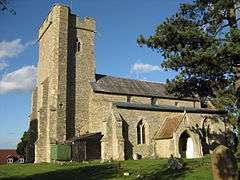 The Parish Church - St Mary's of the Assumption | |
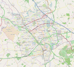 Moulsoe 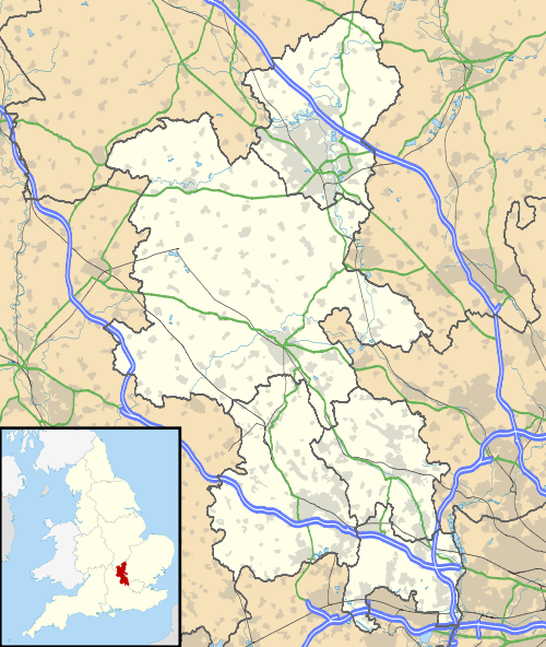 Moulsoe Moulsoe shown within Buckinghamshire | |
| Population | 318 (2011 Census including Caldecote,Buckinghamshire)[1] |
| OS grid reference | SP910419 |
| Civil parish |
|
| Unitary authority | |
| Ceremonial county | |
| Region | |
| Country | England |
| Sovereign state | United Kingdom |
| Post town | NEWPORT PAGNELL |
| Postcode district | MK16 |
| Dialling code | 01908 |
| Police | Thames Valley |
| Fire | Buckinghamshire |
| Ambulance | South Central |
| EU Parliament | South East England |
| UK Parliament | |
Moulsoe is a village and civil parish in the Borough of Milton Keynes and ceremonial county of Buckinghamshire, England.[2] It is on the border with Bedfordshire, just across the M1 from Milton Keynes itself, and about two and a half miles ESE of Newport Pagnell. The main road through the village is the Newport Road coming from the west, changing to the Cranfield Road going east at a bend by the church.
The village name is an Old English language word which means 'Mul's hill spur'. In the Domesday Book of 1086 the village was recorded as Moleshou.[3]
At the 2001 Census, the population of the parish was 330.[4]
There are several old thatched dwellings. Other buildings are of brick apart from some concrete council houses to the west and the church which is of stone, and dates from the 12th century.[5] There is an inn, the Carrington Arms, and a village hall, the Millennium Hall.[6]
Gallery
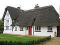 Yew Tree Cottage, Newport Road
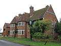 The Carrington Arms, Cranfield Road
 St Mary's church, view from Newport Road
References
- ↑ Neighbourhood Statistics 2011 census, Accessed 4 February 2013
- ↑ Parishes in Milton Keynes Archived 2009-06-08 at the Wayback Machine. - Milton Keynes Council.
- ↑ moulsoe.net/history.htm
- ↑ http://www.mkweb.co.uk/statistics/documents/Population%5FBulletin%5F2005%2D6%2Epdf, page 22
- ↑ Parish of Newport Pagnell Archived 2012-08-02 at the Wayback Machine. St Mary's
- ↑ www.milton-keynes.gov.uk Archived 2012-12-23 at Archive.is Moulsoe Millennium Hall
External links
![]()