Monteagle, New South Wales
| Monteagle New South Wales | |
|---|---|
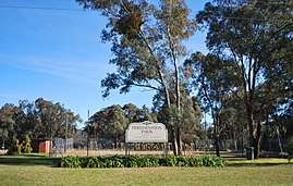 Freudenstein Park at Monteaglee | |
|
Monteagle | |
| Coordinates | 34°11′23″S 148°20′35″E / 34.18972°S 148.34306°ECoordinates: 34°11′23″S 148°20′35″E / 34.18972°S 148.34306°E |
| Population | 208 (2016 census)[1] |
| Postcode(s) | 2594 |
| Elevation | 440 m (1,444 ft) |
| Location | |
| LGA(s) | Hilltops Council |
| State electorate(s) | Cootamundra |
| Federal Division(s) | Riverina |
Monteagle is a locality in the South West Slopes region of New South Wales, Australia. The locality is in the Hilltops Council local government area, 366 kilometres (227 mi) south west of the state capital, Sydney.
At the 2016 census, Monteagle had a population of 208.[1]
References
- 1 2 Australian Bureau of Statistics (27 June 2017). "Monteagle". 2016 Census QuickStats. Retrieved 24 July 2017.

External links
![]()
This article is issued from
Wikipedia.
The text is licensed under Creative Commons - Attribution - Sharealike.
Additional terms may apply for the media files.