Monte Taccone
| Monte Taccone | |
|---|---|
 | |
| Highest point | |
| Elevation | 1,113 m (3,652 ft) [1] |
| Coordinates | 44°33′38″N 08°51′00″E / 44.56056°N 8.85000°ECoordinates: 44°33′38″N 08°51′00″E / 44.56056°N 8.85000°E |
| Geography | |
 Monte Taccone Location in Italy | |
| Location | Liguria and Piedmont, Italy |
| Parent range | Ligurian Appennines |
| Climbing | |
| First ascent | ancestral |
| Easiest route | hike |
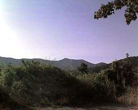
Monte Taccone is a mountain located between Liguria and Piedmont in north-western Italy. It is part of the Ligurian Appennines.
Access to the summit
The mountain is accessible by signposed foothpaths departing from Bocchetta Pass or Isoverde (municipality of Campomorone).
The Alta Via dei Monti Liguri, a long-distance trail from Ventimiglia (province of Imperia) to Bolano (province of La Spezia), passes very close to the mountain's summit.[2]
Nature conservation
The northern slopes of Monte Taccone are included in the Capanne di Marcarolo natural park.[3]
References
![]()
- ↑ Istituto Geografico Centrale - Carta dei sentieri 1:50.000 n. 16 Genova - Varazze -Ovada
- ↑ Fabrizio Oneto and Fabrizio Càlzia. L'alta via dei monti liguri - Monti di Genova (PDF). www.altaviadeimontiliguri.it (in Italian). Galata. Archived from the original (PDF) on 2015-12-11. Retrieved 2016-04-09.
- ↑ Siti di Importanza Comunitaria (SIC), Regione Piemonte, list on gis.csi.it Archived 2016-03-03 at the Wayback Machine. (accessed on April 2016)
This article is issued from
Wikipedia.
The text is licensed under Creative Commons - Attribution - Sharealike.
Additional terms may apply for the media files.