Monroe Township, Adams County, Indiana
| Monroe Township | |
|---|---|
| Township | |
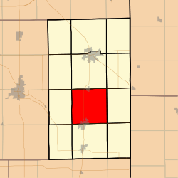 Location in Adams County | |
| Coordinates: 40°42′10″N 84°56′03″W / 40.70278°N 84.93417°WCoordinates: 40°42′10″N 84°56′03″W / 40.70278°N 84.93417°W | |
| Country | United States |
| State | Indiana |
| County | Adams |
| Government | |
| • Type | Indiana township |
| Area | |
| • Total | 36.39 sq mi (94.2 km2) |
| • Land | 36.34 sq mi (94.1 km2) |
| • Water | 0.05 sq mi (0.1 km2) 0.14% |
| Elevation | 833 ft (254 m) |
| Population (2010) | |
| • Total | 4,858 |
| • Density | 133.7/sq mi (51.6/km2) |
| ZIP codes | 46711, 46733, 46772 |
| GNIS feature ID | 0453633 |
Monroe Township is one of twelve townships in Adams County, Indiana, United States. As of the 2010 census, its population was 4,858.[1]
Geography
According to the 2010 census, the township has a total area of 36.39 square miles (94.2 km2), of which 36.34 square miles (94.1 km2) (or 99.86%) is land and 0.05 square miles (0.13 km2) (or 0.14%) is water.[2]
Cities, towns, villages
Adjacent townships
- Washington Township (north)
- St. Marys Township (northeast)
- Blue Creek Township (east)
- Wabash Township (south)
- Hartford Township (southwest)
- French Township (west)
- Kirkland Township (northwest)
Cemeteries
The township contains these four cemeteries: Graber, Mazelin, Ray, Smith, and Winchester.
Major highways
Airports and landing strips
- Sprungers South Adams County Airstrip
School districts
- Adams Central Community Schools
- South Adams Schools
Political districts
- Indiana's 6th congressional district
- State House District 79
- State Senate District 19
References
- "Monroe Township, Adams County, Indiana". Geographic Names Information System. United States Geological Survey. Retrieved 2009-09-24.
- United States Census Bureau 2007 TIGER/Line Shapefiles
- United States National Atlas
- ↑ "Geographic Identifiers: 2010 Demographic Profile Data (G001): Monroe township, Adams County, Indiana". U.S. Census Bureau, American Factfinder. Retrieved May 8, 2013.
- ↑ 2002 Census of Governments, Individual State Descriptions (PDF)
External links
Municipalities and communities of Adams County, Indiana, United States | ||
|---|---|---|
| Cities | ||
| Towns | ||
| Townships | ||
| Unincorporated communities |
| |
This article is issued from
Wikipedia.
The text is licensed under Creative Commons - Attribution - Sharealike.
Additional terms may apply for the media files.