Mitterfels
| Mitterfels | ||
|---|---|---|
| ||
 Mitterfels Location of Mitterfels within Straubing-Bogen district 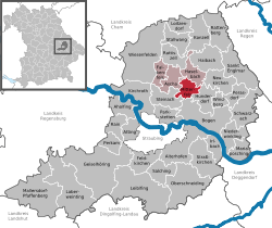 | ||
| Coordinates: 48°58′N 12°41′E / 48.967°N 12.683°ECoordinates: 48°58′N 12°41′E / 48.967°N 12.683°E | ||
| Country | Germany | |
| State | Bavaria | |
| Admin. region | Niederbayern | |
| District | Straubing-Bogen | |
| Municipal assoc. | Mitterfels | |
| Government | ||
| • Mayor | Heinrich Stenzel (Freie Wählergemeinschaft) | |
| Area | ||
| • Total | 14.23 km2 (5.49 sq mi) | |
| Elevation | 407 m (1,335 ft) | |
| Population (2017-12-31)[1] | ||
| • Total | 2,799 | |
| • Density | 200/km2 (510/sq mi) | |
| Time zone | CET/CEST (UTC+1/+2) | |
| Postal codes | 94360 | |
| Dialling codes | 09961 | |
| Vehicle registration | SR | |
| Website | www.mitterfels.de | |

Mitterfels is a municipality in the district of Straubing-Bogen in Bavaria, Germany. It is the head of the Verwaltungsgemeinschaft Mitterfels.
Geography
Mitterfels is located in the region between the Danube and the Bavarian Forest.
History
In 1104 the dukes of Bogen founded the Monastery Oberalteich. The Castle of Mitterfels was first mentioned in 1194. The Township in today's extent was founded in 1818.
At the census in the year 2000, 2,372 inhabitants lived in Mitterfels.
The mayor of the town is Heinrich Stenzel (Community of Independent Voters). He came into office in 2002 as successor of Werner Lang.
Education
In the year 1999, the following institutions were established:
- A nursery with 70 places and 81 children
- An elementary school with 22 teachers and 362 pupils
References
- ↑ "Fortschreibung des Bevölkerungsstandes". Bayerisches Landesamt für Statistik und Datenverarbeitung (in German). September 2018.
This article is issued from
Wikipedia.
The text is licensed under Creative Commons - Attribution - Sharealike.
Additional terms may apply for the media files.