Konzell
| Konzell | ||
|---|---|---|
| ||
 Konzell Location of Konzell within Straubing-Bogen district 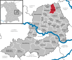 | ||
| Coordinates: 49°4′N 12°43′E / 49.067°N 12.717°ECoordinates: 49°4′N 12°43′E / 49.067°N 12.717°E | ||
| Country | Germany | |
| State | Bavaria | |
| Admin. region | Niederbayern | |
| District | Straubing-Bogen | |
| Government | ||
| • Mayor | Michael Kienberger (CSU) | |
| Area | ||
| • Total | 26.76 km2 (10.33 sq mi) | |
| Elevation | 500-900 m (−2,500 ft) | |
| Population (2017-12-31)[1] | ||
| • Total | 1,755 | |
| • Density | 66/km2 (170/sq mi) | |
| Time zone | CET/CEST (UTC+1/+2) | |
| Postal codes | 94357 | |
| Dialling codes | 09963 | |
| Vehicle registration | SR | |
| Website | www.konzell.de | |

Konzell is a municipality in the district of Straubing-Bogen in Bavaria, Germany.
Geography
Konzell is situated in the south of the Bavarian Forest. Here is the spring of the Menach, which flows in the valley of Menach direction the Bogen.
Mountains
The Gallner Berg to the south, the western summit of the Gallner, and the Kramerschopf to the east are the highest points, each reaching 710 metres. To the north is the Himmelberg at 680 metres.
Urban districts
To Konzell belong the urban districts Auggenbach, Denkzell, Gossersdorf and Kasparzell.
References
- ↑ "Fortschreibung des Bevölkerungsstandes". Bayerisches Landesamt für Statistik und Datenverarbeitung (in German). September 2018.
Impressions
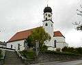 Catholic church St. Martin
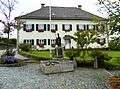 manse
manse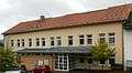 Primary school
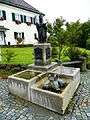 fountain near school and church
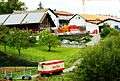 Brewerie (Klett-Bräu)
This article is issued from
Wikipedia.
The text is licensed under Creative Commons - Attribution - Sharealike.
Additional terms may apply for the media files.