Merhavia (kibbutz)
| Merhavia מֶרְחַבְיָה | |
|---|---|
| Hebrew transcription(s) | |
| • standard | Merhavya |
 Merhavia | |
| Coordinates: 32°36′21″N 35°18′26″E / 32.60583°N 35.30722°ECoordinates: 32°36′21″N 35°18′26″E / 32.60583°N 35.30722°E | |
| Grid position | 179/223 PAL |
| District | Northern |
| Council | Jezreel Valley |
| Affiliation | Kibbutz Movement |
| Founded | 1929 |
| Founded by | Galician Hashomer Hatzair members |
| Population (2017)[1] | 1,162 |
| Website | www.merchavia.org.il |
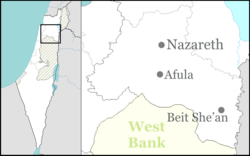
Merhavia (Hebrew: מֶרְחַבְיָה, lit. Great Enlargement – God) is a kibbutz in northern Israel. Located to the east of Afula, it falls under the jurisdiction of Jezreel Valley Regional Council. In 2017 it had a population of 1,162.[1]
Etymology
The name Merhavia is derived from the Book of Psalms 118:5;
Out of my straits I called upon the LORD; .. answered me with great enlargement – God.
In the metaphorical sense: "God set me free" - the experience of the Jews immigrating to the Land of Israel and achieving a new homeland without the straits of persecution.
History
The place was earlier named in Arabic al-Fuleh ("The beans"),[2] also rendered as El Fuleh, al-Fula etc. It was possibly the place called Alpha in the list of Thutmes III.[3]
In the Crusader era it was known as la Feve or Castrum Fabe. It had a Templar castle (first mentioned in 1169/72), of which just some mounds remain.[4][5] The area was under Crusader control between 1099 and 1187.[6] In 1183 the Battle of Al-Fule took place here, between the Crusaders and the forces of Saladin.
In 1226, Syrian geographer Yaqut al-Hamawi mentioned it as being "a town in Jund Filastin," and formerly a Crusader castle between Zir'in and Nazareth.[7] The area was again under Crusader control between 1240/1 and 1263.[6]
The Survey of Western Palestine (SWP) noted a ruined church about 200 meters SSE of the castle,[8] which probably was the remains of the Crusader parish church.[6] However, these remains were destroyed in 1939-1940.[6]
Ottoman era
According to Denys Pringle, al-Fula, the Arab village, seem to have existed until the end of the sixteenth century.[6]
In 1799, during Napoleon's Syrian campaign, the Battle of Mount Tabor was fought around Al-Fuleh.[9]
In 1816, James Silk Buckingham described Fooli as a village. He observed there the remains of a large building, which he presumed was "Saracen". By the water wells he found two covers for sarcophagi, one was ornamented with sculptures. There were several other settlements in sight, all populated by Muslims.[10]
In 1838, Edward Robinson described both Al-Fuleh and the adjacent Afuleh as "deserted".[11]
In 1859 Al-Fuleh had 64 inhabitants, and the tillage was 14 feddans, according to the English consul Rogers.[3] William McClure Thomson, in a book published the same year, noted that both El Fuleh and the adjacent Afuleh, were "both now deserted, though both were inhabited twenty-five years ago when I first passed this way." Thomson blamed their desertion on the bedouin.[12]
In 1875 Victor Guérin noted the remains of multicoloured mosaics by Bir Fouleh. At this time, Al-Fuleh was the home of 15 Arab families.[9] In 1882, the Palestine Exploration Fund's Survey of Western Palestine (SWP) described Al-Fuleh as a small adobe village, "with a few stone houses in the middle. It stands on a swell of ground, and is surrounded by corn land, and has marshy ground to the north. The water supply is from wells west of the village. Round the site are remains of the ancient Crusader fosse."[3]
A population list from about 1887 showed that Fuleh had about 300 inhabitants; all Muslims.[13]
British Mandate era
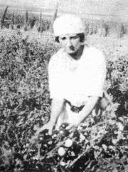
Kibbutz Merhavia was established in 1929 adjacent to moshav Merhavia (from which it took its name). The founders were members of Hashomer Hatzair who had immigrated from Galicia after World War I and had been living in Haifa, including Eliezer Peri, who later represented Mapam in the Knesset.
Notable residents
- Ran Goren
- Golda Meir (1898–1978), fourth Prime Minister of the State of Israel
- Yaakov Shabtai (1934–1981), novelist, playwright, and translator
- Yedidya Ya'ari
- Tuvya Ruebner, poet, editor, translator and photographer
References
- 1 2 "List of localities, in Alphabetical order" (PDF). Israel Central Bureau of Statistics. Retrieved August 26, 2018.
- ↑ Palmer, 1881, p. 161
- 1 2 3 Conder and Kitchener, 1882, SWP II, p. 82
- ↑ Rey, 1883, p. 439
- ↑ Pringle, 1997, p. 49
- 1 2 3 4 5 Pringle, 1993, p. 207
- ↑ le Strange, 1890, p. 441
- ↑ Conder and Kitchener, 1881, SWP II, p.101. Note typo: Afuleh for Fule
- 1 2 Guérin, 1880, pp. 110-111
- ↑ Buckingham, 1822, vol 2, p. 381
- ↑ Robinson and Smith, 1841, vol 3, pp. 163, 181
- ↑ Thomson, 1859, vol 2, p. 216
- ↑ Schumacher, 1888, p. 183
Bibliography
- Conder, C. R.; Kitchener, H. H. (1882). The Survey of Western Palestine: Memoirs of the Topography, Orography, Hydrography, and Archaeology. 2. London: Committee of the Palestine Exploration Fund. (p. 116)
- Dauphin, Claudine (1998). La Palestine byzantine, Peuplement et Populations. BAR International Series 726 (in French). III : Catalogue. Oxford: Archeopress.
- Guérin, V. (1880). Description Géographique Historique et Archéologique de la Palestine (in French). 3: Galilee, pt. 1. Paris: L'Imprimerie Nationale.
- Hadawi, S. (1970). Village Statistics of 1945: A Classification of Land and Area ownership in Palestine. Palestine Liberation Organization Research Center.
- Kedar, Benjamin Z.; Pringle, Denys (1985). "La Fève: A Crusader Castle in the Jezreel Valley". Israel Exploration Journal. 35 (2/3): 164–179.
- Buckingham, J. S. (1822). Travels in Palestine through the countries of Bashan and Gilead, east of the River Jordan, including a visit to the cities of Geraza and Gamala in the Decapolis. 2. London: Longman, Hurst, Rees, Orme and Brown.
- Mills, E., ed. (1932). Census of Palestine 1931. Population of Villages, Towns and Administrative Areas. Jerusalem: Government of Palestine.
- Palmer, E. H. (1881). The Survey of Western Palestine: Arabic and English Name Lists Collected During the Survey by Lieutenants Conder and Kitchener, R. E. Transliterated and Explained by E.H. Palmer. Committee of the Palestine Exploration Fund.
- Pringle, Denys (1993). The Churches of the Crusader Kingdom of Jerusalem: A-K (excluding Acre and Jerusalem). I. Cambridge University Press. ISBN 0 521 39036 2.
- Pringle, Denys (1997). Secular buildings in the Crusader Kingdom of Jerusalem: an archaeological Gazetter. Cambridge University Press. ISBN 0521 46010 7.
- Rey, E. G. (1883). Les colonies franques de Syrie aux XIIme et XIIIme siècles (in French). Paris: A. Picard.
- Robinson, E.; Smith, E. (1841). Biblical Researches in Palestine, Mount Sinai and Arabia Petraea: A Journal of Travels in the year 1838. 3. Boston: Crocker & Brewster.
- Schumacher, G. (1888). "Population list of the Liwa of Akka". Quarterly statement - Palestine Exploration Fund. 20: 169–191.
- Strange, le, G. (1890). Palestine Under the Moslems: A Description of Syria and the Holy Land from A.D. 650 to 1500. Committee of the Palestine Exploration Fund.
- Thomson, W. M. (1859). The Land and the Book: Or, Biblical Illustrations Drawn from the Manners and Customs, the Scenes and Scenery, of the Holy Land. 2 (1 ed.). New York: Harper & brothers.
- Wilson, C. W., ed. (c. 1881). Picturesque Palestine, Sinai and Egypt. 2. New York: D. Appleton. p. 25
External links
- Village website (in Hebrew)
- Survey of Western Palestine (SWP), Map 9: IAA, Wikimedia commons