Tel Adashim
| Tel Adashim תֵּל עֲדָשִׁים | |
|---|---|
 | |
 Tel Adashim | |
| Coordinates: 32°39′18.72″N 35°18′3.95″E / 32.6552000°N 35.3010972°ECoordinates: 32°39′18.72″N 35°18′3.95″E / 32.6552000°N 35.3010972°E | |
| District | Northern |
| Council | Jezreel Valley |
| Affiliation | Moshavim Movement |
| Founded | 1923 |
| Population (2017)[1] | 1,483 |
| Name meaning | Lentils Hill |
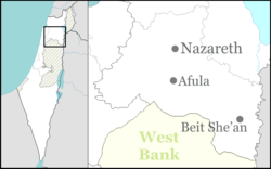
Tel Adashim (Hebrew: תֵּל עֲדָשִׁים, lit. Lentils Hill) is a moshav in northern Israel. Located between Nazareth and Afula, it falls under the jurisdiction of Jezreel Valley Regional Council.[2] In 2017 it had a population of 1,483.[1]
History
Jewish settlement began in the area in 1913 when Hashomer established Tel Adash, a settlement whose purpose was to defend the oil pipeline from Iraq to Haifa. By 1918, only two families remained.[3]
In 1921 the Zionist completed a purchase of 22,000 dunams at Tel-el-Adas from the Sursuk family of Beirut. At that time, there were 150 [Muslim] families living there.[4]
In the 1922 census of Palestine, conducted by the British Mandate authorities, Tal Adas had a population of 118; 98 Muslims, 16 Jews and 4 Christians.[5]
In 1923, a moshav ovdim was established on the site and was named Tel Adashim.[3]
Notable past and present residents include Rafael Eitan, Yigal Cohen, A. D. Gordon and Alexander Zaïd.[3]
References
| Wikimedia Commons has media related to Tel Adashim. |
- 1 2 "List of localities, in Alphabetical order" (PDF). Israel Central Bureau of Statistics. Retrieved August 26, 2018.
- ↑ Tel Adashim Moshavim of Israel
- 1 2 3 About Tel Adashim (in Hebrew)
- ↑ List of villages sold by Sursocks and their partners to the Zionists since British occupation of Palestine, evidence to the Shaw Commission, 1930
- ↑ Barron, J. B., ed. (1923). Palestine: Report and General Abstracts of the Census of 1922. Government of Palestine. p. 38.