Mechanicsburg, Pennsylvania
| Mechanicsburg, Pennsylvania | |
|---|---|
| Borough | |
| Motto(s): "A good place to live since 1828" | |
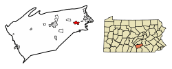 Location of Mechanicsburg in Cumberland County, Pennsylvania. | |
 Mechanicsburg Location in Pennsylvania and the United States  Mechanicsburg Mechanicsburg (the US) | |
| Coordinates: 40°12′44″N 77°00′22″W / 40.21222°N 77.00611°WCoordinates: 40°12′44″N 77°00′22″W / 40.21222°N 77.00611°W | |
| Country | United States |
| State | Pennsylvania |
| County | Cumberland |
| Settled | 1806 |
| Incorporated | 1828 |
| Government | |
| • Type | Borough Council |
| • Mayor | Jack Ritter |
| • Council President | Rodney Whitcomb |
| • Council Vice-President | Jack Winchell |
| • Borough Manager | Patrick Edward Dennis |
| • Borough Solicitor | Lisa M. Coyne, Esq. |
| Area[1] | |
| • Total | 2.41 sq mi (6.25 km2) |
| • Land | 2.41 sq mi (6.24 km2) |
| • Water | 0.00 sq mi (0.00 km2) |
| Elevation | 446 ft (136 m) |
| Population (2010) | |
| • Total | 8,981 |
| • Estimate (2016)[2] | 9,007 |
| • Density | 3,737.34/sq mi (1,442.70/km2) |
| Time zone | UTC-5 (Eastern (EST)) |
| • Summer (DST) | UTC-4 (EDT) |
| ZIP codes | 17055, 17050 |
| Area code(s) | 717 |
| FIPS code | 42-48376 |
| Website |
www |
Mechanicsburg is a borough in Cumberland County, Pennsylvania, United States, 8 miles (13 km) west of Harrisburg. It is part of the Harrisburg–Carlisle Metropolitan Statistical Area. As of the 2010 census it had a population of 8,981.[3]
Geography
Mechanicsburg is located in eastern Cumberland County at 40°12′44″N 77°00′22″W / 40.212089°N 77.006143°W.[4] It is in a rich agricultural region known as the Cumberland Valley, a broad zone between South Mountain and the Ridge-and-Valley Appalachians.
Mechanicsburg is bordered by Silver Spring Township to the northwest, Monroe Township to the southwest, Upper Allen Township to the south, Lower Allen Township to the east, and Hampden Township to the northeast. Pennsylvania Route 641 (Trindle Road) is the main east-west street through the borough, leading east 4 miles (6 km) to Camp Hill and west 10 miles (16 km) to Carlisle, the county seat. Pennsylvania Route 114 leads north out of town on York Street and south on Market Street. Interstate 76, the Pennsylvania Turnpike, passes just south of Mechanicsburg, with access to the southeast of town via Exit 236 (U.S. Route 15).
According to the United States Census Bureau, the borough has a total area of 2.41 square miles (6.25 km2), of which 1.1 acres (4,478 m2), or 0.07%, is water.[3]
Demographics
In 1900, 3,841 people lived here; in 1910, the population was 4,469, which increased to 5,709 in 1940. As of the 2010 census, the borough population was 8,981.
| Historical population | |||
|---|---|---|---|
| Census | Pop. | %± | |
| 1830 | 534 | — | |
| 1840 | 670 | 25.5% | |
| 1850 | 888 | 32.5% | |
| 1860 | 1,939 | 118.4% | |
| 1870 | 2,569 | 32.5% | |
| 1880 | 3,018 | 17.5% | |
| 1890 | 3,691 | 22.3% | |
| 1900 | 3,841 | 4.1% | |
| 1910 | 4,469 | 16.3% | |
| 1920 | 4,688 | 4.9% | |
| 1930 | 5,647 | 20.5% | |
| 1940 | 5,709 | 1.1% | |
| 1950 | 6,786 | 18.9% | |
| 1960 | 8,123 | 19.7% | |
| 1970 | 9,385 | 15.5% | |
| 1980 | 9,487 | 1.1% | |
| 1990 | 9,452 | −0.4% | |
| 2000 | 9,042 | −4.3% | |
| 2010 | 8,981 | −0.7% | |
| Est. 2016 | 9,007 | [2] | 0.3% |
| Sources:[5][6][7] | |||
As of the census[6] of 2000, there were 9,042 people, 4,023 households, and 2,466 families residing in the borough. The population density was 3,494.6 people per square mile (1,347.9/km2). There were 4,169 housing units at an average density of 1,611.3 per square mile (621.5/km2). The racial makeup of the borough was 96.97% White, 0.43% African American, 0.09% Native American, 1.15% Asian, 0.28% from other races, and 1.08% from two or more races. Hispanic or Latino of any race were 0.83% of the population.
There were 4,024 households, out of which 25.7% had children under the age of 18 living with them, 49.1% were married couples living together, 8.8% had a female householder with no husband present, and 38.7% were non-families. Of all households, 32.8% were made up of individuals, and 10.3% had someone living alone who was 65 years of age or older. The average household size was 2.23 and the average family size was 2.85.
In the borough the population was spread out, with 21.5% under the age of 18, 7.3% from 18 to 24, 30.8% from 25 to 44, 24.6% from 45 to 64, and 15.8% who were 65 years of age or older. The median age was 39 years. For every 100 females, there were 91.3 males. For every 100 females age 18 and over, there were 86.7 males.
The median income for a household in the borough was $45,200, and the median income for a family was $54,228. Males had a median income of $37,130 versus $27,940 for females. The per capita income for the borough was $22,812. About 2.4% of families and 4.2% of the population were below the poverty line, including 6.0% of those under age 18 and 5.0% of those age 65 or over.
History
Named for a settlement of mechanics who made and repaired Conestoga wagons in the early 19th century, Mechanicsburg's continued growth was also attributed to the Cumberland Valley Railroad (CVRR). Completing its line in 1837, Mechanicsburg was designated as a water station where workers could restock the locomotive's wood and pump water. The train became the town's link to the world of business and industry. Grain and feed companies, lumber yards and numerous factories were purposely built alongside the railroad tracks. Archives show that, at one time, there were twenty-five trains chugging through the town daily carrying travelers, coal, feathers, fruit, ice, mail and newspapers. During the American Civil War, the railroad was an invaluable method of transporting troops and supplies. Today, approximately six trains travel through Mechanicsburg each day, which has recently increased due to new operations on the local sub-line owned by Norfolk Southern. Another part of Mechanicsburg's growth occurred when the Naval Support Activity was built on 840 acres (3.4 km2) of land in Hampden Township, Pennsylvania. NSA Mechanicsburg continues to serve as one of the Defense Departments major logistics sites. Although automotive technology changed the town forever, today's residents cannot dismiss the vital role the railroad played in its development.[8]
Present-day Mechanicsburg is centered on 100 acres (0.40 km2) that Leonard Fisher purchased from Joseph Heynes tract (No. 1442 of an original grant of 267 acres (1.08 km2) from William Penn. Before becoming incorporated on April 12, 1828, the town went by several different names. First, Drytown, because of the extreme scarcity of water during the winter and summer. It was also known as Pinchgut, a German name used as a sign of amusement given to a small village of only a few people. Some also referred to the town as Staufferstown, in honor of Henry Stauffer, the owner of much of the land in the center of town. Briefly, referred to as Creekville during the Colonial Era, Mechanicsburg is home to many historic markers, such as Irving Female College (named for Washington Irving, a trustee), the first women's college in Pennsylvania to grant degrees in arts and sciences.[8]
On June 28, 1863, Confederate troops led by Brig. Gen. Albert G. Jenkins raided Mechanicsburg, and two days later, met with Union forces in the Skirmish of Sporting Hill, just east of town. It is known as the northern most engagement of the Civil War. Following the Skirmish of Sporting Hill, the Confederate forces retreated south into the little town of Gettysburg where the Battle of Gettysburg would be fought.[8]
The oldest building in Mechanicsburg is the Frankeberger Tavern. One of Mechanicsburg's first residents was George Frankeberger, who in 1801 applied for a license to open his newly built log home for the "convenience" of travelers. In exchange for a small fee, Mr. Frankeberger offered cattle drivers a warm meal and a place to sleep. This proved to be rather lucrative, as many people were making the two day trek between Harrisburg (the state capital) and Carlisle (Cumberland County's county seat). A local legend tells of a man who came into a good deal of money having just sold some cattle in Harrisburg. After boasting about it in front of many of the other travelers in the tavern, he retired for the night. Another man, having heard about the gold he was carrying, followed him to his room, cut off his head, and stole his money. Legend has it that a headless ghost can sometimes be seen sitting atop the roof of Frankeberger Tavern, looking out over the roofs of town, searching for the man who stole his gold.[8]
The Mechanicsburg Commercial Historic District, Irving Female College, Cumberland Valley Railroad Station and Station Master's House, Adam Orris House, and Simpson Street School are listed on the National Register of Historic Places.[9]
Government and infrastructure
The Pennsylvania Department of Corrections has its headquarters in Hampden Township, Cumberland County, near Mechanicsburg.[10][11] Mechanicsburg lies in the center of a regional transportation crossroads, with Interstate 81, Interstate 76, Interstate 83, US Route 11, and US Route 15 passing in close proximity to the borough. The Appalachian Trail passes through Pennsylvania a few miles west of Mechanicsburg, in nearby Boiling Springs.
Points of interest
- Liberty Forge Arboretum
- Mechanicsburg Area Senior High School
- Cumberland Valley High School
- Williams Grove Speedway
- Union Church
- Stationmaster's House
- Frankeberger Tavern
- Hall's tower
- Juice & Java
Notable people
- Carla Thomas (basketball): former professional basketball player (2007, 1st Rd Draft Pick), first Mid-Penn Women's Basketball player to be drafted into the WNBA
- Shawn Abner: former Major League Baseball outfielder, father of Call of Duty world champion Seth "Scump" Abner.
- Bret Michaels: lead singer for the group Poison[12]
- Andrew Kevin Walker: screenwriter noted for writing Seven and other films
- Seth "Scump" Abner: professional eSports competitor, two-time COD World Series Champion, and player for OpTic Gaming
- Jon Ritchie: former professional football player, currently a Philadelphia sports radio personality on WIP middays
- Luke Matheny: Academy Award-winning director, actor, and writer
See also
![]()
References
- ↑ "2016 U.S. Gazetteer Files". United States Census Bureau. Retrieved Aug 13, 2017.
- 1 2 "Population and Housing Unit Estimates". Retrieved June 9, 2017.
- 1 2 "Geographic Identifiers: 2010 Census Summary File 1 (G001): Mechanicsburg borough, Pennsylvania". U.S. Census Bureau, American Factfinder. Retrieved June 18, 2015.
- ↑ "US Gazetteer files: 2010, 2000, and 1990". United States Census Bureau. 2011-02-12. Retrieved 2011-04-23.
- ↑ "Census of Population and Housing". U.S. Census Bureau. Retrieved 11 December 2013.
- 1 2 "American FactFinder". United States Census Bureau. Retrieved 2008-01-31.
- ↑ "Incorporated Places and Minor Civil Divisions Datasets: Subcounty Resident Population Estimates: April 1, 2010 to July 1, 2012". Population Estimates. U.S. Census Bureau. Retrieved 11 December 2013.
- 1 2 3 4 "Mechanicsburg Museum". Retrieved 2008-05-07.
- ↑ National Park Service (2010-07-09). "National Register Information System". National Register of Historic Places. National Park Service.
- ↑ "Contact Us." Pennsylvania Department of Corrections. Retrieved on October 5, 2012. "Central Office: 1920 Technology Parkway, Mechanicsburg, PA 17050"
- ↑ "Street Map." (Archive) Hampden Township. Retrieved on October 5, 2012.
- ↑ "Fire destroys Bret Michaels' Pennsylvania childhood home". Las Vegas Sun. January 28, 2016. Archived from the original on February 6, 2016. Retrieved November 30, 2017.
External links
| Wikimedia Commons has media related to Mechanicsburg, Pennsylvania. |

- Borough of Mechanicsburg official website
Municipalities and communities of Cumberland County, Pennsylvania, United States | ||
|---|---|---|
| Boroughs | 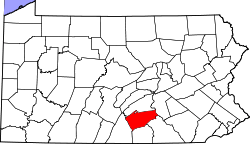 | |
| Townships | ||
| CDPs | ||
| Unincorporated communities | ||
| Footnotes | ‡This populated place also has portions in an adjacent county or counties | |