Walnut Bottom, Pennsylvania
| Walnut Bottom, Pennsylvania | |
|---|---|
| Unincorporated community | |
 Walnut Bottom | |
| Coordinates: 40°05′22″N 77°24′14″W / 40.08944°N 77.40389°WCoordinates: 40°05′22″N 77°24′14″W / 40.08944°N 77.40389°W | |
| Country | United States |
| State | Pennsylvania |
| County | Cumberland |
| Elevation | 725 ft (221 m) |
| Time zone | UTC-5 (Eastern (EST)) |
| • Summer (DST) | UTC-4 (EDT) |
| ZIP code | 17266 |
| Area code(s) | 223 & 717 |
| GNIS feature ID | 1190539[1] |
Walnut Bottom is an unincorporated community in Cumberland County, Pennsylvania, United States.[1] The community is located along Pennsylvania Route 174 6.7 miles (10.8 km) east-northeast of Shippensburg. Walnut Bottom has a post office with ZIP code 17266, which opened on January 14, 1850.[2][3]
References
- 1 2 "Walnut Bottom". Geographic Names Information System. United States Geological Survey.
- ↑ United States Postal Service. "USPS - Look Up a ZIP Code". Retrieved August 12, 2017.
- ↑ "Postmaster Finder - Post Offices by ZIP Code". United States Postal Service. Retrieved August 12, 2017.
Municipalities and communities of Cumberland County, Pennsylvania, United States | ||
|---|---|---|
| Boroughs | 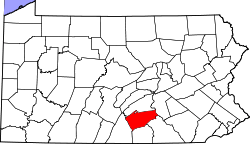 | |
| Townships | ||
| CDPs | ||
| Unincorporated communities | ||
| Footnotes | ‡This populated place also has portions in an adjacent county or counties | |
This article is issued from
Wikipedia.
The text is licensed under Creative Commons - Attribution - Sharealike.
Additional terms may apply for the media files.