Mealrigg
| Mealrigg | |
|---|---|
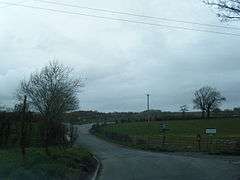 B5301 road junction at Mealrigg | |
 Mealrigg Mealrigg shown within Cumbria | |
| OS grid reference | NY129457 |
| Civil parish | |
| District | |
| Shire county | |
| Region | |
| Country | England |
| Sovereign state | United Kingdom |
| Post town | WIGTON |
| Postcode district | CA7 |
| Dialling code | 016973 |
| Police | Cumbria |
| Fire | Cumbria |
| Ambulance | North West |
| EU Parliament | North West England |
| UK Parliament | |
Mealrigg is a small settlement in the civil parish of Westnewton, close to the boundary with the civil parish of Holme St. Cuthbert in Cumbria, United Kingdom.[1]
Mealrigg is situated one mile north-west of Westnewton, a quarter-of-a-mile east of New Cowper, and half-a-mile south of Aikshaw. Other nearby settlements include Jericho, Tarns, and Langrigg.
Historically, Mealrigg formed part of the township of Langrigg and Mealrigg.
Etymology
The name Mealrigg comes from the Old English middle-hrycg, meaning a middle ridge. There are several recorded variant spellings, including Midelrig, Meldrige, Milrig, and Meldrigg.[2]
References
| Wikimedia Commons has media related to Mealrigg. |
- ↑ "Google Maps - Mealrigg". Retrieved 14 October 2015.
- ↑ Holme St. Cuthbert History Group (2004). Plain People: Bygone Times on the Solway Plain. ISBN 0954882318.
This article is issued from
Wikipedia.
The text is licensed under Creative Commons - Attribution - Sharealike.
Additional terms may apply for the media files.