Max, Minnesota
| Max, Minnesota | |
|---|---|
| Unincorporated community | |
 Max, Minnesota Location of the community of Max within Max Township, Itasca County  Max, Minnesota Max, Minnesota (the US) | |
| Coordinates: 47°36′53″N 94°04′05″W / 47.61472°N 94.06806°WCoordinates: 47°36′53″N 94°04′05″W / 47.61472°N 94.06806°W | |
| Country | United States |
| State | Minnesota |
| County | Itasca |
| Township | Max Township |
| Elevation | 1,371 ft (418 m) |
| Time zone | UTC-6 (Central (CST)) |
| • Summer (DST) | UTC-5 (CDT) |
| ZIP code | 56659 |
| Area code(s) | 218 |
| GNIS feature ID | 657341[1] |
Max is an unincorporated community in Max Township, Itasca County, Minnesota, United States; located within the Chippewa National Forest and the Leech Lake Indian Reservation.
The community is located southeast of Squaw Lake at the junction of Itasca County Roads 4 and 34. State Highway 46 (MN 46) is nearby.
Max has a post office with ZIP code 56659.[2]
Nearby places include Squaw Lake, Spring Lake, Inger, and Alvwood.
Max is located 3.5 miles southeast of Squaw Lake. Max is also located 25 miles northwest of Deer River.
References
- Rand McNally Road Atlas – 2007 edition – Minnesota entry
- Official State of Minnesota Highway Map – 2011/2012 edition
- Mn/DOT map of Itasca County – Sheet 2 – 2011 edition
Municipalities and communities of Itasca County, Minnesota, United States | ||
|---|---|---|
| Cities | 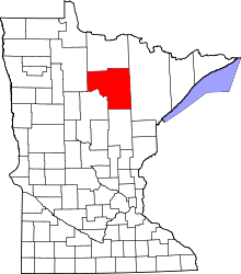 | |
| Townships |
| |
| Unorganized territories | ||
| CDPs | ||
| Unincorporated communities | ||
| Indian reservations | ||
| Footnotes | ‡This populated place also has portions in an adjacent county or counties | |
This article is issued from
Wikipedia.
The text is licensed under Creative Commons - Attribution - Sharealike.
Additional terms may apply for the media files.