Mack, Minnesota
| Mack, Minnesota | |
|---|---|
| Unincorporated community | |
 Mack, Minnesota Location of the community of Mack within Itasca County  Mack, Minnesota Mack, Minnesota (the US) | |
| Coordinates: 47°33′58″N 93°46′28″W / 47.56611°N 93.77444°WCoordinates: 47°33′58″N 93°46′28″W / 47.56611°N 93.77444°W | |
| Country | United States |
| State | Minnesota |
| County | Itasca |
| Elevation | 1,352 ft (412 m) |
| Population | |
| • Total | 10 |
| Time zone | UTC-6 (Central (CST)) |
| • Summer (DST) | UTC-5 (CDT) |
| ZIP code | 56636 and 56657 |
| Area code(s) | 218 |
| GNIS feature ID | 659414[1] |
Mack is an unincorporated community in Itasca County, Minnesota, United States; located within the Chippewa National Forest. The community is located between Deer River and Talmoon; at the junction of State Highway 6 (MN 6) and Mac Road.
Nearby places include Talmoon, Bowstring, and Marcell. Mack is located 17 miles north of Deer River; and 2 miles south of Talmoon. Mack is 7 miles southwest of Marcell. Mack is located along the boundary line between Bowstring Township and Marcell Township.
ZIP codes 56657 (Marcell), 56636 (Deer River), and 56637 (Talmoon) all meet near Mack. Lake Jessie Township is also in the vicinity.
References
- Mn/DOT map of Itasca County – Sheet 2 and 3 – 2011 edition
Municipalities and communities of Itasca County, Minnesota, United States | ||
|---|---|---|
| Cities | 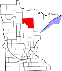 | |
| Townships |
| |
| Unorganized territories | ||
| CDPs | ||
| Unincorporated communities | ||
| Indian reservations | ||
| Footnotes | ‡This populated place also has portions in an adjacent county or counties | |
This article is issued from
Wikipedia.
The text is licensed under Creative Commons - Attribution - Sharealike.
Additional terms may apply for the media files.