Maryfield, Saskatchewan
| Maryfield | |
|---|---|
| Village | |
| Village of Maryfield | |
.jpg) Views of Maryfield, 1909. | |
 Location of Maryfield in Saskatchewan  Maryfield, Saskatchewan (Canada) | |
| Coordinates: 49°50′10″N 101°31′31″W / 49.8360°N 101.5253°W | |
| Country |
|
| Province |
|
| Region | Southeast |
| Census division | 1 |
| Rural Municipality | Maryfield No. 91 |
| Post office Founded | 1896 |
| Incorporated (Village) | 1907 |
| Government | |
| • Type | Municipal |
| • Governing body | Maryfield Village Council |
| • Mayor | David Hill |
| • Administrator | Denine Neufeld |
| • MP | Robert Kitchen |
| • MLA | Dan D'Autremont |
| Area | |
| • Total | 2.69 km2 (1.04 sq mi) |
| Population (2016) | |
| • Total | 348 |
| • Density | 129.5/km2 (335/sq mi) |
| Time zone | UTC-6 (CST) |
| Postal code | S0G 3K0 |
| Area code(s) | 306 |
| Highways |
|
| Railways | Canadian National Railway |
| [1][2][3][4] | |
Maryfield is a village within the Rural Municipality of Maryfield No. 91 in the province of Saskatchewan, Canada. The village lies south of the intersection of Highway 48 and Highway 600 and is about 8 km west of the Manitoba border. It is a junction point on the Canadian National Railway between the main line heading northwest towards Regina and a branch line heading southwest toward Carlyle and Lampman. The village had a population of 348 in the 2016 Canada Census, (a -4.7% decrease from 365 in the 2011 Canada Census).
Demographics
| Canada census – Maryfield, Saskatchewan community profile | |||
|---|---|---|---|
| 2016 | 2011 | 2006 | |
| Population: | 348 (-4.7% from 2011) | 365 (5.2% from 2006) | 347 (-3.3% from 2001) |
| Land area: | 2.69 km2 (1.04 sq mi) | 2.69 km2 (1.04 sq mi) | 2.69 km2 (1.04 sq mi) |
| Population density: | 129.5/km2 (335/sq mi) | 135.9/km2 (352/sq mi) | 129.2/km2 (335/sq mi) |
| Median age: | 40.2 (M: 36.3, F: 44.0) | 45.2 (M: 39.8, F: 49.0) | 49.9 (M: 43.2, F: 58.0) |
| Total private dwellings: | 178 | 178 | 172 |
| Median household income: | |||
| References: 2016[5] 2011[6] 2006[7] earlier[8] | |||
Climate
| Climate data for Maryfield | |||||||||||||
|---|---|---|---|---|---|---|---|---|---|---|---|---|---|
| Month | Jan | Feb | Mar | Apr | May | Jun | Jul | Aug | Sep | Oct | Nov | Dec | Year |
| Record high °C (°F) | 10 (50) |
15 (59) |
21.5 (70.7) |
34.4 (93.9) |
36.7 (98.1) |
38.3 (100.9) |
37 (99) |
39 (102) |
36.7 (98.1) |
33 (91) |
24 (75) |
12.5 (54.5) |
39 (102) |
| Average high °C (°F) | −10.9 (12.4) |
−7 (19) |
−0.4 (31.3) |
10 (50) |
18.4 (65.1) |
22.4 (72.3) |
25 (77) |
24.6 (76.3) |
18.1 (64.6) |
10.7 (51.3) |
−0.8 (30.6) |
−8.6 (16.5) |
8.5 (47.3) |
| Daily mean °C (°F) | −15.9 (3.4) |
−11.8 (10.8) |
−5.3 (22.5) |
3.9 (39) |
11.7 (53.1) |
16.1 (61) |
18.5 (65.3) |
17.7 (63.9) |
11.7 (53.1) |
4.9 (40.8) |
−5.1 (22.8) |
−13.2 (8.2) |
2.8 (37) |
| Average low °C (°F) | −20.9 (−5.6) |
−16.6 (2.1) |
−10.1 (13.8) |
−2.2 (28) |
4.9 (40.8) |
9.8 (49.6) |
11.9 (53.4) |
10.7 (51.3) |
5.2 (41.4) |
−0.9 (30.4) |
−9.5 (14.9) |
−17.8 (0) |
−3 (27) |
| Record low °C (°F) | −40 (−40) |
−41 (−42) |
−35.6 (−32.1) |
−23.5 (−10.3) |
−8 (18) |
−1.1 (30) |
3 (37) |
−1.5 (29.3) |
−6.5 (20.3) |
−21 (−6) |
−33.5 (−28.3) |
−40 (−40) |
−41 (−42) |
| Average precipitation mm (inches) | 22.8 (0.898) |
17.5 (0.689) |
26.1 (1.028) |
29.5 (1.161) |
56.1 (2.209) |
80.5 (3.169) |
64.7 (2.547) |
58.8 (2.315) |
50.1 (1.972) |
30.2 (1.189) |
20.3 (0.799) |
24.4 (0.961) |
480.9 (18.933) |
| Source: Environment Canada[9] | |||||||||||||
Notable residents
Brock Lesnar Sable
See also
References
- ↑ National Archives, Archivia Net, Post Offices and Postmasters, archived from the original on 2006-10-06
- ↑ Government of Saskatchewan, MRD Home, Municipal Directory System, archived from the original (– Scholar search) on November 21, 2008
- ↑ Canadian Textiles Institute. (2005), CTI Determine your provincial constituency, archived from the original on 2007-09-11
- ↑ Commissioner of Canada Elections, Chief Electoral Officer of Canada (2005), Elections Canada On-line, archived from the original on 2007-04-21
- ↑ "2016 Community Profiles". Canada 2016 Census. Statistics Canada. February 21, 2017. Retrieved 2017-03-15.
- ↑ "2011 Community Profiles". Canada 2011 Census. Statistics Canada. July 5, 2013. Retrieved 2012-10-14.
- ↑ "2006 Community Profiles". Canada 2006 Census. Statistics Canada. March 30, 2011. Retrieved 2011-02-20.
- ↑ "2001 Community Profiles". Canada 2001 Census. Statistics Canada. February 17, 2012.
- ↑ Environment Canada Canadian Climate Normals 1971–2000, accessed 10 September 2010
External links
- Saskatchewan City & Town Maps
- Saskatchewan Gen Web - One Room School Project
- Post Offices and Postmasters - ArchiviaNet - Library and Archives Canada
- Saskatchewan Gen Web Region
- Online Historical Map Digitization Project
- GeoNames Query
- 2006 Community Profiles
| Subdivisions | |
|---|---|
| Communities | |
| Cities | |
| Topics |
|
| |
| Cities | 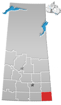 | ||||
|---|---|---|---|---|---|
| Towns | |||||
| Villages | |||||
| Rural municipalities | |||||
| First Nations | |||||
| Indian reserves | |||||
| Unincorporated communities |
| ||||
Coordinates: 49°50′10″N 101°31′31″W / 49.8360°N 101.5253°W
This article is issued from
Wikipedia.
The text is licensed under Creative Commons - Attribution - Sharealike.
Additional terms may apply for the media files.