Carievale
| Carievale | |
|---|---|
| Village | |
| Village of Carievale | |
 Location of Carievale in Saskatchewan  Carievale (Canada) | |
| Coordinates: 49°10′24″N 101°37′32″W / 49.173333°N 101.625556°W | |
| Country |
|
| Province |
|
| Region | Southeast |
| Census division | 1 |
| Rural Municipality | Mount Pleasant No. 2 |
| Post office Founded | February 1, 1891 |
| Incorporated (Village) | May 6, 1907 |
| Government | |
| • Type | Municipal |
| • Governing body | Carievale Village Council |
| • Mayor | Michael Wolf |
| • Administrator | Shayla Reynolds |
| Area | |
| • Land | 0.88 km2 (0.34 sq mi) |
| Population (2016) | |
| • Total | 240 |
| • Density | 273.6/km2 (709/sq mi) |
| Time zone | UTC-6 (CST) |
| Postal code | S0C 0P0 |
| Area code(s) | 306 |
| Highways |
|
| Website | http://tradecorridor.com/carievale/main.htm |
Carievale (2016 Population: 240) is a village within the Rural Municipality of Mount Pleasant No. 2, Saskatchewan, Canada. The village lies at the intersection of Highway 8 and Highway 18.. The community post-office was established on February 1, 1891.[1]
Demographics
| Canada census – Canwood community profile | |||
|---|---|---|---|
| 2016 | 2011 | 2006 | |
| Population: | 240 (+1.7% from 2011) | 236 (-2.1% from 2006) | 241 (-5.1% from 2001) |
| Land area: | 0.88 km2 (0.34 sq mi) | 0.88 km2 (0.34 sq mi) | 0.88 km2 (0.34 sq mi) |
| Population density: | 273.6/km2 (709/sq mi) | 269.0/km2 (697/sq mi) | 274.7/km2 (711/sq mi) |
| Median age: | 33.8 (M: 37.5, F: 31.8) | 36.2 (M: 35.8, F: 36.5) | 31.3 (M: 32.0, F: 31.1) |
| Total private dwellings: | 110 | 121 | 110 |
| Median household income: | |||
| References: 2016[2] 2011[3] 2006[4] earlier[5] | |||
See also
References
- ↑ "Post Offices and Postmasters database". Library and Archives Canada. Retrieved 2011-02-22.
- ↑ "2016 Community Profiles". Canada 2016 Census. Statistics Canada. February 21, 2017. Retrieved 2017-03-15.
- ↑ "2011 Community Profiles". Canada 2011 Census. Statistics Canada. July 5, 2013. Retrieved February 27, 2015.
- ↑ "2006 Community Profiles". Canada 2006 Census. Statistics Canada. March 30, 2011. Retrieved 2011-02-25.
- ↑ "2001 Community Profiles". Canada 2001 Census. Statistics Canada. February 17, 2012.
External links
Places adjacent to Carievale | ||||||||||
|---|---|---|---|---|---|---|---|---|---|---|
| ||||||||||
| Subdivisions | |
|---|---|
| Communities | |
| Cities | |
| Topics |
|
| |
| Cities | 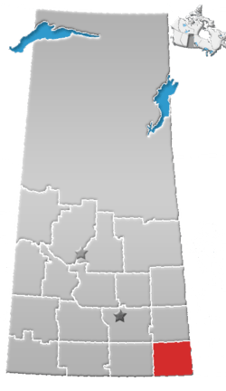 | ||||
|---|---|---|---|---|---|
| Towns | |||||
| Villages | |||||
| Rural municipalities | |||||
| First Nations | |||||
| Indian reserves | |||||
| Unincorporated communities |
| ||||
Coordinates: 49°10′24″N 101°37′32″W / 49.17333°N 101.62556°W
This article is issued from
Wikipedia.
The text is licensed under Creative Commons - Attribution - Sharealike.
Additional terms may apply for the media files.