Benson, Saskatchewan
| Benson | |
|---|---|
 | |
 Location of Benson in Saskatchewan  Benson, Saskatchewan (Canada) | |
| Coordinates: 49°26′48″N 102°59′39″W / 49.446570°N 102.994290°WCoordinates: 49°26′48″N 102°59′39″W / 49.446570°N 102.994290°W | |
| Country | Canada |
| Province | Saskatchewan |
| Rural Municipality | Benson 35 |
| Postal code | S0C 0L0 |
| Area code(s) | 306 |
| Highways | Highway 47 |
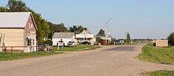
Benson is an unincorporated community in the Canadian province of Saskatchewan. It is located between Estevan and Stoughton on Highway 47. Currently it has a curling rink, community hall and the #35 RM office. The geographical location for Benson is north of the Canada–US border and North Dakota.
Gallery
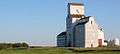 Grain elevator
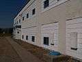 The Benson School in 1995 after it closed
References
| Cities | 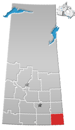 | ||||
|---|---|---|---|---|---|
| Towns | |||||
| Villages | |||||
| Rural municipalities | |||||
| First Nations | |||||
| Indian reserves | |||||
| Unincorporated communities |
| ||||
This article is issued from
Wikipedia.
The text is licensed under Creative Commons - Attribution - Sharealike.
Additional terms may apply for the media files.