Marana, Arizona
| Marana, Arizona | |
|---|---|
| Town | |
 Marana has dozens of miles of hiking trails, including those in the Tortolita Mountains. | |
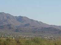
 Location of Marana in Pima County and Pinal County, Arizona | |
 Marana, Arizona Location in the United States | |
| Coordinates: 32°23′12″N 111°7′32″W / 32.38667°N 111.12556°WCoordinates: 32°23′12″N 111°7′32″W / 32.38667°N 111.12556°W | |
| Country | United States |
| State | Arizona |
| County | Pima, Pinal |
| Incorporated | 1977 |
| Government | |
| • Mayor | Ed Honea |
| Area[1] | |
| • Total | 121.70 sq mi (315.19 km2) |
| • Land | 120.96 sq mi (313.30 km2) |
| • Water | 0.73 sq mi (1.90 km2) |
| Elevation | 1,991 ft (607 m) |
| Population (2010)[2] | |
| • Total | 34,961 |
| • Estimate (2016)[3] | 43,474 |
| • Density | 359.40/sq mi (138.76/km2) |
| Time zone | UTC-7 (MST (no DST)) |
| ZIP code | 85653, 85658, 85743 |
| Area code(s) | 520 |
| FIPS code | 04-44270 |
| Website | http://www.marana.com/ |
Marana is a town in Pima County, Arizona, located northwest of Tucson, with a small portion in Pinal County.[4][5] According to the 2010 census, the population of the town is 34,961. Marana was the fourth fastest-growing place among all cities and towns in Arizona of any size from 1990 to 2000.
History
Archaeologists have found about 4,200 years of continuous human settlement in the vicinity of Marana and the middle Santa Cruz Valley. Many important archaeological sites occur near Marana.
- Las Capas a large, early agricultural site, related to the nearby Costello-King site near Ina Road and the Interstate 10 interchange. It was occupied from 4,200 to 2,500 years ago. It is the site of the oldest known cemetery in the southwest and the oldest known canals in North America also the oldest tobacco pipes in the world.
- Los Morteros a Hohokam ballcourt village ruin located on the Santa Cruz floodplain near the Point of the Mountain at the northern end of the Tucson Mountains. Los Morteros has also been identified as the probable location of the Llano del Azotado campsite used by the Juan Bautista de Anza expedition in 1775. The location is near the present day Arizona Portland Cement Plant in the Town of Marana.
- Linda Vista Hill dating between 1200 and 1350 A.D., is a Trincheras culture site in the Tucson Mountains, that inhabited mountain slopes overlooking arable land along streams. The hillside site has more than 150 terraces and 75 pit-houses excavated into the terraces and a massive adobe-walled compound located on the hill summit.
- Marana Mound, dating between 1150 and 1300 A.D., is the remnant of a large platform mound that was the center of the Hohokam community that lived between the Santa Cruz River and the Tortolita Mountains. The mound is surrounded by an adobe compound wall from which multiple rooms were constructed and was associated with 30-35 nearby residential compounds with multiple house features both inside and outside the compounds, wall segments, and trash mounds The whole complex covers an area of approximately one square mile.
- In 1775, Juan Bautista de Anza, Captain of the Presidio of Tubac, led an expedition north along the Santa Cruz River to found the city of San Francisco. His group of about 200 included 30 soldiers and their families and a number of escorts. They brought more than 1,000 head of livestock. Their campsite was at what is now the CalPortland Cement Plant near Marana. A 15-mile (24 km) segment of the route the expedition took through Marana is designated part of the Juan Bautista de Anza National Historic Trail.
- Pointer Mountain Station of the Butterfield Overland Mail stagecoach line used from 1858, was found during the study of Los Morteros, within the limits of the nearby Puerta del Norte trailer court.[6]
- With the early establishment of mining and ranching, it was not until after World War I that Marana became primarily an agricultural center, producing cotton, wheat, barley, alfalfa and pecans.
- During World War II, the rising importance of military power came quickly to Marana. The Marana Airfield (1942-'45) was the largest pilot-training center in the world, training some 10,000 flyers. Five Titan sites were later located in the area as part of a complex of ballistic missile installations built around Tucson.
- In March 1977, the Town incorporated about 10 square miles (26 km2) and in August of that year, the 1,500 residents elected their first town council. In early 1979, the town began to grow through a targeted annexation policy and now measures a little more than 120 square miles (310 km2) with a population of almost 37,000.
Pioneers
According to historian David Leighton, the first member of the Anway family in the Tucson area was Charles B. Anway, who arrived as a result of contracting tuberculosis. In 1919, brother William and his two children Louis and Ila arrived in town but they decided to settle in an area northwest of Tucson called Postvale, Arizona. In 1920, William who had been widowed for many years married Orpha Ralston, who was a member for many years in the Postvale Co-operative Women's Club. This club was involved in getting the local post office renamed from Postvale to the area's first known name Marana and in time the town name became Marana.[7]
Annexation
The southern portion of Marana has grown considerably since the early 1990s with the addition of businesses and some housing, much of it due to annexation of existing unincorporated areas. In 1992, the Marana Town Council voted to annex an area of unincorporated Pima County that was located to the southeast of the town limits. The area selected was a narrow corridor of land that snaked its way south along Interstate 10, then to the east along Ina Road, and then south along Thornydale Road. These areas were mainly high density commercial businesses and shopping centers, including large retailers such as Super KMart (now closed), Costco Wholesale, Target, and Home Depot. The areas were selected by Marana to be annexed, by their own admission, for their sales tax revenue.[8][9] The large residential areas behind these commercial areas were not annexed.[10][11] As a result, the city of Tucson filed a lawsuit in the Superior Court of the State of Arizona in and for the County of Pima (City of Tucson v Town of Marana) claiming that Marana illegally annexed the unincorporated areas in violation of existing state laws. However, on April 4, 1994, Judge Lina Rodriguez ruled in favor of Marana, allowing the annexation to stand.[12] Following this suit, the Arizona State annexation laws were changed, forbidding municipalities from annexing small strips of land without taking large surrounding parcels as well. A "strip annexation" is no longer allowed under Arizona law.[13]
Geography
Marana is located at 32°23′12″N 111°7′32″W / 32.38667°N 111.12556°W (32.386539, -111.125437).[14]
According to the United States Census Bureau, the town has a total area of 121.4 square miles (313.6 km²), of which, 120.7 square miles (312.3 km²) of it is land and 0.7 square miles (1.9 km²) of it (1.22%) is water.
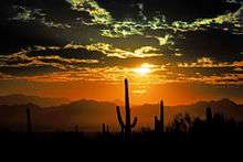
The town extends along Interstate 10 from the line between Pinal and Pima County to the Tucson city line, except the area around the non-affluent unincorporated community of Rillito. The town has a history of farming and ranching. The Tucson Mountains and the western half of Saguaro National Park are located to the south. Phoenix is approximately 90 minutes north via Interstate 10.
Climate
Marana has a hot semi-arid climate (Köppen climate classification BSh). This is characterized by hot summers and relatively mild winters. The area averages only 12.19 inches (310 mm) of annual rainfall. During the dry and sunny winter months, daytime highs usually reach between 60°F and 70°F (16°C and 21°C), with temperatures cooling to well below 50°F (10°C), and sometimes below 40°F (4°C) during the night. Temperatures below the freezing mark are not uncommon during this period. In the summer, high temperatures range between 95°F and 105°F (35°C and 41°C), with nights cooling down to around 70°F (21°C). The occasional heat wave can cause temperatures to soar above 110°F (43°C) for multiple days during the hot summer months. Rain is much more frequent during the summer due to the North American Monsoon, and is sometimes accompanied by high winds and thunderstorms.
| Climate data for Marana, AZ | |||||||||||||
|---|---|---|---|---|---|---|---|---|---|---|---|---|---|
| Month | Jan | Feb | Mar | Apr | May | Jun | Jul | Aug | Sep | Oct | Nov | Dec | Year |
| Record high °F (°C) | 87 (31) |
90 (32) |
97 (36) |
104 (40) |
108 (42) |
115 (46) |
114 (46) |
113 (45) |
109 (43) |
106 (41) |
95 (35) |
88 (31) |
115 (46) |
| Average high °F (°C) | 66 (19) |
69 (21) |
75 (24) |
83 (28) |
92 (33) |
101 (38) |
101 (38) |
99 (37) |
96 (36) |
86 (30) |
75 (24) |
66 (19) |
84 (29) |
| Average low °F (°C) | 39 (4) |
42 (6) |
46 (8) |
52 (11) |
61 (16) |
69 (21) |
74 (23) |
72 (22) |
68 (20) |
57 (14) |
46 (8) |
39 (4) |
55 (13) |
| Record low °F (°C) | 15 (−9) |
19 (−7) |
26 (−3) |
27 (−3) |
42 (6) |
51 (11) |
51 (11) |
46 (8) |
46 (8) |
35 (2) |
26 (−3) |
21 (−6) |
15 (−9) |
| Average precipitation inches (mm) | 1.01 (25.7) |
1.03 (26.2) |
0.93 (23.6) |
0.34 (8.6) |
0.24 (6.1) |
0.17 (4.3) |
2.10 (53.3) |
2.47 (62.7) |
1.33 (33.8) |
0.86 (21.8) |
0.58 (14.7) |
1.13 (28.7) |
12.19 (309.6) |
| Source: The Weather Channel[15] | |||||||||||||
Demographics
| Historical population | |||
|---|---|---|---|
| Census | Pop. | %± | |
| 1970 | 1,154 | — | |
| 1980 | 1,674 | 45.1% | |
| 1990 | 2,187 | 30.6% | |
| 2000 | 13,556 | 519.8% | |
| 2010 | 34,961 | 157.9% | |
| Est. 2016 | 43,474 | [3] | 24.3% |
| U.S. Decennial Census[16] | |||
As of the census of 2010, there were 34,961 people, 11,759 households, and 8,871 families residing in the town. There were 13,706 housing units and the racial makeup of the town was 81.9% White, 4.6% Black or African American, 0.7% Native American, 5.2% Asian, 0.1% Pacific Islander, 9.7% from other races, and 2.2% from two or more races. 21.7% of the population were Hispanic or Latino of any race.
There were 11,759 households out of which 32.5% had children under the age of 18 living with them, 63.2% were married couples living together, 8.2% had a female householder with no husband present, and 24.6% were non-families. 19.3% of all households were made up of individuals and 5.1% had someone living alone who was 65 years of age or older. The average household size was 2.81 and the average family size was 3.17.
In the town, the population was spread out with 26.7% under the age of 18, 7.4% from 18 to 24, 34.3% from 25 to 44, 22.1% from 45 to 64, and 9.5% who were 65 years of age or older. The median age was 37 years. The Town is 50.1% female and 49.9% male.
The median income for a household in the town was $68,361, and the median income for a family was $75,281. Males had a median income of $58,932 versus $37,388 for females. The per capita income for the town was $28,468. About 6.1% of families and 8.1% of the population were below the poverty line, including 15.0% of those under age 18 and 2.3% of those age 65 or over.
Town facts
- Marana was named for the Spanish word maraña ("thicket") by 19th century railroad workers who had to clear a line through the area.
- In 2007, Marana began hosting the PGA Tour's WGC-Accenture Match Play Championship (now the WGC-Cadillac Match Play Championship). Held in late February, the event included the world's top 64 professional golfers. Henrik Stenson won the inaugural event, and Tiger Woods won in 2008, defeating Stewart Cink. Geoff Ogilvy won the 2009 version by defeating Paul Casey. Ian Poulter won the 2010 event and Luke Donald took the 2011 title. The tournament remained in Marana through 2014. (In September 2014, Cadillac was announced as the new title sponsor for 2015, and the event was moved to San Francisco's TPC Harding Park golf course.)
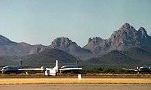
- Pinal Airpark (Evergreen International Aviation), where many commercial airlines send their airplanes for storage, and which was also well known in the 1970s and 1980s as an air base for the CIA is located just north of Marana in Pinal County. The airport was generally accepted as being a U.S. Forest Service air tanker base until a series of forest fires in the mountains surrounding Tucson in the early 1970s. When locals requested that the Forest Service-marked tankers put out the fires, Airpark officials had to admit that the markings were in name only and that the alleged tankers were really paramilitary cargo planes. To this day, access to the Airpark is stringently monitored.
- Marana Regional Airport was purchased by the town from Pima County in 1999. It does not serve commercial airlines. Residents can use the Tucson International Airport to fly commercial.
Education
Marana has a public school system consisting of 16 schools that is coordinated by the Marana Unified School District. Although, Flowing Wells Unified School District coordinates the education in the municipality's extreme southeastern section. Additionally, the portion of the town within Pinal County is served by Red Rock Elementary, and Santa Cruz Valley Unified High.
References
- ↑ "2016 U.S. Gazetteer Files". United States Census Bureau. Retrieved Jul 18, 2017.
- ↑ "American FactFinder". United States Census Bureau. Retrieved 2014-07-10.
- 1 2 "Population and Housing Unit Estimates". Retrieved June 9, 2017.
- ↑ Civicplus.com Archived 2011-07-08 at the Wayback Machine.
- ↑ "Archived copy". Archived from the original on 2014-03-22. Retrieved 2014-03-21.
- ↑ Marana History Pamphlet (673 KB) Archived 2011-09-27 at the Wayback Machine. from Marana, Arizona city website accessed 7/3/2011.
- ↑ David Leighton, "Street Smarts: Pioneering Avra Valley farmer created Anway Road," Arizona Daily Star, March 5, 2017
- ↑ Tekwriteservices.com Archived 2011-07-16 at the Wayback Machine.
- ↑ Tucsonweekly.com
- ↑ PLWeb Document Display Archived 2005-02-12 at the Wayback Machine..
- ↑ Annexations by northwest towns pinching Tucson Archived 2005-09-04 at the Wayback Machine..
- ↑ "Marana's Thornydale-area annexation is upheld" Arizona Daily Star (April 4, 1994)
- ↑ Redrocknews.com Archived 2010-01-06 at the Wayback Machine.
- ↑ "US Gazetteer files: 2010, 2000, and 1990". United States Census Bureau. 2011-02-12. Retrieved 2011-04-23.
- ↑ "Monthly Averages for Marana, AZ". Weather.com. 2018. Retrieved August 14, 2018.
- ↑ "Census of Population and Housing". Census.gov. Retrieved June 4, 2016.
External links
- Town of Marana - official site
- Marana News - local newspaper
- Pioneering People on a Corridor of Change Marana’s Cultural Heritage
- Cultural and Historic Resource Acquisitions, Los Morteros accessed from Pima County website
