Anegam, Arizona
| Anegam, Arizona | |
|---|---|
| Populated place | |
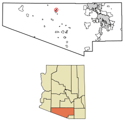 Location of Anegam in Pima County, Arizona. | |
 Anegam, Arizona Location of Anegam in Arizona | |
| Coordinates: 32°22′22″N 112°01′51″W / 32.37278°N 112.03083°WCoordinates: 32°22′22″N 112°01′51″W / 32.37278°N 112.03083°W | |
| Country | United States |
| State | Arizona |
| County | Pima |
| Area[1] | |
| • Total | 2.31 sq mi (5.99 km2) |
| • Land | 2.31 sq mi (5.99 km2) |
| • Water | 0.00 sq mi (0.00 km2) |
| Elevation[2] | 1,762 ft (537 m) |
| Population (2010) | |
| • Total | 862 |
| • Estimate (2016)[3] | N/A |
| Time zone | UTC-7 (Mountain (MST)) |
| • Summer (DST) | UTC-7 (MST) |
| Area code(s) | 520 |
| FIPS code | 025-02270 |
| GNIS feature ID | 652 |
Anegam is a census designated place in Pima County, Arizona. Its population was 154 as of July 1, 2015, and it has a land area of 2.31 square miles (6.0 km2).[4] It has an estimated elevation of 1,762 feet (537 m) above sea level. It is located within the Tohono O'odham Indian Reservation.
Demographics
| Historical population | |||
|---|---|---|---|
| Census | Pop. | %± | |
| U.S. Decennial Census[5] | |||
References
- ↑ "2016 U.S. Gazetteer Files". United States Census Bureau. Retrieved Jul 18, 2017.
- ↑ "Feature Detail Report for: Anegam". Geographic Names Information System. United States Geological Survey.
- ↑ "Population and Housing Unit Estimates". Retrieved June 9, 2017.
- ↑ "Anegam, AZ Profile: Facts, Map & Data". AZ Hometown Locator. Retrieved December 26, 2015.
- ↑ "Census of Population and Housing". Census.gov. Retrieved June 4, 2016.

This article is issued from
Wikipedia.
The text is licensed under Creative Commons - Attribution - Sharealike.
Additional terms may apply for the media files.