Manukau
| Manukau | |
|---|---|
| Basic information | |
| Local authority | Auckland Council |
| Electoral ward | Manukau |
| Local board | Otara-Papatoetoe |
| Board subdivision | Papatoetoe |
| Facilities | |
| Train station(s) | Manukau Train Station |
| Surrounds | |
| North | Papatoetoe |
| Northeast | Clover Park |
| East | Goodwood Heights |
| Southeast | Totara Heights |
| South | Manurewa |
| Southwest | Wiri |
| West | Puhinui |
| Northwest | Papatoetoe |
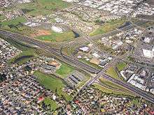
Manukau (/ˈmɑːnʊˌkaʊ/[1][2]), or Manukau Central, is a suburb of South Auckland, New Zealand, centred on the Manukau City Centre business district. It is located 23 kilometres south of the Auckland Central Business District, west of the Southern Motorway, south of Papatoetoe, and north of Manurewa. The industrial and commercial suburb of Wiri lies to the east and south.
The headquarters of Manukau City Council were in Manukau Central until the council was merged into Auckland Council in November 2010. Manukau Central should not be confused with the much larger Manukau City, which was the entire area administered by the city council.
History
The Manukau Central area was part of the largely rural area of Wiri in the early 20th century. Its transition from farmland was driven by Manukau City Council, which formed in 1965 and purchased land there in 1966 for the development of an administrative and commercial centre. The Manukau City Centre mall, now Westfield Manukau City, opened in October 1976, and the Manukau City Council administration building in 1977. Several government departments established offices in the late 1970s.[3]
In 1983 Manukau City Council decided to rename the area Manukau Central, with the name Wiri continuing for the industrial area to the west. The name Manukau City Centre has been used for the central business district around the mall and city council building.[3]
The Rainbow's End theme park opened just south of the city centre in 1982.[3] Vodafone Events Centre, a multi-purpose event centre, is also opened in 2005 located at Manukau. Another shopping centre, Manukau Supa Centa, opened to the west of the city centre in 1998.[4] Manukau Institute of Technology, which has its main campus at Ōtara, is building another campus at Manukau Central in 2014.
Local government
The suburb, since November 2010, is in the Manukau ward, one of the thirteen electoral divisions of Auckland Council.
Services
Manukau is well-connected for transport. The Southwestern Motorway (State Highway 20) joins the Southern Motorway (State Highway 1) at Manukau Central. Eastern Line train services carry passengers between Manukau Railway Station and central Auckland's Britomart Transport Centre. Adjacent to the train station is the new Manukau bus station, opened in April 2018 connecting South and East Auckland.[5][6]
References
| Wikimedia Commons has media related to Manukau. |
- ↑ "Manukau - definition of Manukau by the Free Online Dictionary, Thesaurus and Encyclopedia". The Free Dictionary. Retrieved 5 October 2013.
- ↑ "Define Manukau at Dictionary.com". Dictionary.com. Retrieved 5 October 2013.
- 1 2 3 Ringer, Bruce (2010). "A history of Manukau City Centre". Auckland Libraries. Retrieved 11 May 2014.
- ↑ Dey, Bob (21 January 2008). "AMP Capital re-claims three shopping centres". National Business Review. Retrieved 11 May 2014.
- ↑ "$49m bus station opens in Manukau". RNZ News. 7 April 2018. Retrieved 10 April 2018.
- ↑ "Manukau's new bus station opens". Auckland Transport. Retrieved 5 April 2018.
External links
- Photographs of Manukau held in Auckland Libraries' heritage collections.