Malcolm Land District
| Malcolm Western Australia | |||||||||||||||
|---|---|---|---|---|---|---|---|---|---|---|---|---|---|---|---|
 | |||||||||||||||
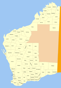
Malcolm Land District is a land district (cadastral division) of Western Australia, located within the Eastern Land Division in the northern Goldfields region of the state.
Location and features
The district is located in the northern Goldfields region, and contains the town of Leonora and the former towns of Gwalia, Malcolm, Kurrajong and Mertondale.[1]
History
The district was created on 22 August 1900,[2] and was amended on 8 May 1907. It was described in the Government Gazette thus:[3]
| “ | Bounded by lines starting from a point situate 2 miles 10 chains West from Survey mark B82, at Brickey's Soak, and extending West to a point situate South from the 24-mile post on the Lawlers–Leonora telegraph line; thence North through the said 24-mile post to a point situate West of Survey mark AN62; thence East through the said survey mark AN62 to a point situate North from the starting point; thence South to the starting point. | ” |
References
- ↑ "Index Map of Western Australia", Department of Lands and Surveys, 1949.
- ↑ "Malcolm (Land) District (per 3647/97)". Western Australia Government Gazette. 22 August 1900. p. 1900:3185.
- ↑ "Amendment of Boundaries of Land Districts (per 3647/97)". Western Australia Government Gazette. 8 May 1907. p. 1907:1344.
Coordinates: 28°50′S 121°20′E / 28.833°S 121.333°E
This article is issued from
Wikipedia.
The text is licensed under Creative Commons - Attribution - Sharealike.
Additional terms may apply for the media files.