Buningonia Land District
| Buningonia Western Australia | |||||||||||||||
|---|---|---|---|---|---|---|---|---|---|---|---|---|---|---|---|
 | |||||||||||||||
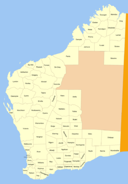
Buningonia Land District is a land district (cadastral division) of Western Australia, located within the Eastern Land Division on the Nullarbor Plain. It spans roughly 30°10'S - 32°00'S in latitude and 122°15'E - 124°00'E in longitude.
Location and features
The district is located on the Nullarbor Plain in the south-east of the state and falls generally East of the city of Kalgoorlie. The Trans-Australian Railway roughly bisects the district. The Aboriginal settlement of Cundeelee and the railway towns of Coonana and Zanthus are located within its boundaries.[1]
History
The district was created on 4 March 1903.[2] The description of the boundaries was subsequently amended on 8 May 1907, and published in the Government Gazette thus:[3]
| “ | Bounded by lines starting from a point situate 20 miles East from the summit of Simon Hill and extending East to a point situate North from a point 20 miles East from the South East corner of East Location 12; thence North to a point situate East from Survey Mark R3; thence West to a point situate North from the North-East corner of Location 32; thence South to a point situate East from the South-West corner of Location 48; thence West to a point situate South from Trig. Station M5; thence South to a point situate West from a point 10 miles North from the summit of Simon Hill; thence East to a point situate North from the starting point; and thence South to the starting point. | ” |
References
- ↑ "Index Map of Western Australia", Department of Lands and Surveys, 1949.
- ↑ "New Land Districts (per 7835/97)". Western Australia Government Gazette. 4 March 1903. p. 1903:613.
- ↑ "Amendment of Boundaries of Land Districts (per 3647/97)". Western Australia Government Gazette. 8 May 1907. p. 1907:1344.
Coordinates: 31°05′S 123°05′E / 31.083°S 123.083°E