Giles Land District
| Giles Western Australia | |||||||||||||||
|---|---|---|---|---|---|---|---|---|---|---|---|---|---|---|---|
 | |||||||||||||||
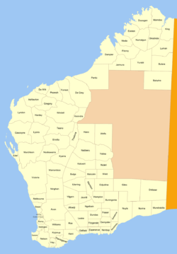
Giles Land District is a land district (cadastral division) of Western Australia, located within the Eastern and Eucla land divisions on the Nullarbor Plain. It spans roughly 29°00'S - 31°00'S in latitude and 123°30'E - 126°30'E in longitude.
The district was created on 20 October 1916 and was defined in the Government Gazette:
| “ | Bounded by lines starting from a point situate South from the summit of Mt. Luck and East from survey mark B. 82 at Brickey's Soak, and extending South to a point due East of survey mark R. 3; thence East to a point South of a point 20 miles East of the South-East corner of East Location 12; thence South to the Trans-Australian Railway Line, thence Eastward along said Railway line to the 300-mile mark; thence North to a point due East of the aforesaid survey mark B. 82, and thence West to the starting point. | ” |
References
- "New Land Districts (per 7835/97)". Western Australia Government Gazette. 20 October 1916. p. 1916:1771.
Coordinates: 30°00′S 125°20′E / 30.000°S 125.333°E
This article is issued from
Wikipedia.
The text is licensed under Creative Commons - Attribution - Sharealike.
Additional terms may apply for the media files.