Lung, Nepal
| Lung लुङ | |
|---|---|
| Village Development Committee | |
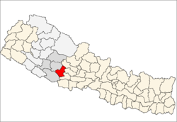
 Lung Location in Nepal | |
| Coordinates: 28°11′N 82°55′E / 28.19°N 82.91°ECoordinates: 28°11′N 82°55′E / 28.19°N 82.91°E | |
| Country |
|
| Region | Mid-Western |
| Zone | Rapti Zone |
| District | Pyuthan District |
| VDC | Lung |
| Population (2001 Census[1]) | |
| • Total | 3,471 |
| 686 households | |
| Time zone | UTC+5:45 (Nepal Time) |
Lung is a town and Village Development Committee in Pyuthan, a Middle Hills district of Rapti Zone, western Nepal.
Villages in this VDC
| Ward | Lat. | Lon | Elev. | ||
|---|---|---|---|---|---|
| Atighar | आटीघर | 28°09'N | 82°54'E | 895m | |
| Bahane | बाहाने | 6 | 28°12'N | 82°54'E | 1,105 |
| Chham | छम | 28°10'N | 82°54'E | 945 | |
| Chichchaur | चिचचौर | 28°11'N | 82°54'E | 990 | |
| Dhand | ढाँड | 5 | 28°11'N | 82°54'E | 1,250 |
| Dobhai | दोभाई | 28°09'N | 82°55'E | 890 | |
| Harela | हरेला | 28°12'N | 82°55'E | 1,310 | |
| Jairikanda | जैरीकाँडा | 28°11'N | 82°55'E | 1,825 | |
| Khal | खाल | 28°11'N | 82°55'E | 1,750 | |
| Khanepani | खानेपानी | 28°11'N | 82°55'E | 1,455 | |
| Kimichaur | किमीचौर | 7 | 28°12'N | 82°55'E | 1,475 |
| Lung | लुङ | 28°11'N | 82°54'E | 1,467 | |
| Lunglekh | लुङलेख | 28°11'N | 82°55'E | 1,650 | |
| Makre | माक्रे | 28°11'N | 82°53'E | 958 | |
| Manabang | मनाबाङ | 28°12'N | 82°55'E | 1,590 | |
| Pipaltari | पिपलटारी | 28°10'N | 82°54'E | 950 | |
| Purnagaun | पुर्नागाउँ | 9 | 28°10'N | 82°54'E | 1,299 |
| Simalchaur | सिमलचौर | 28°12'N | 82°54'E | 1,035 | |
| Sirbari | सिरबारी | 3 | 28°11'N | 82°53'E | 950 |
| Sirseni | सिरसेनी | 28°11'N | 82°54'E | 1,030 | |
| Siurikote | सिउरीकोटे | 28°12'N | 82°54'E | 1,450 | |
| Tham | थाम | 28°11'N | 82°54'E | 1,205 |
References
- ↑ "Nepal Census 2001". Nepal's Village Development Committees. Digital Himalaya. Archived from the original on 12 October 2008. Retrieved 21 September 2008.
- ↑ "Index of Geographical Names of Nepal, Volume IV: Mid Western Development Region, List of Settlements, Pyuthan" (PDF). Government of Nepal, National Geographic Information Infrastructure Program. Archived from the original (PDF) on 2011-07-24. Retrieved 2011-03-12.
External links
This article is issued from
Wikipedia.
The text is licensed under Creative Commons - Attribution - Sharealike.
Additional terms may apply for the media files.