Dharampani, Rapti
| Dharampani धरमपानी | |
|---|---|
| Village Development Committee | |
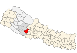
 Dharampani Location in Nepal | |
| Coordinates: 28°04′N 82°45′E / 28.07°N 82.75°ECoordinates: 28°04′N 82°45′E / 28.07°N 82.75°E | |
| Country |
|
| Region | Mid-Western |
| Zone | Rapti Zone |
| District | Pyuthan District |
| VDC | Dharampani |
| Population (2001 Census[1]) | |
| • Total | 2,859 |
| 560 households | |
| Time zone | UTC+5:45 (Nepal Time) |
Dharampani is a village and Village Development Committee in Pyuthan, a Middle Hills district of Rapti Zone, western Nepal.
Villages in VDC
| Ward | Lat. | Lon | Elev. | ||
|---|---|---|---|---|---|
| Argeli | अर्गेली | 28°03'N | 82°56'E | 1,079m | |
| Banchare | बन्चरे | 28°04'N | 82°55'E | 1,190 | |
| Barbot | बरबोट | 8 | 28°04'N | 82°56'E | 1,272 |
| Bhedikhore | भेडीखोरे | 28°03'N | 82°56'E | 870 | |
| Bujathati | बुजाथाटी | 28°03'N | 82°57'E | 805 | |
| Bukeni | बुकेनी | 5 | 28°05'N | 82°55'E | 1,685 |
| Chauthi Laune | चौथी लाउने | 28°04'N | 82°56'E | 1,308 | |
| Chhap | छाप | 28°04'N | 82°55'E | 1,170 | |
| Dhanubas | धनुबास | 28°05'N | 82°55'E | 1,370 | |
| Dharampani | धरमपानी | 2 | 28°04'N | 82°54'E | 1,250 |
| Gahtara | गहतरा | 28°04'N | 82°56'E | 1,045 | |
| Girichaur | गिरीचौर | 1 | 28°04'N | 82°53'E | 1,570 |
| Jebundanda | जेबुनडाँडा | 28°04'N | 82°55'E | 1,142 | |
| Khanidanda | खानीडाँडा | 28°03'N | 82°53'E | 1,210 | |
| Maidan | मैदान | 28°04'N | 82°56'E | 1,198 | |
| Manjh Pokhara | माँझ पोखरा | 28°04'N | 82°56'E | 1,170 | |
| Mundanda | मुनडाँडा | 28°04'N | 82°56'E | 1,418 | |
| Nisan Takura | निसान टाकुरा | 28°05'N | 82°55'E | 1,461 | |
| Sirkot | सिरकोट | 28°04'N | 82°53'E | 1,485 | |
| Tallo Takura | तल्लो टाकुरा | 28°04'N | 82°56'E | 1,100 |
References
- ↑ "Nepal Census 2001". Nepal's Village Development Committees. Digital Himalaya. Archived from the original on 12 October 2008. Retrieved 21 September 2008.
- ↑ "Index of Geographical Names of Nepal, Volume IV: Mid Western Development Region, List of Settlements, Pyuthan" (PDF). Government of Nepal, National Geographic Information Infrastructure Program. Archived from the original (PDF) on 2011-07-24. Retrieved 2011-03-12.
External links
This article is issued from
Wikipedia.
The text is licensed under Creative Commons - Attribution - Sharealike.
Additional terms may apply for the media files.